Poop-Poop

Mr Toad drives his vintage automobile down Southminster Road

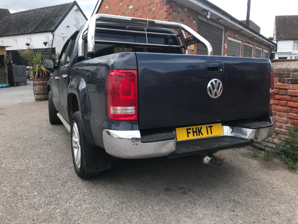
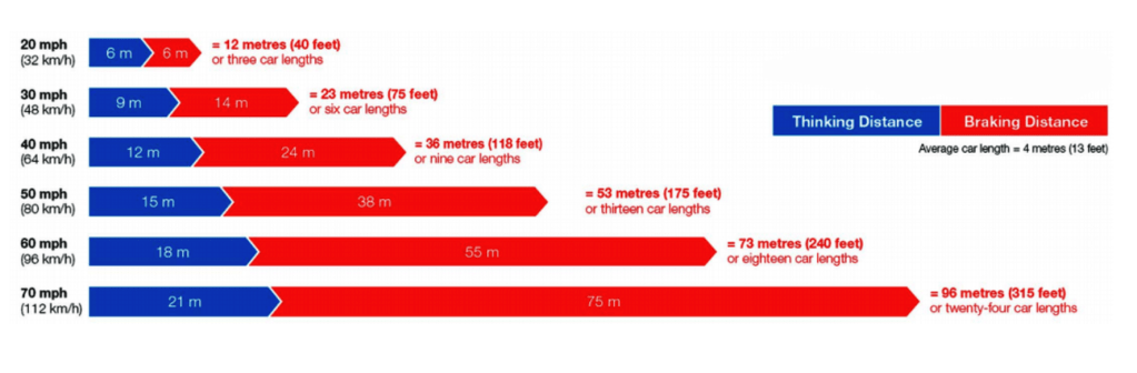
Barely a week goes by now without a collision on the Dengie roads. A couple of months ago this sadly included two fatalities. There’s clearly a problem with drunk and drug driving, but this appears to be a factor in only a minority of cases and doesn’t sufficiently explain the frequency of dangerous driving incidents. While excess speed is likely a factor, that doesn’t necessarily mean speeding —the recent Department of Transport study Road safety factors: initial analysis (30 May 2024) found that only 19% of fatal road collisions are recorded as a driver exceeding the speed limit. A fact which caused Sam Wakeling of campaign group Living Streets to ask: ‘Does that suggest that a whole lot of deadly speed is accepted within the legal limit? And that our speed limits are not set at safe levels?

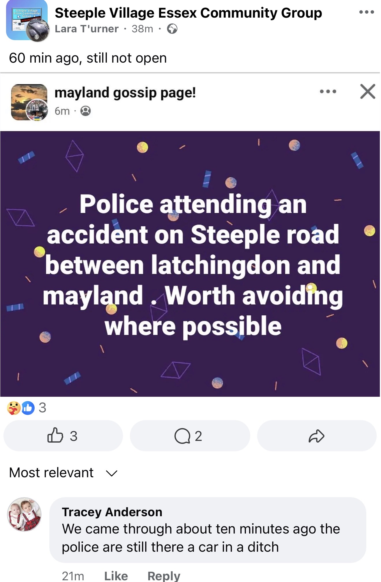
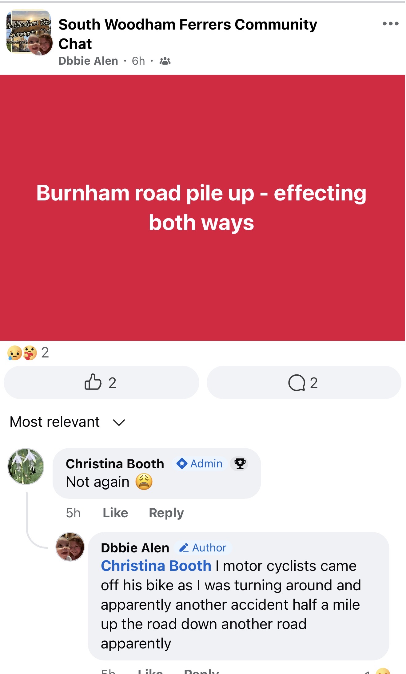
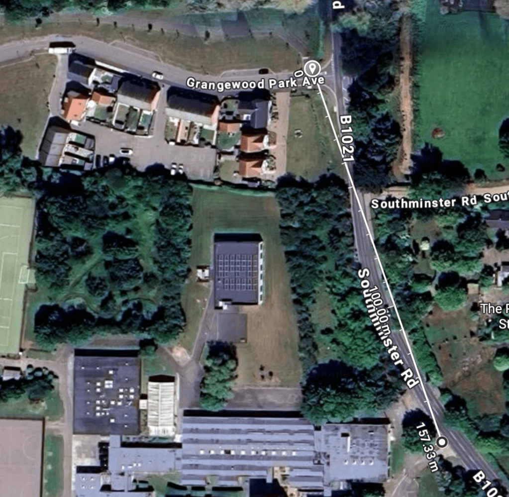
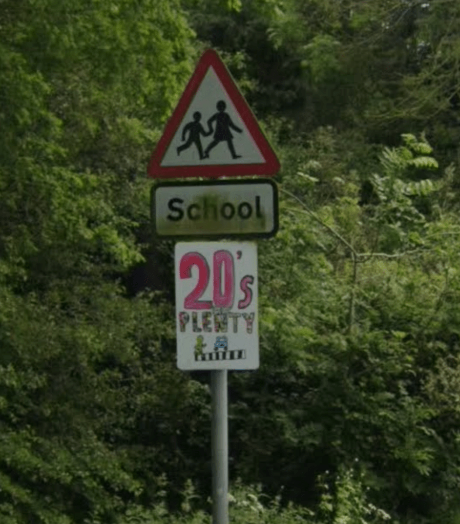
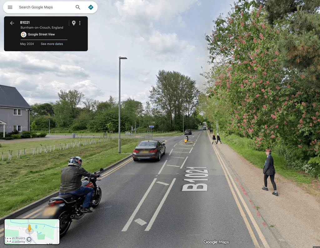
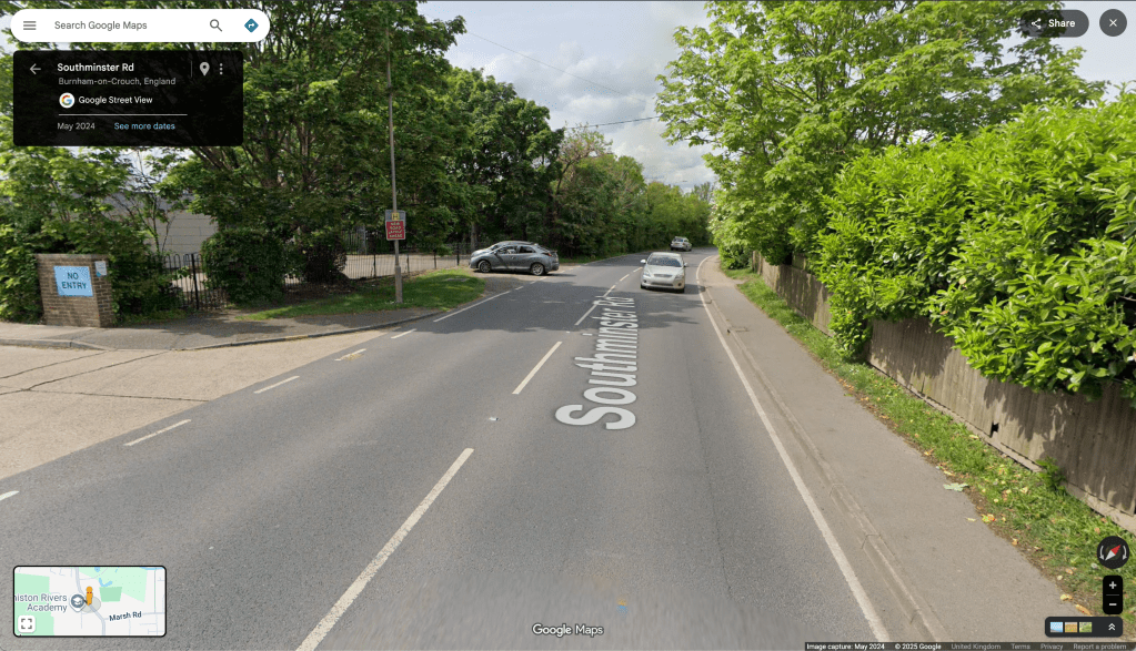
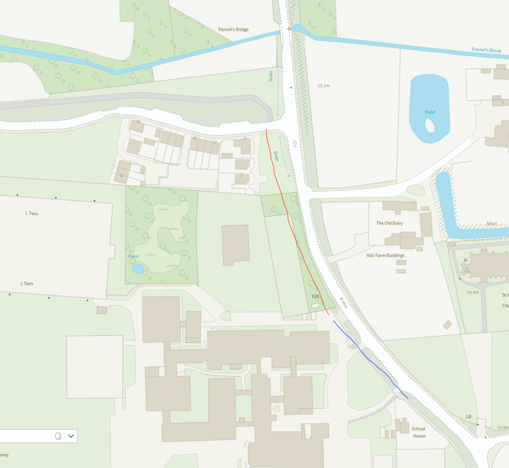
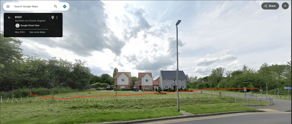
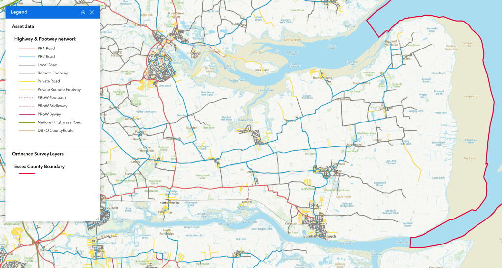
Yesterday saw another collision on Mayland Hill. The B1018 (Southminster Road) around the Mayland Hill/Dairy Farm Road junction is proving to be an accident hotspot. The default ‘national speed limit applies’ is clearly not working for the Dengie’s roads. This is just one location where speed limits need to be reduced with traffic calming infrastructure to enforce slower speeds.

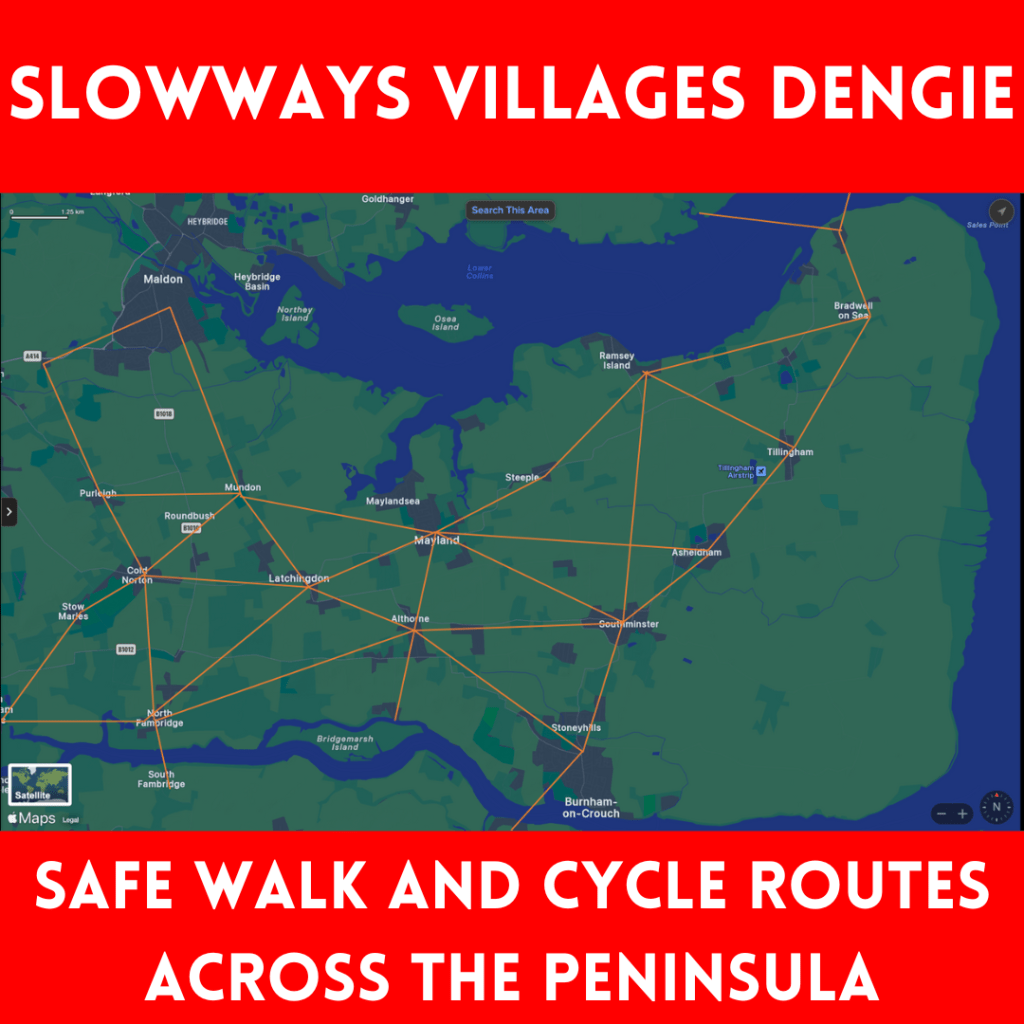
Mayland Hill and Dairy Farm Road are good candidates for ‘Quiet Lane’ status – and to be made priority routes for walkers/wheelers/cyclists. Measures need to be implemented to avoid their use as rat runs. Unless and until, safe segregated direct routes for walkers, wheelers and cyclists are created (connecting every settlement on the Dengie) the carriageway network must be managed to meet the needs and security of all road users. All the tools in the arsenal must be applied.

While it is the drivers of automobiles that hold the responsibility for the increasing jeopardy on our road network, they sadly remain the privileged users of that network.

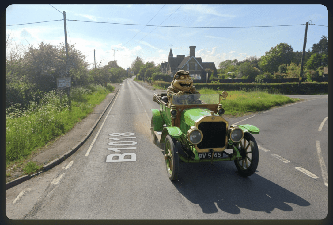
It makes one bound to ask: when was the first appearance of a motor car on the Dengie?

Was it this leisure run in the June of 1900, the first Summer of the Twentieth Century?

The Essex County Chronicle (Friday 29 June 1900), p.3


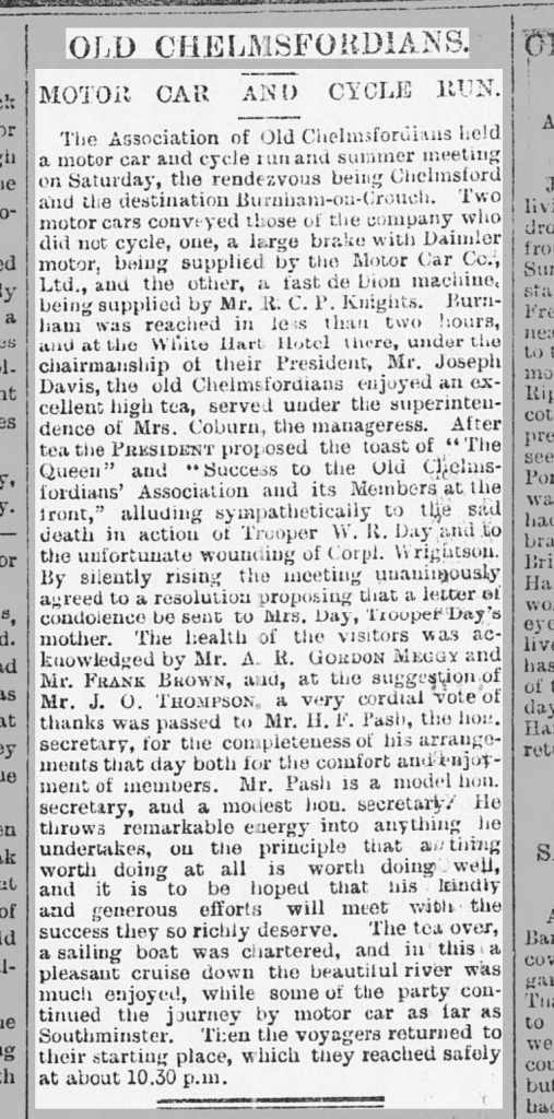
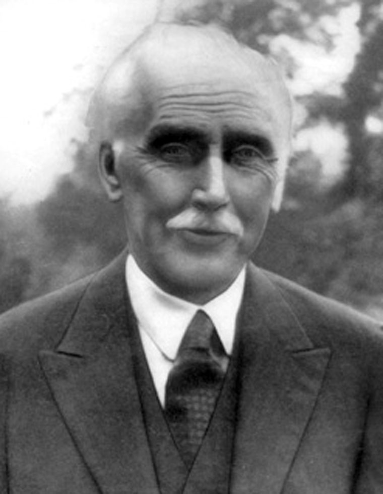
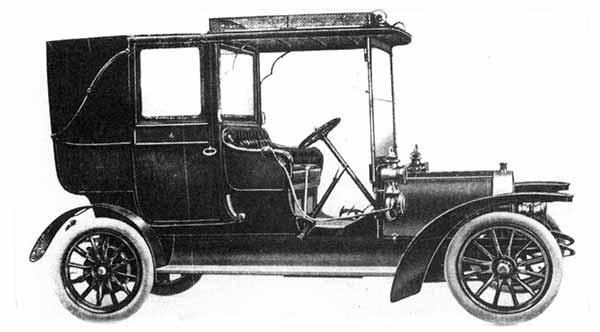
Apparently, Edmund Ernest Bentall of the Maldon agricultural equipment manufacturing family purchased a twin cylinder Georges Richard car in 1900 and become the first motorist in the district (Bentalls later made automobiles themselves) – but it looks like the Old Chelmsfordians may have beaten him out on to the peninsula, travelling as far as Southminster.


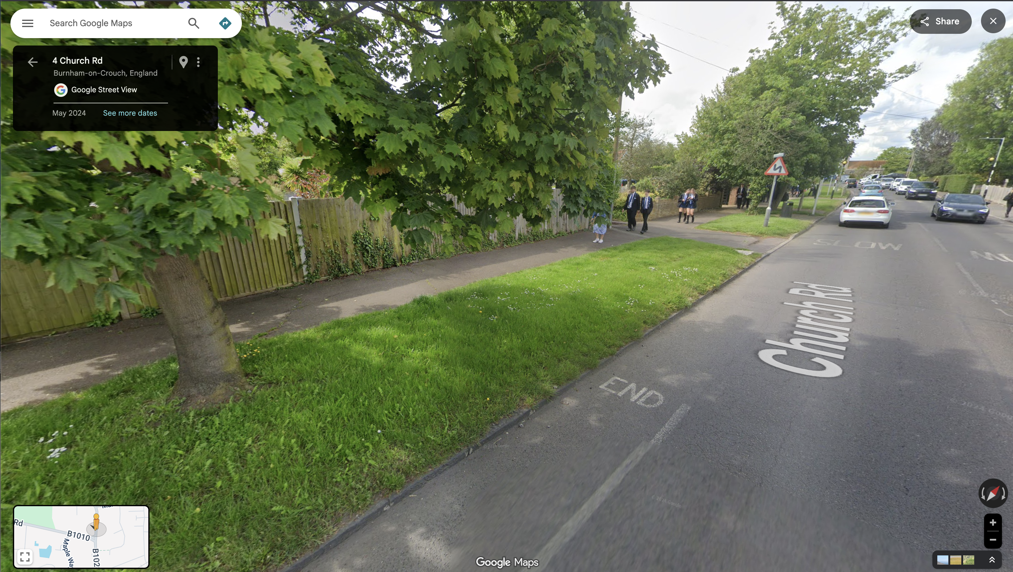
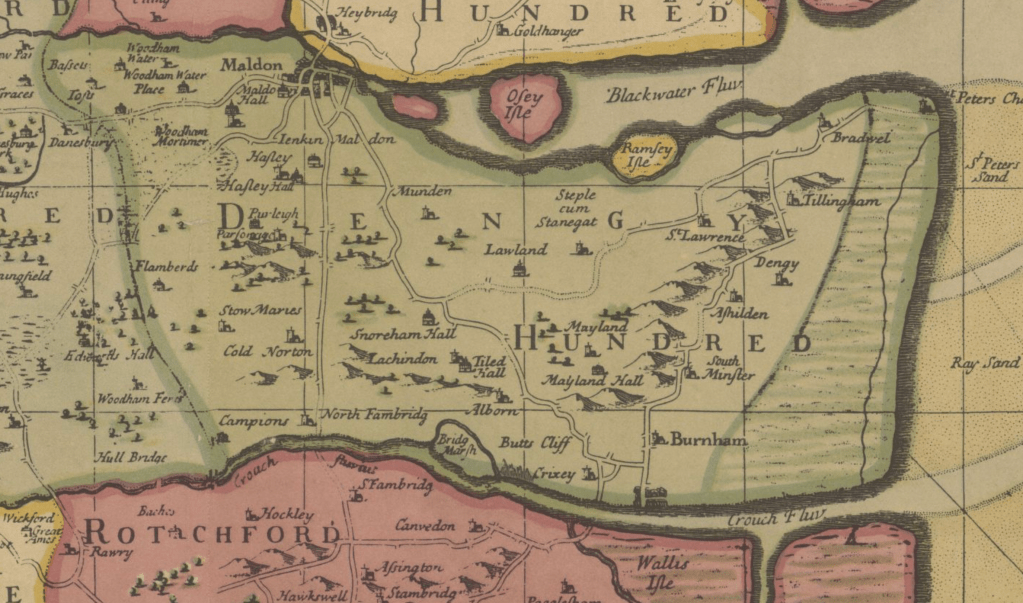
In its course and location, the road network then was much the same then as it is now, indeed as it had been for centuries. These routes were made by walkers, and to a lesser extent horse riders and carters. In the 1890s they were joined by bicyclists.

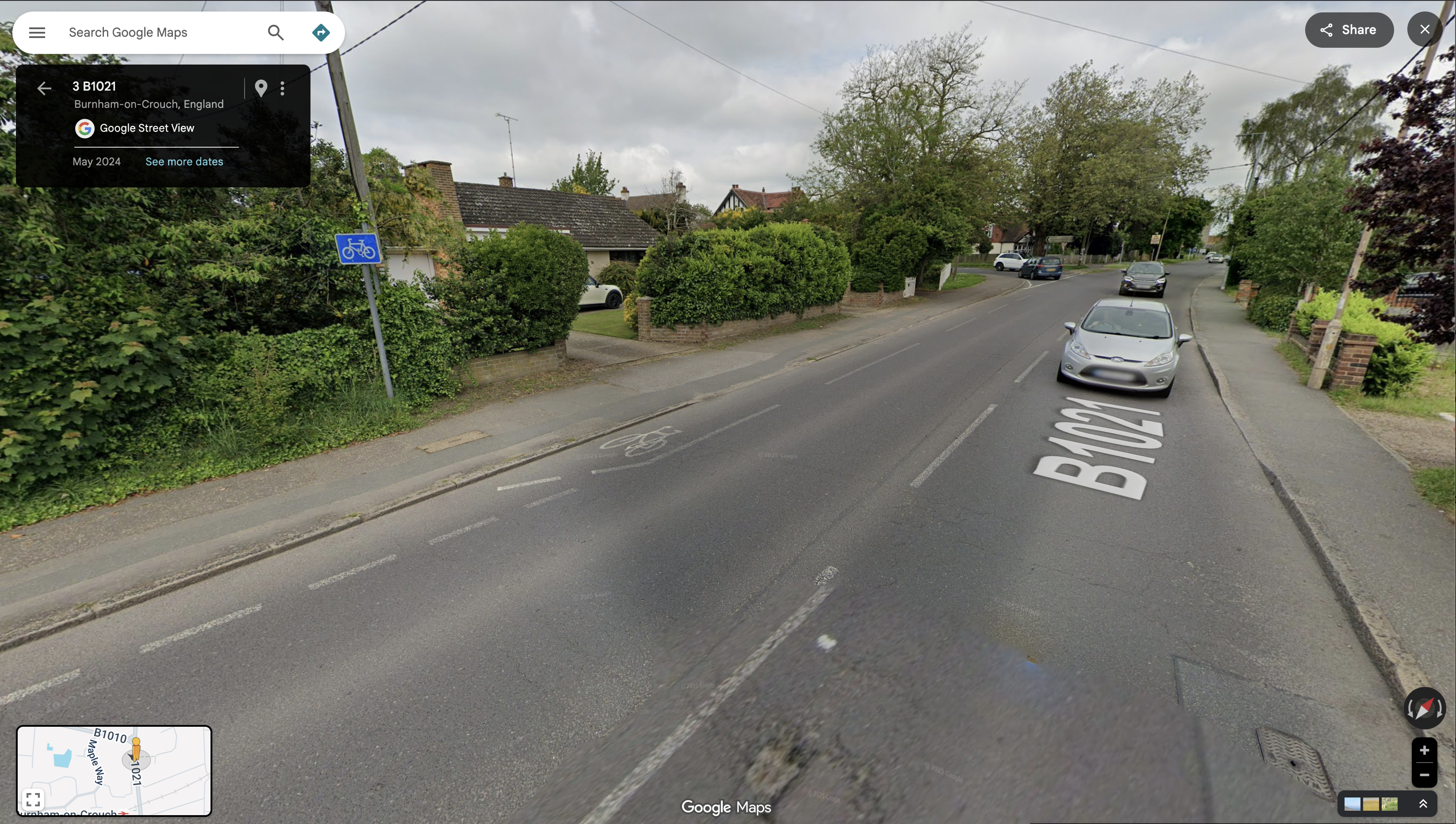
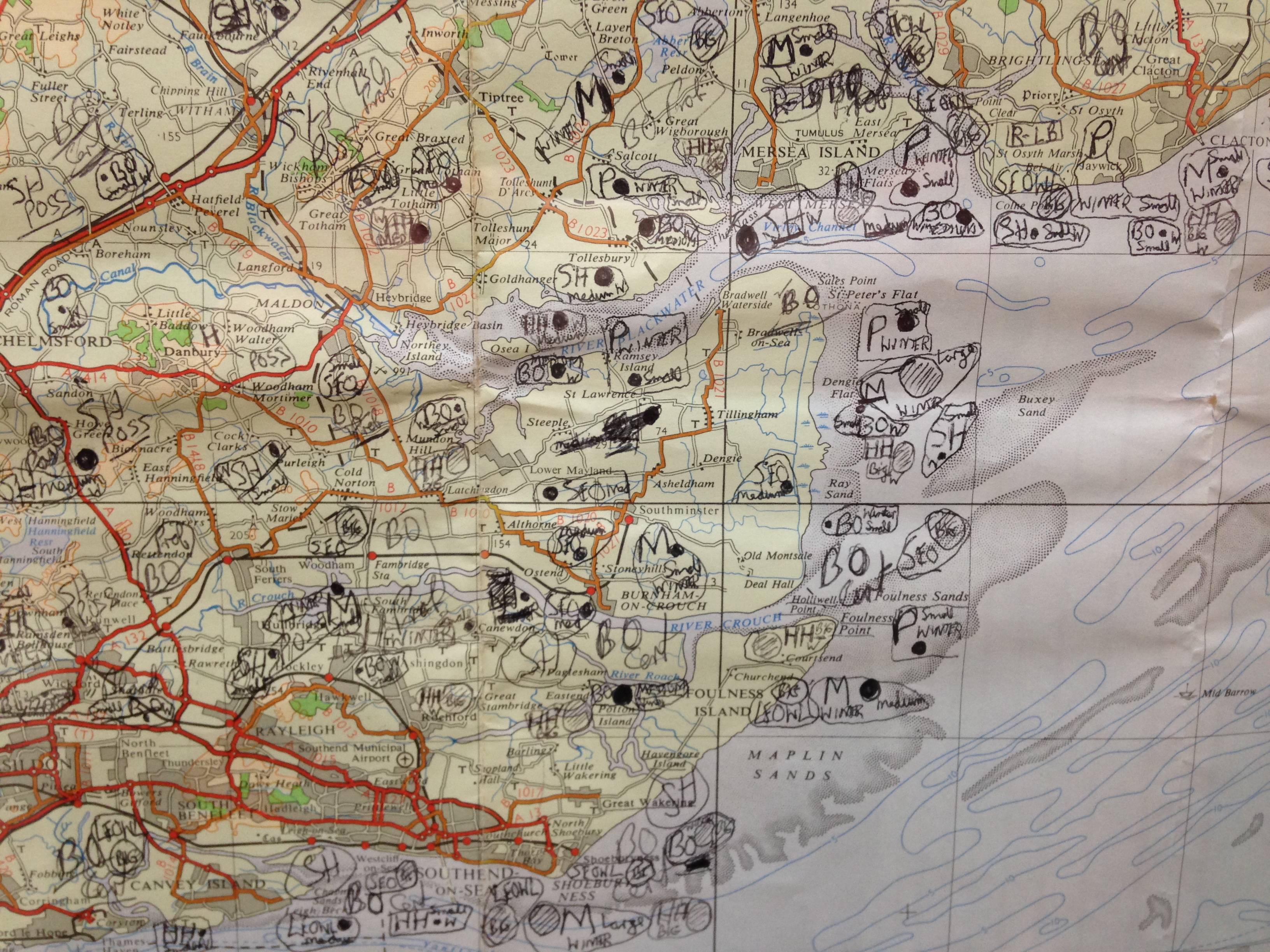
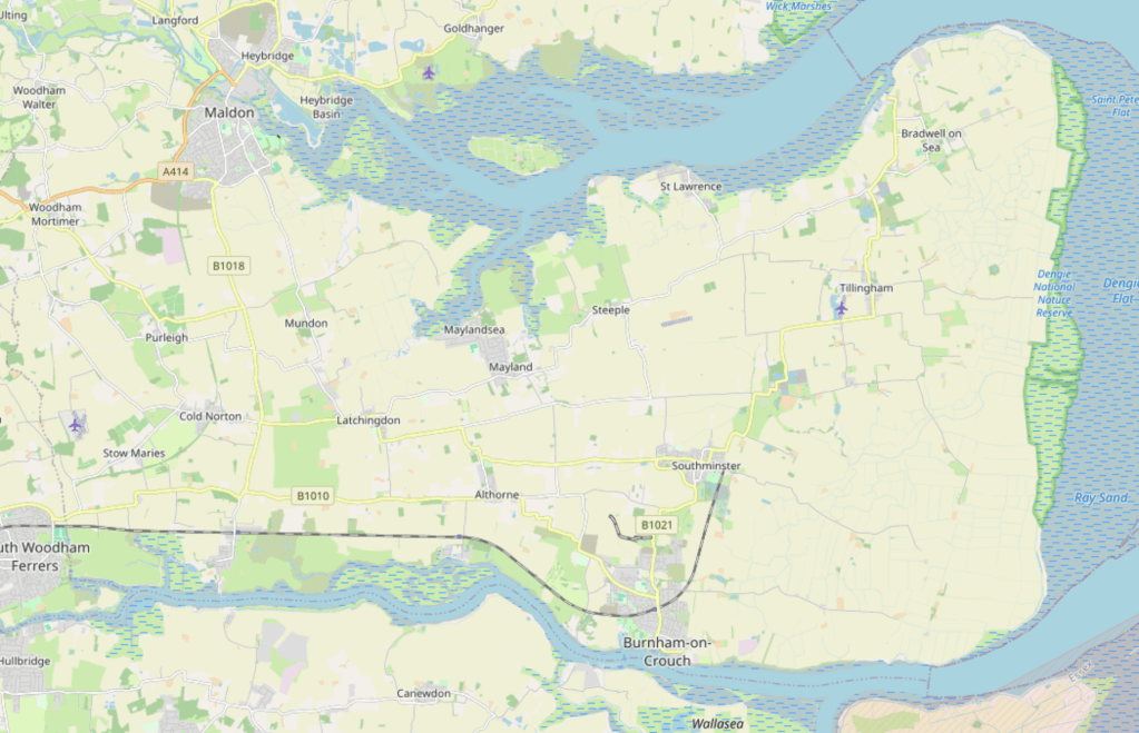
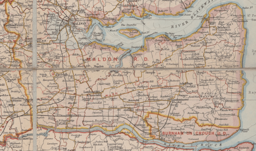
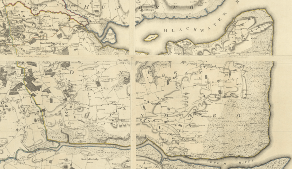
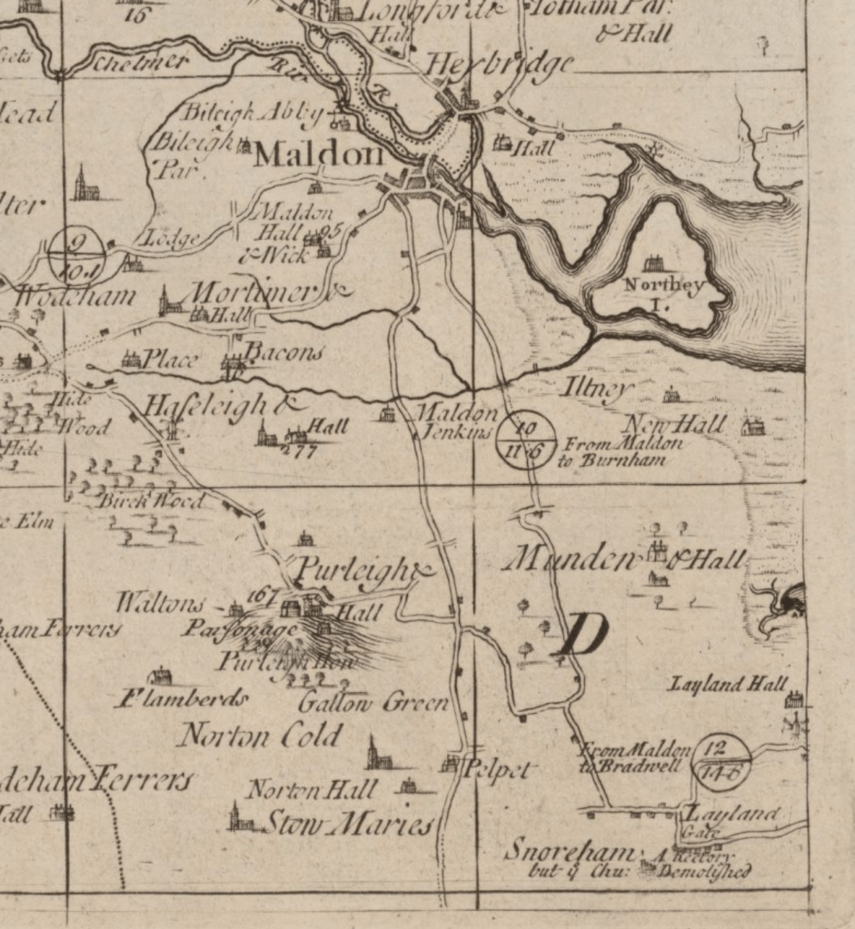
What we now call the B1010, the B1012, the B1018, the B1021, all the ‘priority routes’ recognised by Essex Highways and most of the local roads too, are already visible on the Chapman/Andre Map of Essex of 1777 – the first comprehensive chart of the county. In fact, the major routes on the Dengie could already be seen on a map of 1724: A new and correct mapp of Middlesex, Essex, and Hertford-shire, with the roads rivers sea-coast &c. actually surveyed by John Warburton, Joseph Bland and Payler Smyth.

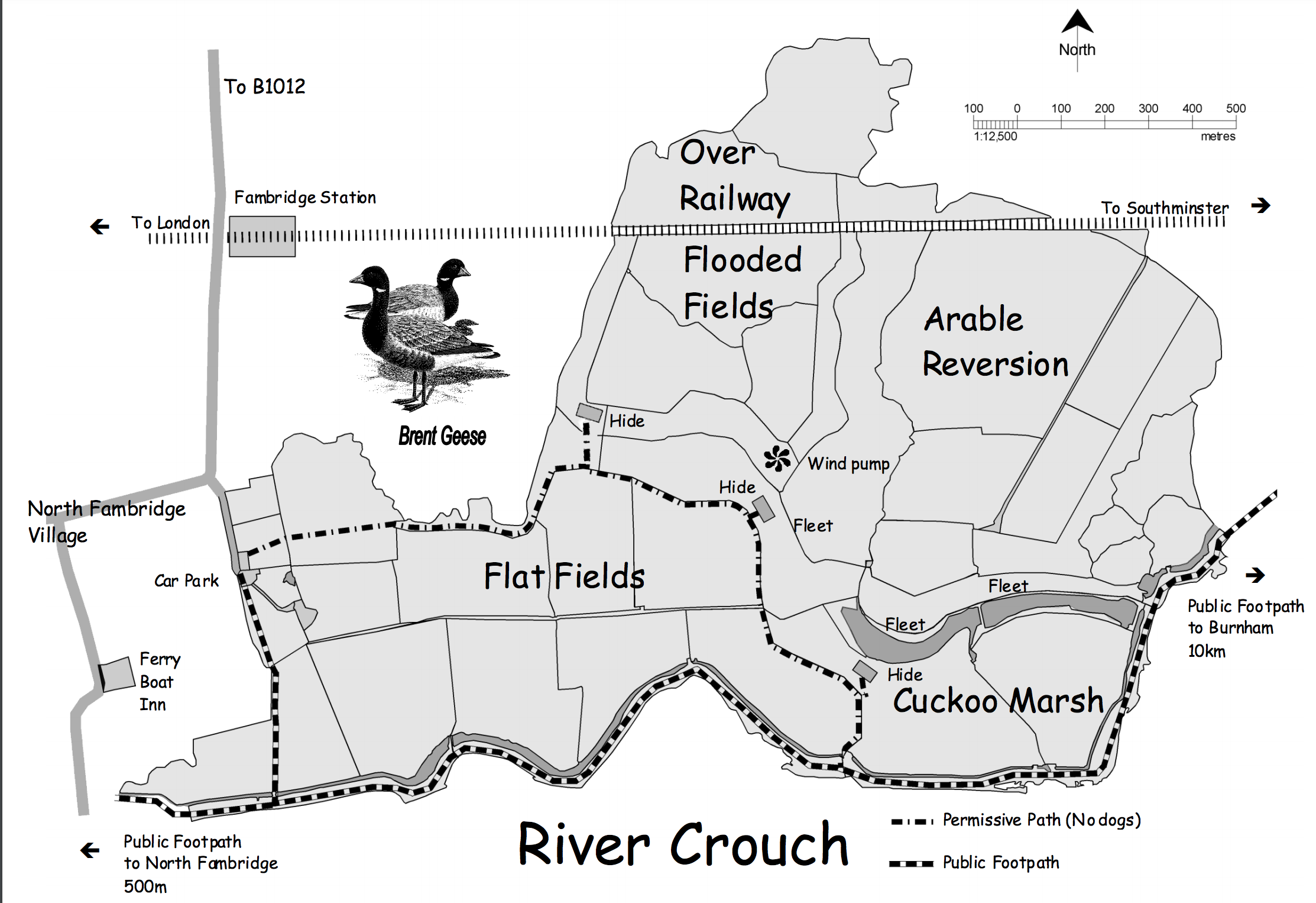
Much of the B1010, B1018 and B1021 to be, as well as the road running from Latchingdon through Steeple and St Lawrence to Bradwell are seen on the even earlier A map of the county of Essex: by a new survey … (1696) ‘performed by John Oliver’. Undoubtedly, these ways predate mapping and follow the lines of prehistoric pathfinding. They remain the ‘main arteries for the flow of commerce, goods and people‘.

The automobile was the Johnny-come-lately joining road users which had enjoyed these paths for hundreds of years. Bridleways, byways and footpaths were additional to these — not substitutes for them, routes to be retired to when the motor-car demanded the road. The rights-of-way for walkers and riders include the roads they have used since time immemorial.

Open Street Map (Accessed 2025)
Bacon’s new survey map of the counties of Essex, Hertford, Middlesex and London (c.1910)
Map of Essex (1777) by John Chapman & Peter André
Essex Highways Information Map (Accessed 2025) showing local highway network
From A new and correct mapp of Middlesex, Essex, and Hertford-shire, with the roads rivers sea-coast &c. actually surveyed (1724) by John Warburton, Joseph Bland and Payler Smyth.
A map of the county of Essex: by a new survey … (1696) performed by John Oliver [1947 facsimile]


At first, these the Johnny-come-latelys were slow, inconvenient and rare but as they became faster, accommodating and common they were also, increasingly, not friendly fellow travellers but road-hogs claiming the highway as their own.

Today, both the walker and the rider on these roads finds themselves unwelcome and endangered on the very ways that their forebears chose and formed. What are they doing on the road!?!?!?! cries the driver.

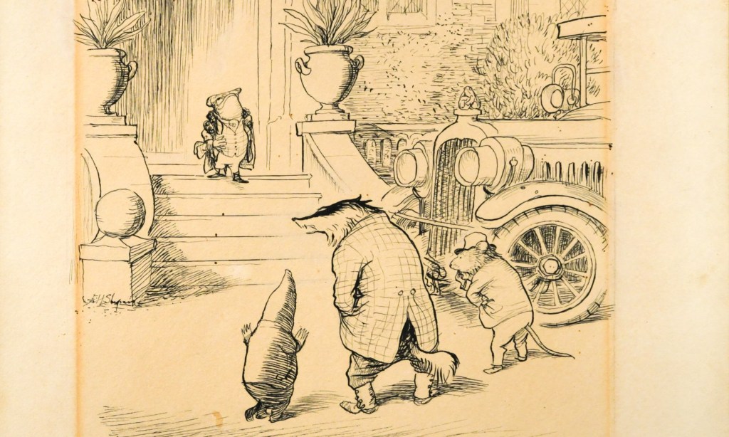
As Kenneth Grahame described in The Wind in the Willows (1908):

“They were strolling along the high-road easily, the Mole by the horse’s head, talking to him, since the horse had complained that he was being frightfully left out of it, and nobody considered him in the least; the Toad and the Water Rat walking behind the cart talking together–at least Toad was talking, and Rat was saying at intervals, ‘Yes, precisely; and what did YOU say to HIM?’–and thinking all the time of something very different, when far behind them they heard a faint warning hum; like the drone of a distant bee. Glancing back, they saw a small cloud of dust, with a dark centre of energy, advancing on them at incredible speed, while from out the dust a faint ‘Poop-poop!’ wailed like an uneasy animal in pain. Hardly regarding it, they turned to resume their conversation, when in an instant (as it seemed) the peaceful scene was changed, and with a blast of wind and a whirl of sound that made them jump for the nearest ditch, It was on them! The ‘Poop-poop’ rang with a brazen shout in their ears, they had a moment’s glimpse of an interior of glittering plate-glass and rich morocco, and the magnificent motor-car, immense, breath-snatching, passionate, with its pilot tense and hugging his wheel, possessed all earth and air for the fraction of a second, flung an enveloping cloud of dust that blinded and enwrapped them utterly, and then dwindled to a speck in the far distance, changed back into a droning bee once more.

The old grey horse, dreaming, as he plodded along, of his quiet paddock, in a new raw situation such as this simply abandoned himself to his natural emotions. Rearing, plunging, backing steadily, in spite of all the Mole’s efforts at his head, and all the Mole’s lively language directed at his better feelings, he drove the cart backwards towards the deep ditch at the side of the road. It wavered an instant–then there was a heartrending crash–and the canary-coloured cart, their pride and their joy, lay on its side in the ditch, an irredeemable wreck.

The Rat danced up and down in the road, simply transported with passion. ‘You villains!’ he shouted, shaking both fists, ‘You scoundrels, you highwaymen, you–you–roadhogs!–I’ll have the law of you! I’ll report you! I’ll take you through all the Courts!’ “

Drivers on the Dengie are victims of car dependence themselves. Where are their mobility options? Where is their freedom to choose their form of transportation? How can they escape the traffic to which they contribute? Why must they be bound to the expense and upkeep of a private vehicle? How are they to be protected from dangerous drivers, from speed limits that are not set at safe levels?

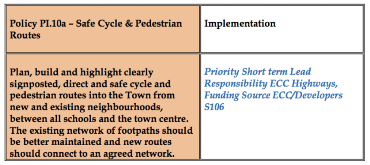
Providing mobility freedom, making our roads safer and calmer, and making a fairer use of our route network all require investment in, and attention to, active and public transport. We need to rECOnnect Dengie

“You knew it must come to this, sooner or later, Toad,” the Badger explained severely. “You’ve disregarded all the warnings we’ve given you, you’ve gone on squandering the money your father left you, and you’re getting us animals a bad name in the district by your furious driving and your smashes and your rows with the police. Independence is all very well, but we animals never allow our friends to make fools of themselves beyond a certain limit; and that limit you’ve reached. Now, you’re a good fellow in many respects, and I don’t want to be too hard on you. I’ll make one more effort to bring you to reason.”

‘Swaggering Down the Steps’ by EH Shepard
Local emotional support vehicle

Stitching the Path: Connecting Disjointed Walk & Cycle Routes 1

A mission objective of the rECOnnect Dengie project is to improve the active travel infrastructure on the Dengie and get a safe network of routes connecting all the settlements. As I’ve noted previously, there are lots of good words about achieving this sort of thing in the strategy documents produced from the national level down to the parish – but what happens next? How does it happen?

This in the first in a series of posts where I’ll look at where there are opportunities on the Dengie to connect up existing routes and how we might turn document objectives into objective fact. I’m starting close to home in Burnham-on-Crouch.

The Burnham-on-Crouch Neighbourhood Development Plan [pdf](2017) expressed a clear desire for better active travel infrastructure:

5.3 Make Burnham-on-Crouch a More Pedestrian and Cycle Friendly Place to Live

The Town should have a friendlier environment for cycling and walking. Its main and secondary roads are dominated by vehicles. New pedestrian and cycle routes should be provided that link the town centre with existing and new neighbourhoods, schools and recreation areas via quieter roads.’

It substantiates this objective with policies including:

One of the first new neighbourhoods created after the NDP is the Grangewood Park estate which was built on agricultural land allocated for new housing as Site S2 (j) in the Maldon District Local Development Plan [pdf]. A site with a long southern boundary to the town’s Secondary School, the Ormiston Rivers Academy.

Figure 12 in the Burnham NDP (Apologies for poor image quality, this is as it appears online)

The masterplan [pdf] presented by developers Charles Church in their planning application included a new off-road foot/cycle path running through the green space on the estate and providing a connection from Southminster Road in the east to Green Lane in the north.

Their document notes that the Maldon LDP includes:

T2 Transport Infrastructure in New Developments The layout of new developments should provide for safe access to and from the highway including… links to adjacent or nearby foot/cycle path network’

and that it states that amongst the criteria any proposed development must satisfy is:

‘Safe pedestrian and cycle linkages are provided from the development to the town centre, other public service facilities and the existing urban area’.

(The Residential Travel Plan [pdf] supplied in the developer’s application noted that ‘[t]here are no dedicated cycle facilities in the vicinity of the development site’)

Later the planning application notes that ‘[t]he Burnham Neighbourhood Plan shows proposed cycle links that the Town would like to see progressed; within this diagram a possible link is shown into the site subject to this application. The provision of this link would rely on third party land and therefore cannot be provided by Charles Church, however the scheme has been developed to facilitate future connectivity.’

It’s unclear exactly what this is referring to, as the Burnham NDP includes text references to possible cycle routes but no maps showing these. The diagram with ‘a possible link’ is perhaps the green dotted line ‘new pedestrian route’ shown in the NDP’s ‘Figure 12’ (copied above) connecting the site to Maldon Road in the south, and running along the western boundary of Ormiston Rivers’s playing fields. This would have been a convenient addition to Burnham’s walk/wheel/cycle routes but it never materialised and it illustrates succinctly a key unaddressed problem in getting better active travel infrastructure.

i.e A government strategy proposes active travel infrastructure as an essential part of new developments, a developer provides infrastructure within the development – but the value of such infrastructure is largely produced by a larger connectivity that neither government nor developer is providing.

The National Planning Policy Framework (NPPF) make enough noises about pedestrian and cycle routes that applications for new housing tend to include vague promises about including them. On the ground this tends to result in intra-estate pathways that have genuine utility but terminate at the estates’ boundaries with no clear sense of how onward travel on foot, mobility device or bicycle might proceed.

Foot/cycle paths shown in grey to the north of the housing on Grangewood Park estate

True to their promise, the developers of Grangewood Park delivered the walk/cycle path on their masterplan and the estate includes what is, currently, the best example of active travel infrastructure in the town with an off-road path that connects Southminster Road with Green Lane – but what happens when you get to Southminster Road or Green Lane? What contribution does it make to a safe, active travel network?

At Southminster Road (B1021) the pathway ends 160 metres north of the entrance to Ormiston Rivers school. A child on a bicycle coming through Grangewood Park must now leave the off-road cycle path, cross a lane of northbound traffic leaving town on the B1021, and join the southbound lane – before turning across the path of northbound traffic again to complete their journey to school. Opposite the Grangewood junction there’s a road sign with the red triangle warning of a school ahead and, beneath it, one of those advisory-only ’20’s Plenty’ signs – but the B1021 has a 30mph speed limit at this point and has limited direct access along this section, a form that tends to encourage vehicle speeds in excess of the legal limit. The common experience of cyclists, of all ages, using this road is driver impatience and an aggressive eagerness to pass.

Meanwhile, pedestrians leaving the off-road path at Southminster Road find there is no footway providing an onward walking route north or south. There is a narrow pavement on the east side of Southminster Road but there is no controlled crossing to reach it (a small traffic island provides some pedestrian refuge).

School children cross the B1021 to reach the Grangewood Park Estate.
The junction of Grangewood Park Avenue and Southminster Road, where the foot/cycle path ends

Once the road is crossed, a pedestrian can proceed south on pavement into Burnham. If it’s a child walking to the school they can pass the school entrance on the other side of the road and carry on further south around a bend to cross the road at a zebra crossing, then walk north again up the opposite pavement to reach the school entrance – a distance of 450m. Will they do that though? Of course not!, once they are opposite the school entrance our cyclist used – 160m down, they’ll do what she did and cross the road there. The curve of the road means that drivers travelling south will be blind to a child crossing the road there until they are quite close. The Highway Code calculates the stopping distance of an average car at 30mph in dry conditions to be 23 metres.

Looking north up Southminster Road where a child is liable to cross to reach the school
Car stopping distances in the Highway Code

‘But there’s no alternative!’ I hear you cry, ‘you just have to make do with what you’ve got’.

‘I know this estate is right next to the secondary school and we agreed in the neighbourhood plan to “plan, build and highlight clearly signposted, direct and safe cycle and pedestrian routes into the Town from new and existing neighbourhoods, between all schools and the town centre” and we agreed that we would “improve the pedestrian and cycle journeys to/from each of the schools” – but really what else could we have done?

Let me tell you!

Grangewood Park shares a border with Ormiston Rivers school, their frontage to Southminster Road is contiguous. The foot/cycle path could have gone over Grangewood Park Avenue and continued south over amenity land to the boundary of the school and through the small woodland which separates it from the paved area of the school grounds.

The red line indicates where the Grangewood path could be connected to Ormiston school, the blue line how that could continue to the existing footway

All the land involved either belongs to the developer or to Essex County Council. The developer was on-board with facilitating connectivity, the Town and District Councils wanted connectivity, Essex County Council/Essex Highways wants kids to cycle to school. It should have happened… and it still can!

The current residents of the three houses on Grangewood Park estate facing Southminster Road might prefer the current area of mown grass and small flower bed, but they’d benefit from a walk/cycle/wheel route through it. Improving active travel routes is beneficial for everyone, not just children.

This missing link would facilitate footway access from Burnham’s riverside, urban centre and railway station through to Green Lane by reducing the number of necessary road crossings. It would complete a safe cycle route from the Grangewood Park estate to Ormiston school.

EXTRA CREDIT: The pavement going south from Ormiston School has an area of verge and is wide enough to allow a shared foot/cycle way to the junction with Maldon Road (B1010). Across the B1010 junction, in the northbound lane, there is also Burnham’s oldest piece of cycling infrastructure – a painted cycle lane that begins just south of it and finishes quickly north of it – it’s of spurious utility but nevertheless could easily merge into a cycleway on the west of Southminster Road and gain a connectivity it has never had before!

What happens at the other end of the Grangewood Park estate foot/cycle path though? Can we get anywhere from there? Look out for Stitching the Path: Connecting Disjointed Walk & Cycle Routes 2 – where I will address these very questions!

Better Walk/Wheel/Cycle Routes

Next week, work commences on a solar farm south of Keelings Road, Dengie.

This will involve constructing an access road from Keelings Road to Asheldham Brook, which could be made suitable for cycle access.

From Asheldham Brook it’s only 2km to The Marshes, Southminster through land (Northwycke Farm) with a single owner: Lincoln College, Oxford.

Continue reading “Better Walk/Wheel/Cycle Routes”

Link up Rural Areas

The latest Essex cycling & walking plan is out for consultation. I’ve just taken a quick look and this is my hot take.

4 of the proposed cycle routes go through the Dengie:

Mid Essex Cycle Route 12 (Burnham-on-Crouch-Southminster-Tillingham-Bradwell-on-Sea)

Mid Essex Cycle Route 13 (Maldon-Latchingdon-Mayland-Bradwell-on-Sea)

Maldon Green Link 11 (Mundon-Purleigh-StowMaries)

Maldon Green Link 19 (Cold Norton-Latchingdon-Southminster)

Mid Essex Cycle Route 9 also skirts the Dengie (Danbury-South Woodham Ferrers)

These would help move towards the #rECOnnectDengie ‘Slow Ways Dengie’ vision but a quick look already reveals the lack of:

  • a south Dengie route connecting through to National Cycle Network route 13
  • routes connecting north Dengie villages to south Dengie villages and the Crouch Valley railway line (eg. Mayland-Althorne-Althorne station, and Woodham Mortimer-Purleigh-Cold Norton- Fambridge)
  • a link to the Burnham Ferry connecting the Dengie to Rochford/Southend/South Essex
  • plans that avoid busy roads (eg. B1021)

There are no maps or route descriptions for walking that I have seen so far and the cycle routes seem to entirely be on existing roads. When I go into the survey and more of the supporting documents I’m hoping to see more ambition: elements like segregated cycle routes, and a network vision. At the very least I’m expecting something on ‘quiet lane’ designations, continuous pavements, safe crossing points, speed restrictions and traffic calming measures

Beneath the Seawall, the Beach of Dreams

Photograph of the walkers paused by the entombed Bradwell Nuclear Power Station to hear Angenita Teekens speak.
The walk pauses by the entombed Bradwell Nuclear Power Station to hear Angenita Teekens on her mile

Last Sunday I participated in a stage of Beach of Dreams, walking between Bradwell Waterside and Burnham-on-Crouch. Beach of Dreams is an art project initiated by Ali Pretty of Kinetika, it’s a collaborative 500-mile walk between Lowestoft and Tilbury

Continue reading “Beneath the Seawall, the Beach of Dreams”

Ultra Dengie: Southend-on-Sea

IMG_1415 2

A trip out to meet Graham Burnett at home in Westcliff-on-Sea. Travelled by train BoC to Wickford on the branch, then down the mainline to Southend Victoria. A little exploration around rainbound Southend before going on to Graham’s. I made the regular pilgrimage down the High Street to look out over the Thames Estuary from Pier Hill, then returned north via Southend library. Continue reading “Ultra Dengie: Southend-on-Sea”

Beating the Bounds 3: Coastal Path at Battlesbridge

IMG_1413 2

From the cafe on the upper storey of the Antiques Centre in the old mill at Battlesbridge a view of the River Crouch. Battlesbridge is the head of the River Crouch navigation, the upper reach of the tidal zone and site of the most easterly bridge over the river. Geographically Battlesbridge sits at the south west corner of the Dengie peninsula.

On the north bank a rough track along the riverside (not a registered PROW) shortly connects with a riverside footpath (PROW 229_41) where a creek inlet meets Maltings Road by the Riverside Industrial Park. This rough track should form part of the Coastal Path. Continue reading “Beating the Bounds 3: Coastal Path at Battlesbridge”

Beating the Bounds 2: BoC to Southminster

IMG_1360

A circular walk between Burnham-on-Crouch and Southminster. Leaving Burnham by Wick Road travelling east, turning north on to the footpath across Burnham Wick Farm fields (PROW 242_15) and travelling on path until it meets Marsh Road by Dammer Wick farm. Passed two dog walkers using the track. Rye planted in fields. Continue reading “Beating the Bounds 2: BoC to Southminster”

Beating the Bounds 1: North Fambridge to BoC

An afternoon bracer: off the train at North Fambridge at 15.10 then south down at Fambridge Road. At the turn to The Avenue I instead took the footpath (PROW 256_10) along Blue House Farm Chase towards Blue House Farm. Instead of proceeding directly to the sea wall by the continuing public footpath (PROW 256_13) I took the permissive path east across Blue House Farm land. This initially dragged me north easterly along a raised bund, higher than the wet fields and fleets.

Screen Shot 2018-03-30 at 11.27.58 Continue reading “Beating the Bounds 1: North Fambridge to BoC”