A map is not the territory it represents, but, if correct, it has a similar structure to the territory, which accounts for its usefulness.
— Alfred Korzybski, Science and Sanity (1933, p. 58)
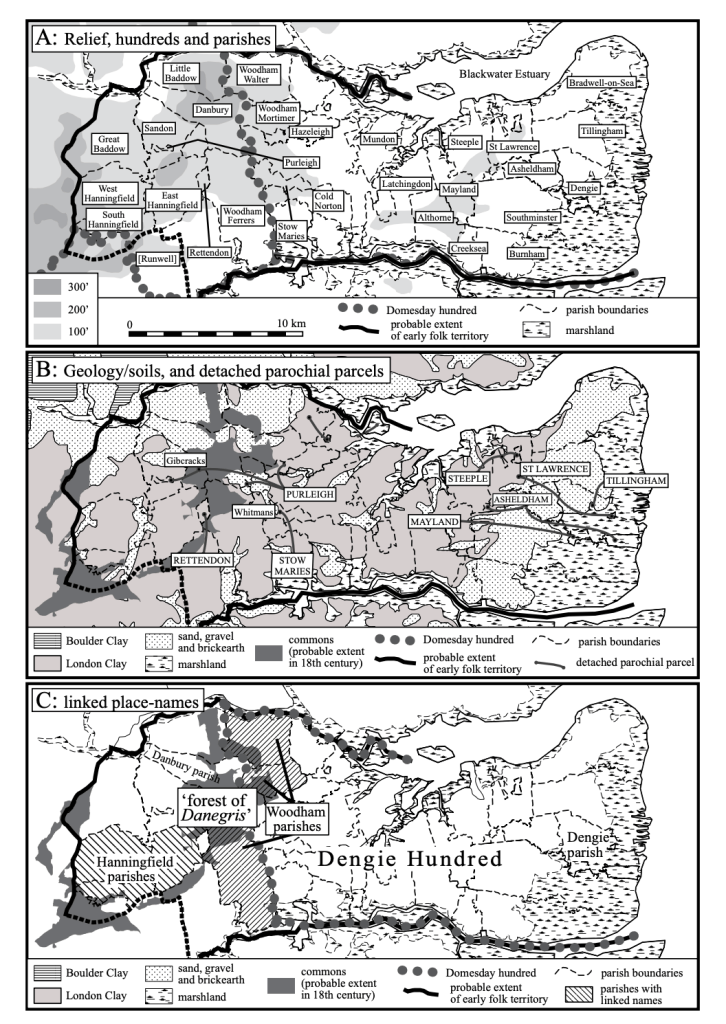
The Dengie is a low-lying peninsula in Mid-Essex. It is bordered by the North Sea to the East and the tidal inlets of the River Blackwater to the North and the River Crouch to the South.
The land area is within the ancient regio of Deningei and is roughly equivalent to the later administrative division of the Dengie Hundred but the western extent exceeds that a little and is defined by the tidal reaches of the Blackwater and Crouch. It is entirely within the future Mid-Essex Unitary Authority area.
On the Dengie peninsula I’m walking the public rights of way and beating the bounds.

