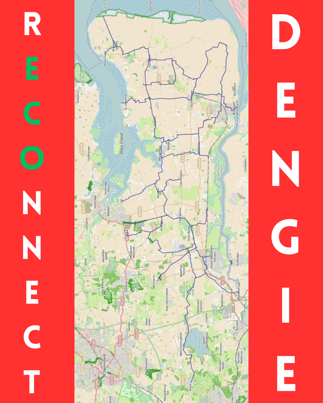
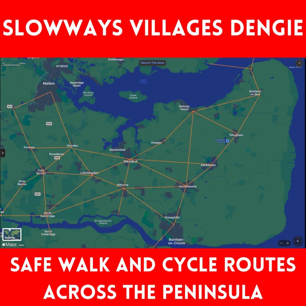
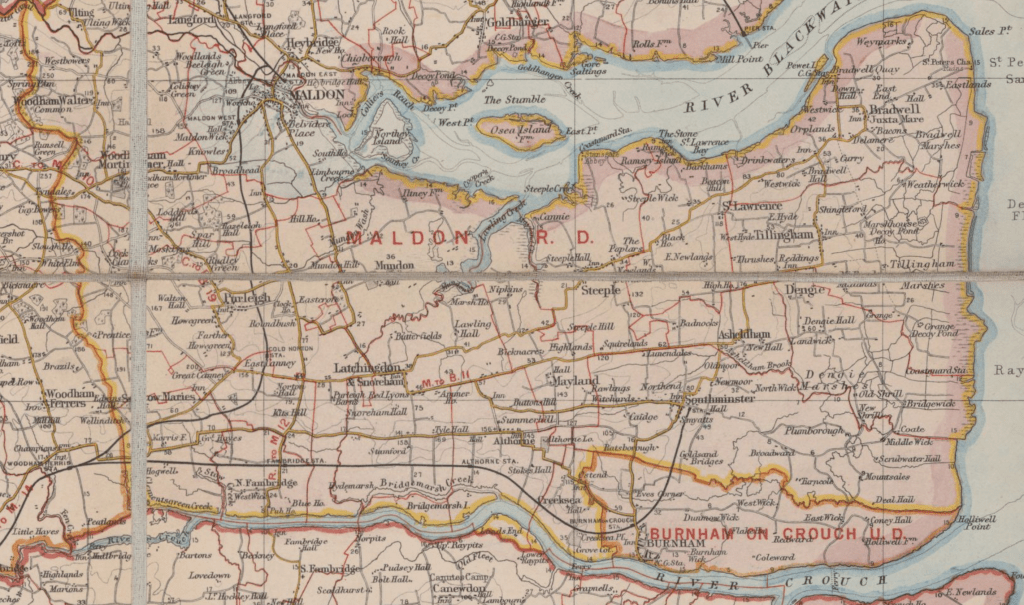
The recent and successive cycle strategy documents from Essex and Maldon have failed to suggest what cycle routes on the Dengie could look like – so, I’ve had a go…
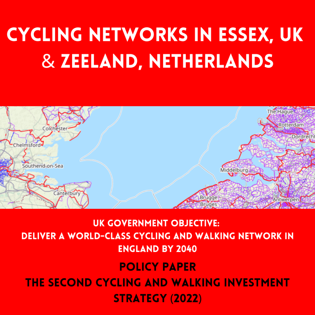
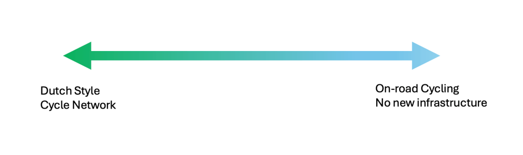
[I should start by stating that the ideal situation would be a Dutch style network, including completely new cycleways taking the most direct line between settlements. This is the only option that would achieve the aim to ‘deliver a world-class cycling and walking network in England by 2040’ expressed in ‘The second cycling and walking investment strategy (CWIS2)’ published under the 2019 to 2022 Johnson Conservative government.
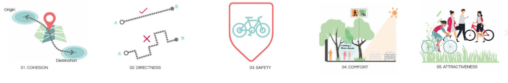
The Dutch CROW Design Manual for Bicycle Traffic considers five basic design principles for network design: Cohesion, Directness, Safety, Comfort and Attractiveness
Despite this being the only option that would meet the national objective, if we place it at one end of an excellent-to-useless-spectrum, then the other end is no-change and cyclists left to fend for themselves on the existing road network. (A bit of signage and some lines painted on the road would be barely better.)
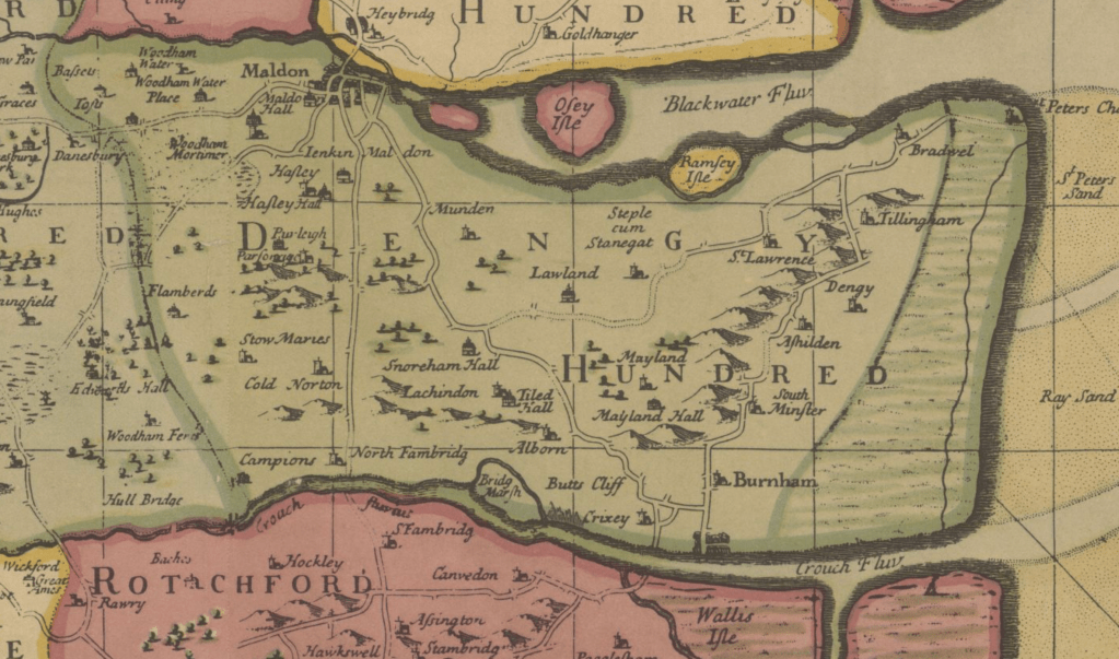
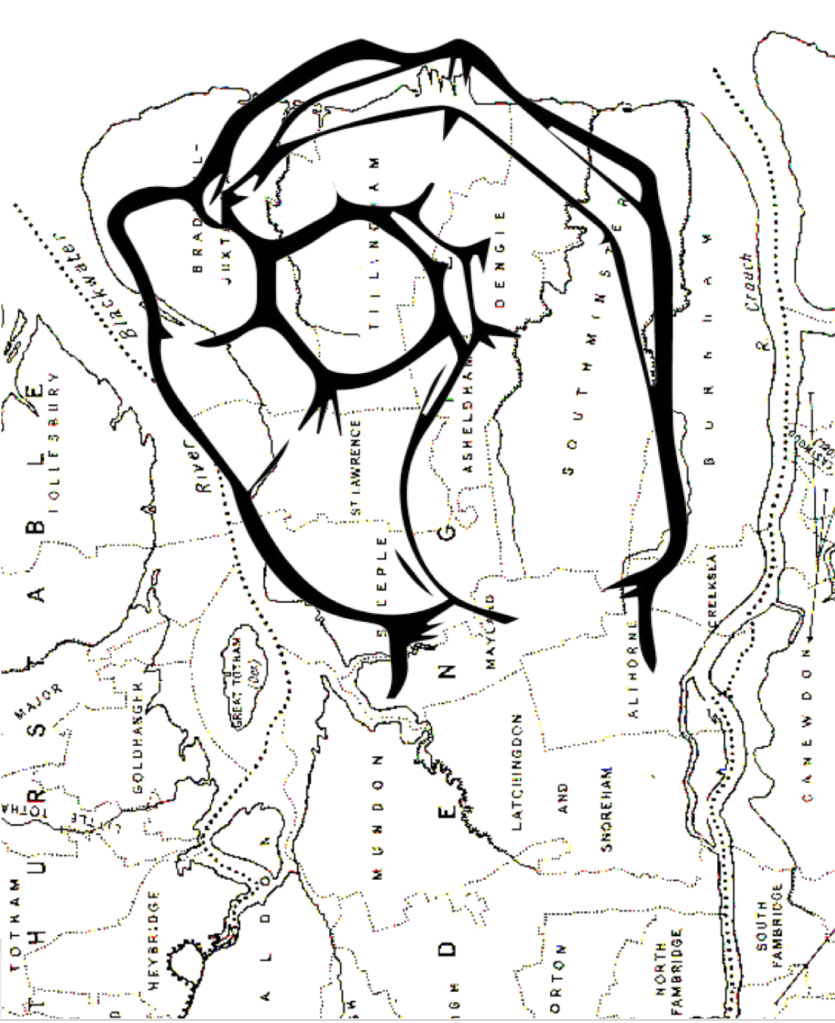
I’ve started with the rECOnnect Dengie aim that every settlement on the peninsula should be connected with a safe active travel route. Railway station and ferry routes should be connected to the network.
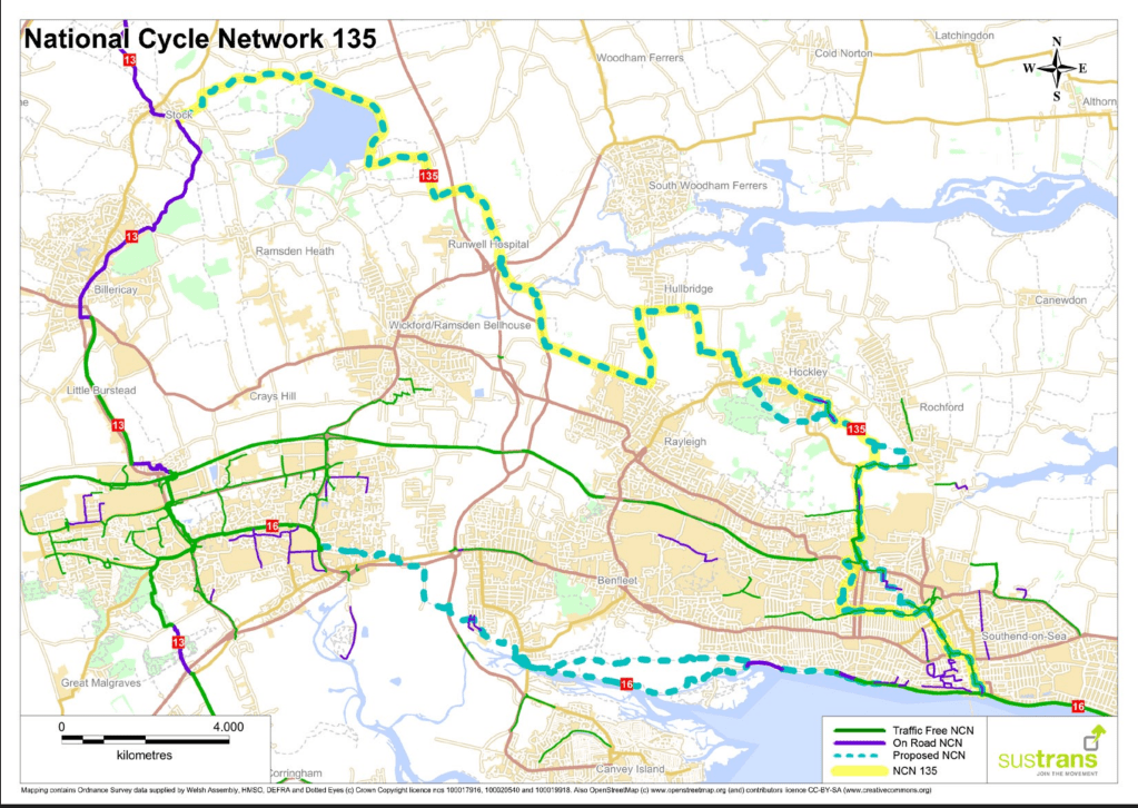
I’ve also looked for how Dengie routes could be connected both to the urban cycle networks in Maldon town and South Woodham Ferrers, and to the National Cycle Network (with connections to NCN 1 at Maldon, NCN 13 at Stock, and the proposed NCN 135 [pdf] at Battlesbridge.
Existing National Cycle Network routesProposed National Cycle Network route |(NCN 135]
I began with using the few bridleways and byways we have, but we don’t have many of them.
We have a better footpath network, and footpaths can be awarded ‘higher rights’ (e.g. use by bicycles) so I’ve tried to fill gaps with them but this still leaves a lot missing.
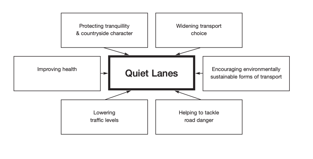
Maldon District currently has no roads designated with Quiet Lane status but I then proceeded to use roads which I think would be appropriate for such a status (avoiding the ‘priority’ PR1 and PR2 roads). Quiet Lane status should being slower speed limits and traffic calming infrastructure.
This still doesn’t provide a network that meets the objective of connecting every settlement, so I’ve then proposed sections over land that currently has no public rights of way (PROW). This will always be controversial and argued over – but cannot be avoided. Here I have prioritised old railway alignments, solar/wind farm access roads and existing farm tracks.
This still leaves some things unaddressed – Latchingdon, for example, is hard to link into a network using existing PROW and avoiding ‘priority roads’; Similarly, connecting North Fambridge and Althorne, other than by the indirect seawall route – bolder plans are necessary here.
The map in the first image is purposely large-scale to avoid instant arguments over routes but I’m happy to share more detailed mapping with anyone who wants to get involved with planning and proposing a network. More local knowledge would certainly improve the routing.
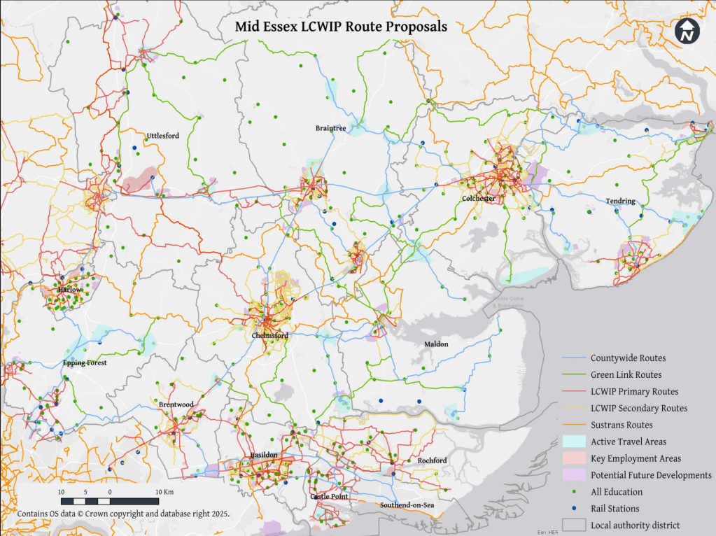
Like me, many of you may have responded to the Essex County Council consultation on the ‘Essex Wide Walking and Cycling Infrastructure Plan’. The results of that consultation were quietly released last August (2025), so you may not have seen them. I’m still working through the documents and I welcome comment and feedback from anyone else who braves them!
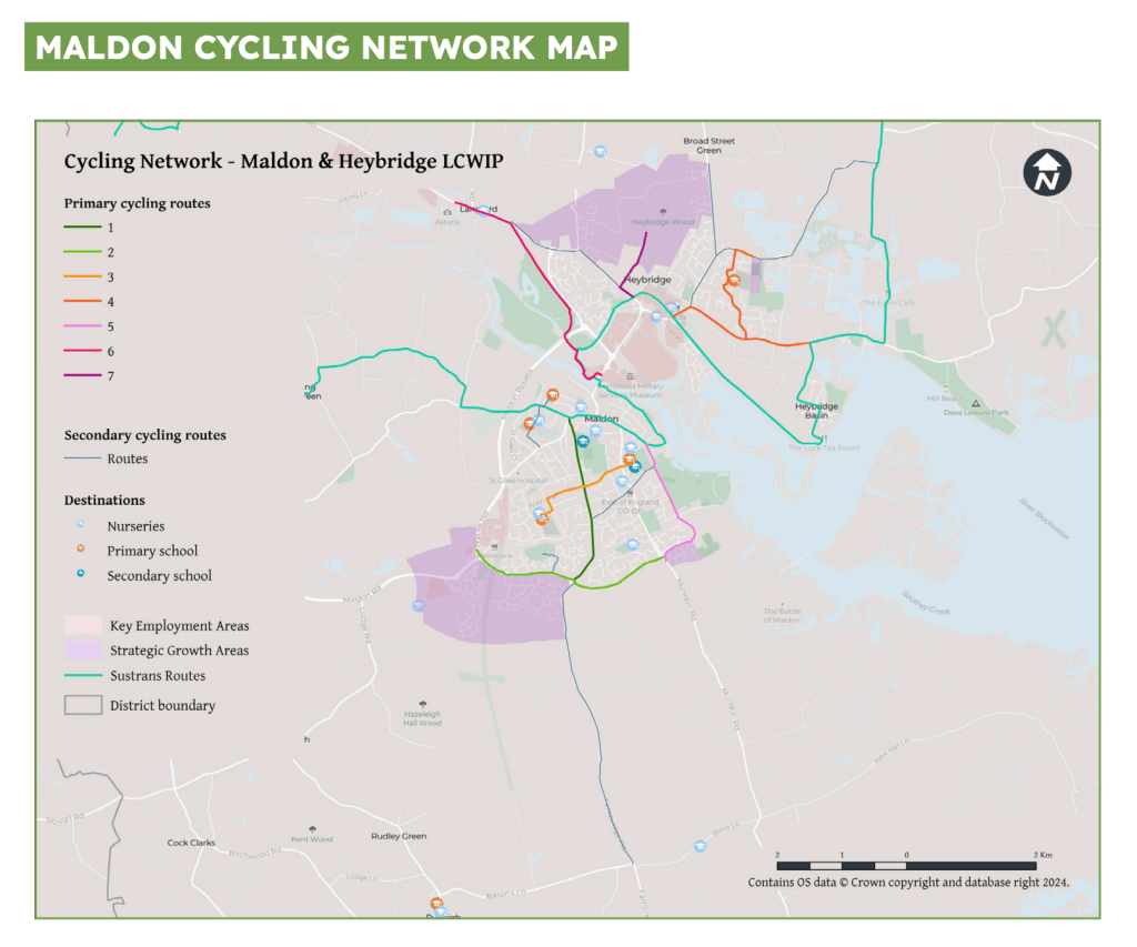
[As a reminder, settlements of 20k+ population each got their own Local Cycling and Walking Infrastructure Plan (LCWIP) while everywhere else in Essex was covered by the ‘Essex Wide’ plan. As no settlement on the Dengie reached the 20k threshold, the entire peninsula is covered by that plan. Maldon & Heybridge’s population combined exceeds 20K so they have a separate LCWIP. One of the maps in that document indicates a ‘secondary cycle route’ from Maldon into the Dengie using the B1010/Fambridge Road and ending abruptly at the Baron’s Lane junction]
The Consultation response consists of three documents :
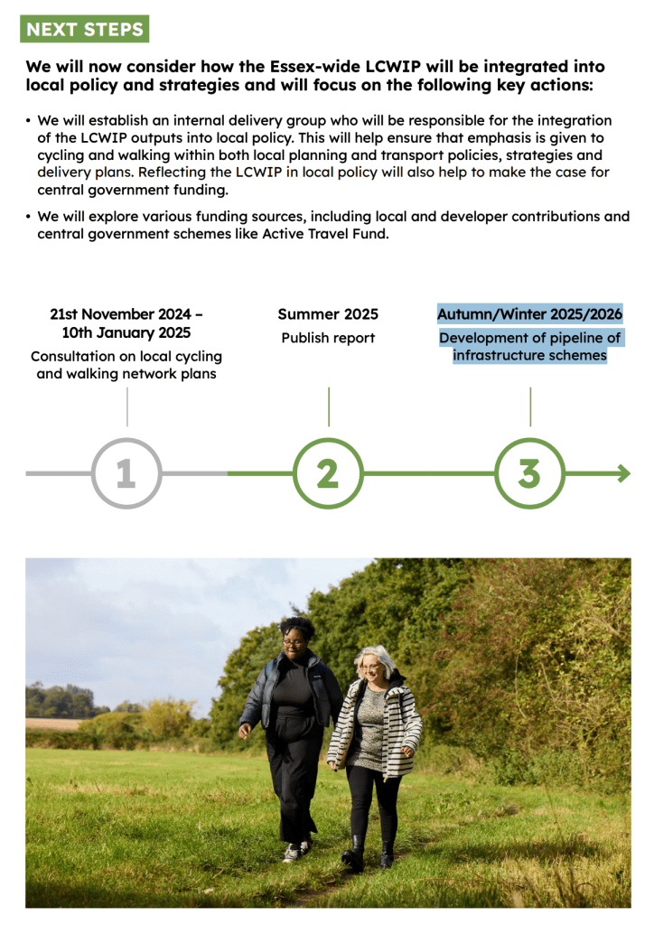
The Summary Report is not particularly informative. It contains a timeline of three steps which ends with ‘Autumn/Winter 2025/2026 Development of pipeline of infrastructure schemes’ – we are in the last weeks of that period now but I can find no further information on these infrastructure schemes.
If you commented on the consultation, you should find your remarks reflected in the Consultation Report (the Dengie is poorly represented in the maps included in this document with just a glimpse of the south of the peninsula to the top of the South Essex Map)
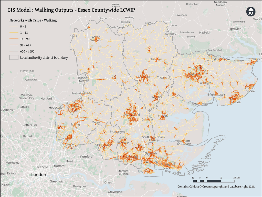
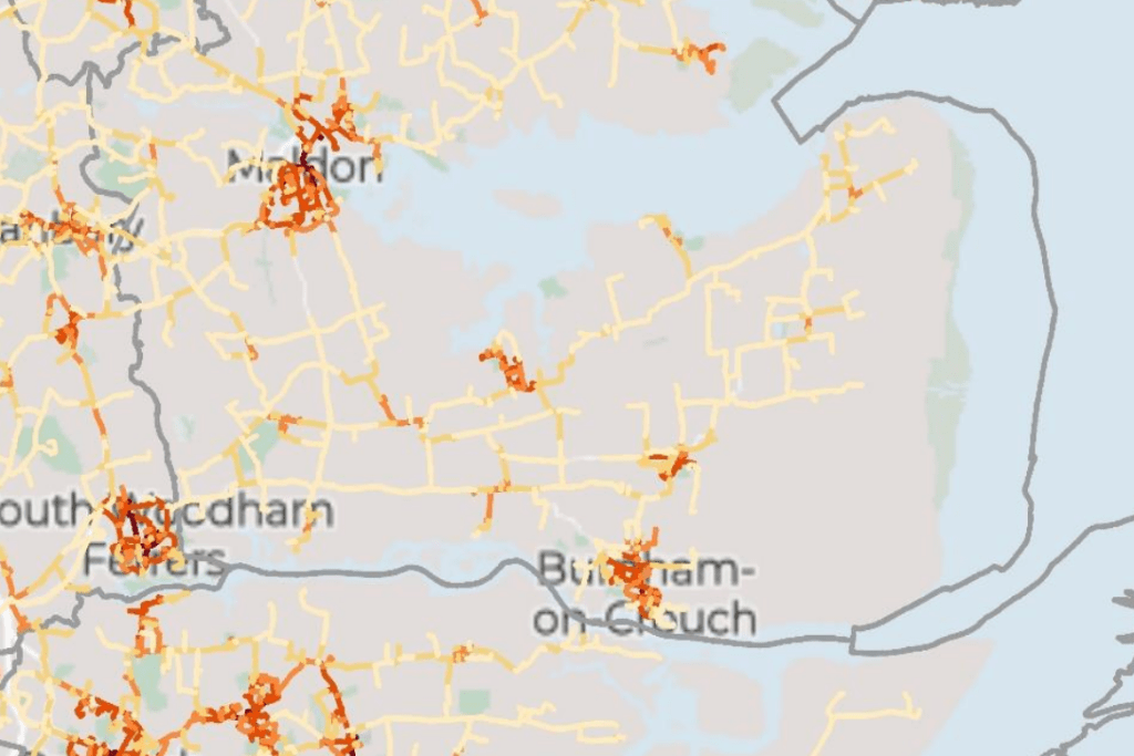
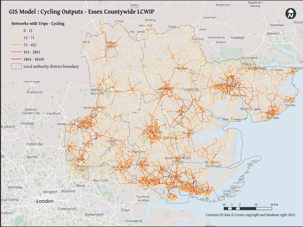
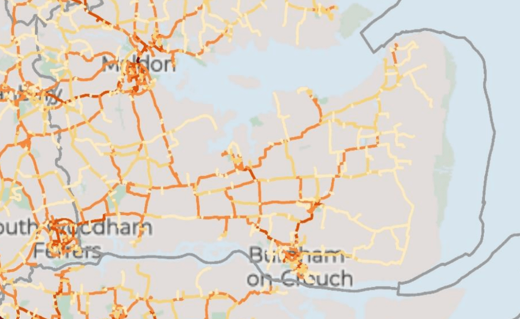
The most interesting of the three documents is the Technical Report which includes new maps identifying potential key walking and cycling networks which I share below, with zoomed in images of the Dengie.
The ‘route proposals’ in the Final Network Plans look identical to those in the Consultation document however, they don’t reflect these key walking and cycling networks, and they follow existing roads without a clear sense of how walking and cycling will be made safe on these highways.
The Technical report notes that:
‘Given the rural nature of the area [Essex], the plan prioritises cross-boundary connections between towns and cities, utilising off-road routes like Public Rights of Way (PROWs) and bridleways, and innovative on-road cycling solutions in constrained networks.‘
The Summary Report expands this slightly in it’s introduction:
‘Given the mainly rural nature of Essex, the Essex-wide plan prioritises links between villages, towns and cities. The proposals aim to make use of off-road routes such as byways and bridleways, alongside innovative on-road cycling solutions on space-limited networks such as quiet lanes to deliver the LCWIPs.’
The nod to rural areas is appreciated but I’m dismayed that the strategy seems to depend on:
existing byways (there are 3 on the Dengie totalling 2714m in length)
existing bridleways (there are 8 on the Dengie totalling 9,178m in length)
existing ‘quiet lanes’ (there are none designated in Maldon District totalling 0m in length)
That’s a total of a bit over 7 miles of ways that already exist and that we know are not fit to provide a continuous cycling route – they are isolated, dispersed, poorly connected and provide no east-west connections. I haven’t yet found any reference to improvement works on these already existing paths, so its unclear what the consultation/strategy/plans have added to the status quo.
It may be that the plan is for new off-road routes, new byways, bridleways and quiet lanes – which would be great! I haven’t found any hint of that in the documents yet though.
You’ll also have noted that the walking and cycling plans often seem to just talk about cycling. New cycling routes would also increase capacity for those walking and wheeling but it would be good to see some more reference to the particular needs of all active transport users in these reports
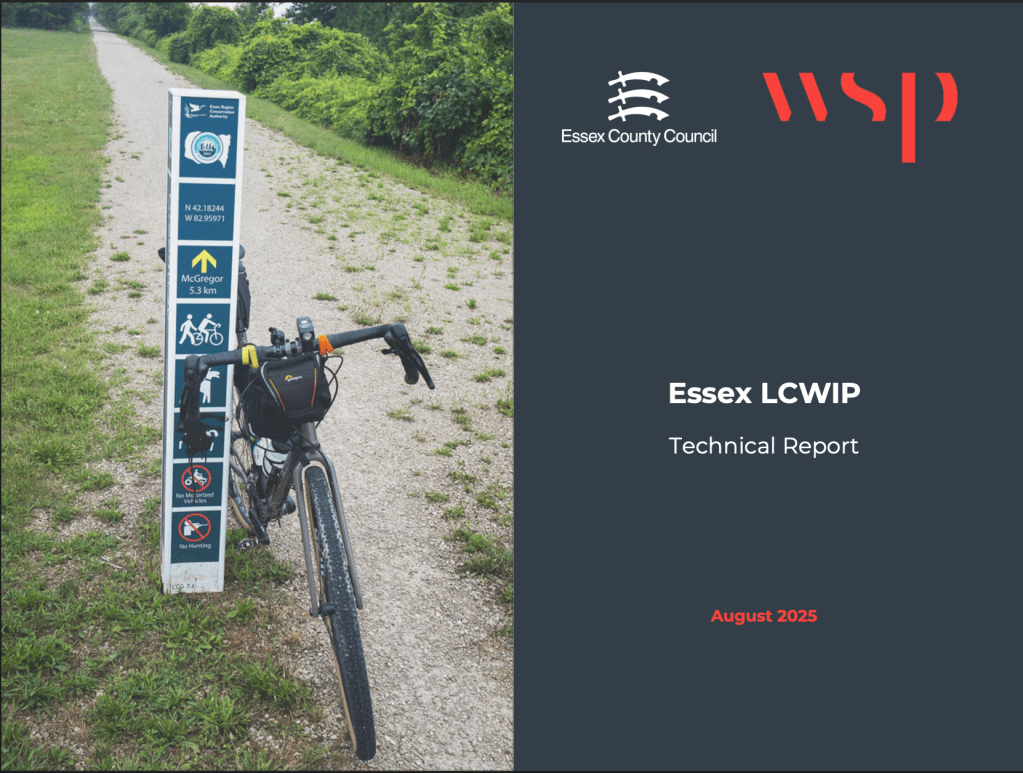
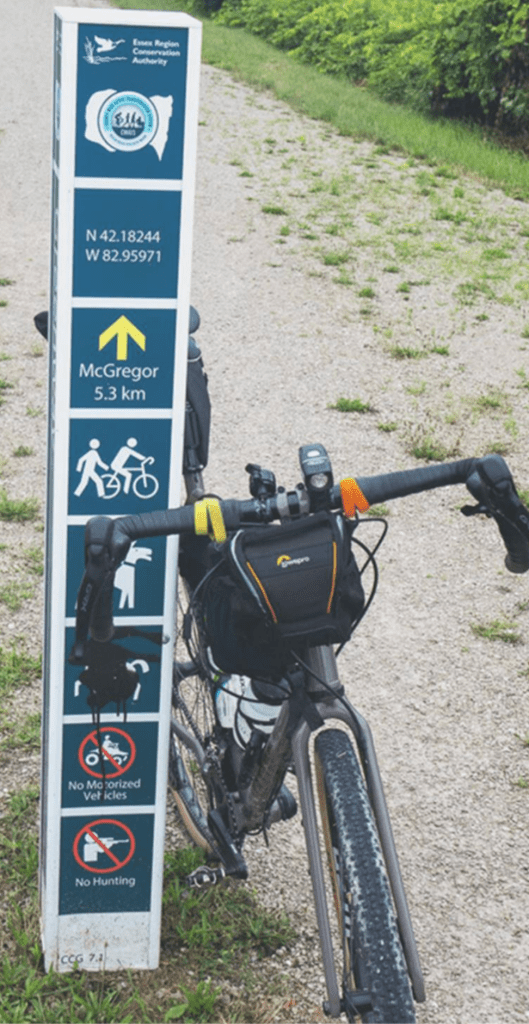
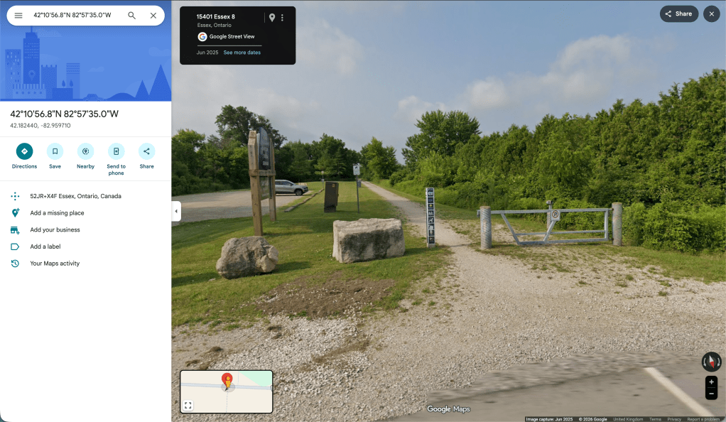
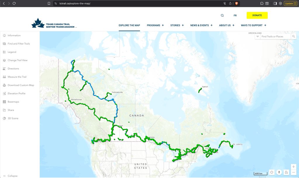
The Technical Report prepared by consultants WSP has a photograph on its first page of a rural cycle path, with a bike propped up against a smart wayfinding post which immediately had me wondering where in Essex this was, as I haven’t seen anything like it in the county before. I zoomed in to see more detail – at the top there’s a logo and text for the ‘Essex Region Conservation Authority’, neither of which I recognise, and the phrase ‘Essex Region’ sounds off. Below this are some co-ordinates that seem off too and a distance marker to somewhere called McGregor. The final square on the post has a person with a rifle on it and the legend ‘No Hunting’.
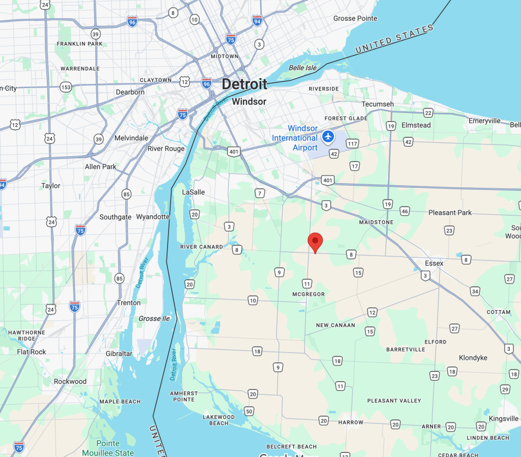
If you hadn’t guessed it yet, this photograph isn’t from the English county of Essex, it’s from 6000km away in Essex County, Ontario, Canada – close to the motor city of Detroit. It’s a photo on the Chrysler Greenway, a 50-kilometre nature trail that comprises the southernmost link of the Trans Canada Trail – at 28,000 km (17,000 mi) the longest recreational, multi-use trail network in the world.
I trust that this indicates the scale and ambition of Essex County Council’s plans rather than a stock photography fail by a WSP intern and I look forward to the Autumn/Winter 2025/2026 announcement of the infrastructure schemes to make it happen!
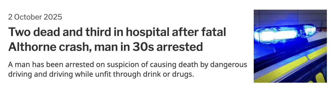
Barely a week goes by now without a collision on the Dengie roads. A couple of months ago this sadly included two fatalities. There’s clearly a problem with drunk and drug driving, but this appears to be a factor in only a minority of cases and doesn’t sufficiently explain the frequency of dangerous driving incidents. While excess speed is likely a factor, that doesn’t necessarily mean speeding —the recent Department of Transport study Road safety factors: initial analysis (30 May 2024) found that only 19% of fatal road collisions are recorded as a driver exceeding the speed limit. A fact which caused Sam Wakeling of campaign group Living Streets to ask: ‘Does that suggest that a whole lot of deadly speed is accepted within the legal limit? And that our speed limits are not set at safe levels?
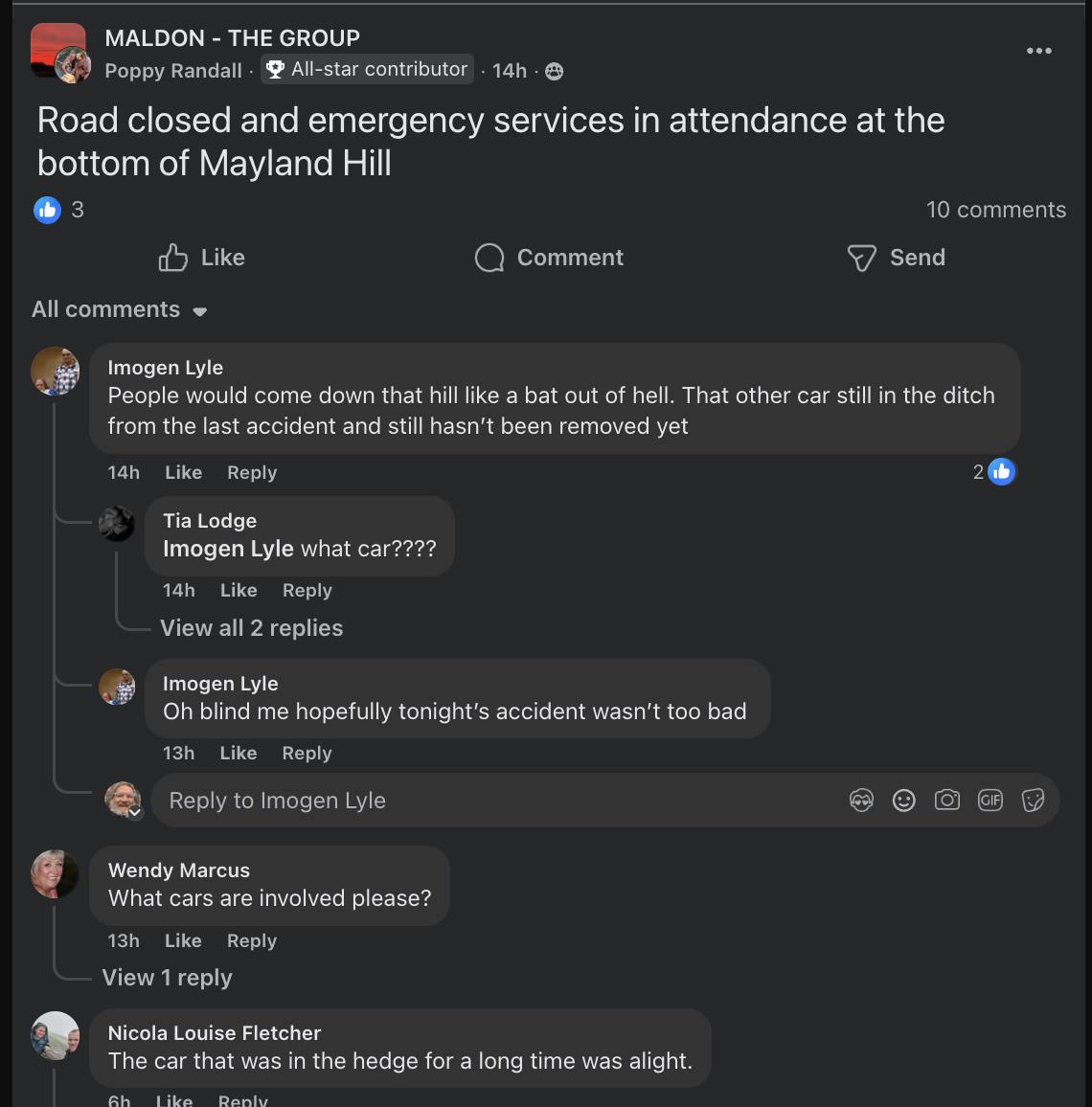
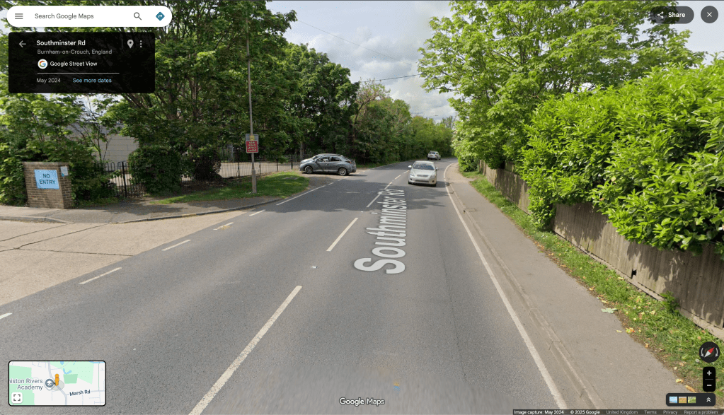
Yesterday saw another collision on Mayland Hill. The B1018 (Southminster Road) around the Mayland Hill/Dairy Farm Road junction is proving to be an accident hotspot. The default ‘national speed limit applies’ is clearly not working for the Dengie’s roads. This is just one location where speed limits need to be reduced with traffic calming infrastructure to enforce slower speeds.
Mayland Hill and Dairy Farm Road are good candidates for ‘Quiet Lane’ status – and to be made priority routes for walkers/wheelers/cyclists. Measures need to be implemented to avoid their use as rat runs. Unless and until, safe segregated direct routes for walkers, wheelers and cyclists are created (connecting every settlement on the Dengie) the carriageway network must be managed to meet the needs and security of all road users. All the tools in the arsenal must be applied.
While it is the drivers of automobiles that hold the responsibility for the increasing jeopardy on our road network, they sadly remain the privileged users of that network.
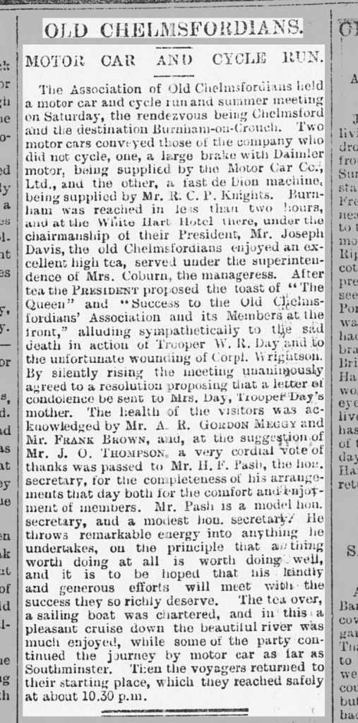
It makes one bound to ask: when was the first appearance of a motor car on the Dengie?
Was it this leisure run in the June of 1900, the first Summer of the Twentieth Century?
The Essex County Chronicle (Friday 29 June 1900), p.3
Apparently, Edmund Ernest Bentall of the Maldon agricultural equipment manufacturing family purchased a twin cylinder Georges Richard car in 1900 and become the first motorist in the district (Bentalls later made automobiles themselves) – but it looks like the Old Chelmsfordians may have beaten him out on to the peninsula, travelling as far as Southminster.
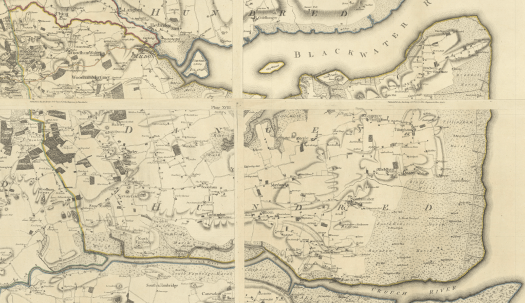
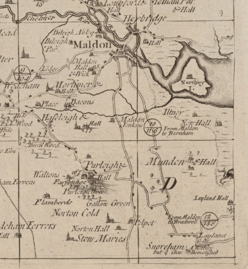
In its course and location, the road network then was much the same then as it is now, indeed as it had been for centuries. These routes were made by walkers, and to a lesser extent horse riders and carters. In the 1890s they were joined by bicyclists.
What we now call the B1010, the B1012, the B1018, the B1021, all the ‘priority routes’ recognised by Essex Highways and most of the local roads too, are already visible on the Chapman/Andre Map of Essex of 1777 – the first comprehensive chart of the county. In fact, the major routes on the Dengie could already be seen on a map of 1724: A new and correct mapp of Middlesex, Essex, and Hertford-shire, with the roads rivers sea-coast &c. actually surveyed by John Warburton, Joseph Bland and Payler Smyth.
Much of the B1010, B1018 and B1021 to be, as well as the road running from Latchingdon through Steeple and St Lawrence to Bradwell are seen on the even earlier A map of the county of Essex: by a new survey … (1696) ‘performed by John Oliver’. Undoubtedly, these ways predate mapping and follow the lines of prehistoric pathfinding. They remain the ‘main arteries for the flow of commerce, goods and people‘.
The automobile was the Johnny-come-lately joining road users which had enjoyed these paths for hundreds of years. Bridleways, byways and footpaths were additional to these — not substitutes for them, routes to be retired to when the motor-car demanded the road. The rights-of-way for walkers and riders include the roads they have used since time immemorial.
At first, these the Johnny-come-latelys were slow, inconvenient and rare but as they became faster, accommodating and common they were also, increasingly, not friendly fellow travellers but road-hogs claiming the highway as their own.
Today, both the walker and the rider on these roads finds themselves unwelcome and endangered on the very ways that their forebears chose and formed. What are they doing on the road!?!?!?! cries the driver.
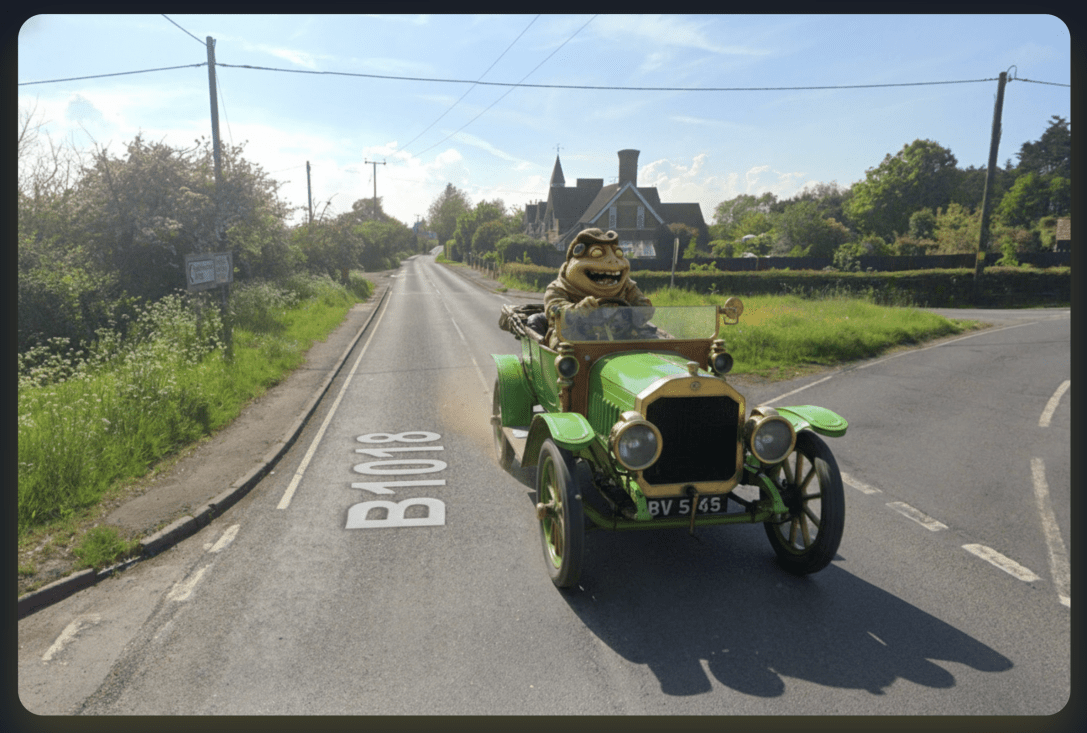
As Kenneth Grahame described in The Wind in the Willows (1908):
“They were strolling along the high-road easily, the Mole by the horse’s head, talking to him, since the horse had complained that he was being frightfully left out of it, and nobody considered him in the least; the Toad and the Water Rat walking behind the cart talking together–at least Toad was talking, and Rat was saying at intervals, ‘Yes, precisely; and what did YOU say to HIM?’–and thinking all the time of something very different, when far behind them they heard a faint warning hum; like the drone of a distant bee. Glancing back, they saw a small cloud of dust, with a dark centre of energy, advancing on them at incredible speed, while from out the dust a faint ‘Poop-poop!’ wailed like an uneasy animal in pain. Hardly regarding it, they turned to resume their conversation, when in an instant (as it seemed) the peaceful scene was changed, and with a blast of wind and a whirl of sound that made them jump for the nearest ditch, It was on them! The ‘Poop-poop’ rang with a brazen shout in their ears, they had a moment’s glimpse of an interior of glittering plate-glass and rich morocco, and the magnificent motor-car, immense, breath-snatching, passionate, with its pilot tense and hugging his wheel, possessed all earth and air for the fraction of a second, flung an enveloping cloud of dust that blinded and enwrapped them utterly, and then dwindled to a speck in the far distance, changed back into a droning bee once more.
The old grey horse, dreaming, as he plodded along, of his quiet paddock, in a new raw situation such as this simply abandoned himself to his natural emotions. Rearing, plunging, backing steadily, in spite of all the Mole’s efforts at his head, and all the Mole’s lively language directed at his better feelings, he drove the cart backwards towards the deep ditch at the side of the road. It wavered an instant–then there was a heartrending crash–and the canary-coloured cart, their pride and their joy, lay on its side in the ditch, an irredeemable wreck.
The Rat danced up and down in the road, simply transported with passion. ‘You villains!’ he shouted, shaking both fists, ‘You scoundrels, you highwaymen, you–you–roadhogs!–I’ll have the law of you! I’ll report you! I’ll take you through all the Courts!’ “
Drivers on the Dengie are victims of car dependence themselves. Where are their mobility options? Where is their freedom to choose their form of transportation? How can they escape the traffic to which they contribute? Why must they be bound to the expense and upkeep of a private vehicle? How are they to be protected from dangerous drivers, from speed limits that are not set at safe levels?
Providing mobility freedom, making our roads safer and calmer, and making a fairer use of our route network all require investment in, and attention to, active and public transport. We need to rECOnnect Dengie
“You knew it must come to this, sooner or later, Toad,” the Badger explained severely. “You’ve disregarded all the warnings we’ve given you, you’ve gone on squandering the money your father left you, and you’re getting us animals a bad name in the district by your furious driving and your smashes and your rows with the police. Independence is all very well, but we animals never allow our friends to make fools of themselves beyond a certain limit; and that limit you’ve reached. Now, you’re a good fellow in many respects, and I don’t want to be too hard on you. I’ll make one more effort to bring you to reason.”
‘Swaggering Down the Steps’ by EH ShepardLocal emotional support vehicle
A mission objective of the rECOnnect Dengie project is to improve the active travel infrastructure on the Dengie and get a safe network of routes connecting all the settlements. As I’ve noted previously, there are lots of good words about achieving this sort of thing in the strategy documents produced from the national level down to the parish – but what happens next? How does it happen?
This in the first in a series of posts where I’ll look at where there are opportunities on the Dengie to connect up existing routes and how we might turn document objectives into objective fact. I’m starting close to home in Burnham-on-Crouch.
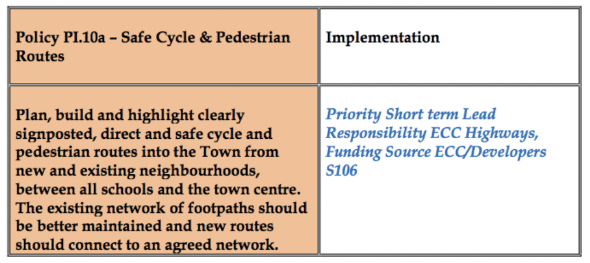
‘5.3 Make Burnham-on-Crouch a More Pedestrian and Cycle Friendly Place to Live
The Town should have a friendlier environment for cycling and walking. Its main and secondary roads are dominated by vehicles. New pedestrian and cycle routes should be provided that link the town centre with existing and new neighbourhoods, schools and recreation areas via quieter roads.’
It substantiates this objective with policies including:
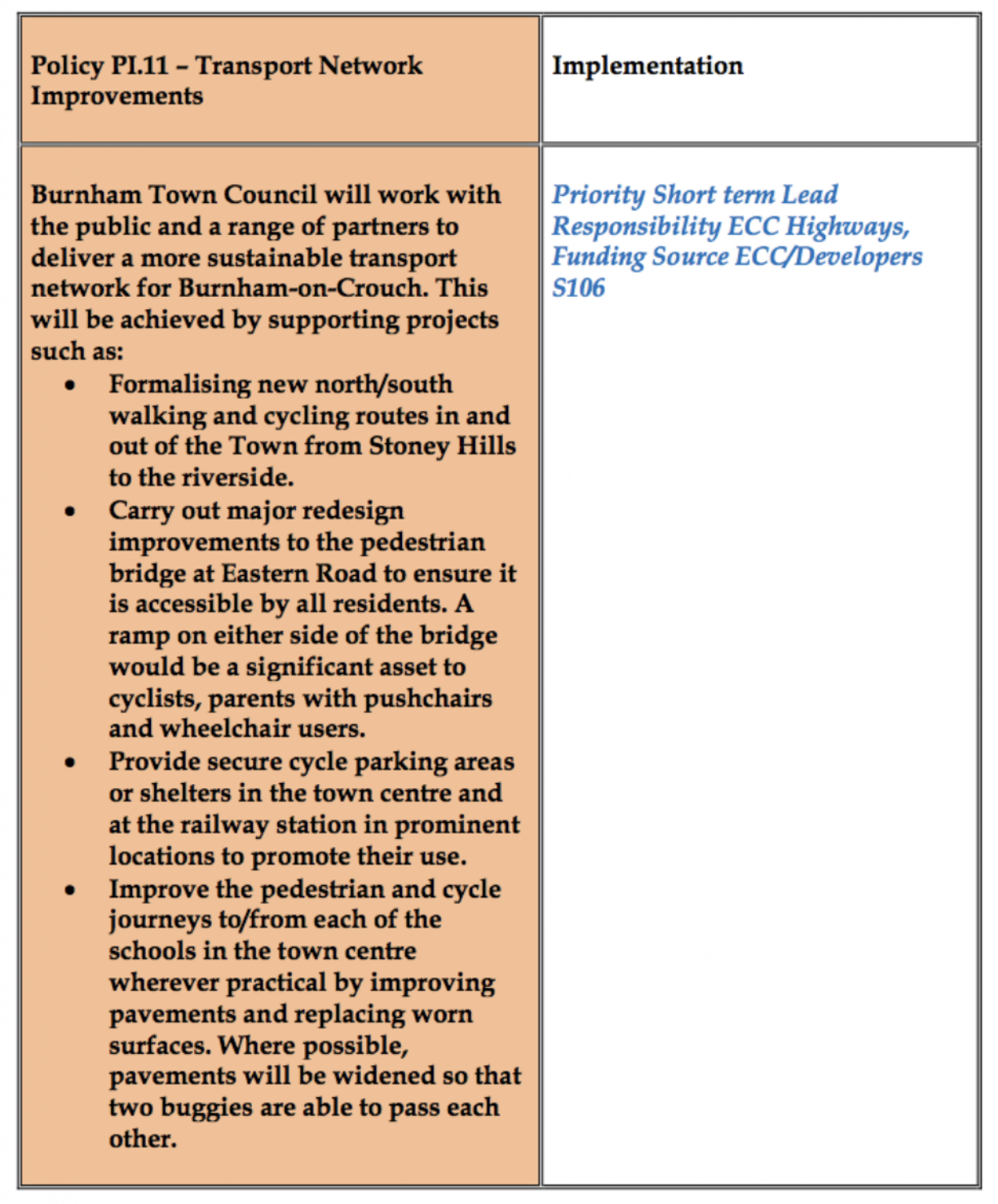
One of the first new neighbourhoods created after the NDP is the Grangewood Park estate which was built on agricultural land allocated for new housing as Site S2 (j) in the Maldon District Local Development Plan [pdf]. A site with a long southern boundary to the town’s Secondary School, the Ormiston Rivers Academy.
Figure 12 in the Burnham NDP (Apologies for poor image quality, this is as it appears online)
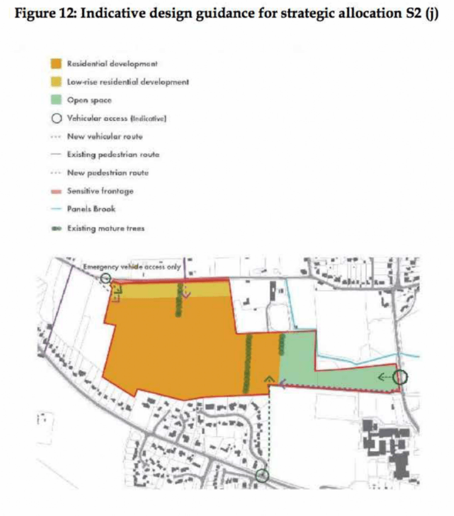
The masterplan [pdf] presented by developers Charles Church in their planning application included a new off-road foot/cycle path running through the green space on the estate and providing a connection from Southminster Road in the east to Green Lane in the north.
Their document notes that the Maldon LDP includes:
‘T2 Transport Infrastructure in New Developments The layout of new developments should provide for safe access to and from the highway including… links to adjacent or nearby foot/cycle path network’
and that it states that amongst the criteria any proposed development must satisfy is:
‘Safe pedestrian and cycle linkages are provided from the development to the town centre, other public service facilities and the existing urban area’.
(The Residential Travel Plan [pdf] supplied in the developer’s application noted that ‘[t]here are no dedicated cycle facilities in the vicinity of the development site’)
Later the planning application notes that ‘[t]he Burnham Neighbourhood Plan shows proposed cycle links that the Town would like to see progressed; within this diagram a possible link is shown into the site subject to this application. The provision of this link would rely on third party land and therefore cannot be provided by Charles Church, however the scheme has been developed to facilitate future connectivity.’
It’s unclear exactly what this is referring to, as the Burnham NDP includes text references to possible cycle routes but no maps showing these. The diagram with ‘a possible link’ is perhaps the green dotted line ‘new pedestrian route’ shown in the NDP’s ‘Figure 12’ (copied above) connecting the site to Maldon Road in the south, and running along the western boundary of Ormiston Rivers’s playing fields. This would have been a convenient addition to Burnham’s walk/wheel/cycle routes but it never materialised and it illustrates succinctly a key unaddressed problem in getting better active travel infrastructure.
i.e A government strategy proposes active travel infrastructure as an essential part of new developments, a developer provides infrastructure within the development – but the value of such infrastructure is largely produced by a larger connectivity that neither government nor developer is providing.
The National Planning Policy Framework (NPPF) make enough noises about pedestrian and cycle routes that applications for new housing tend to include vague promises about including them. On the ground this tends to result in intra-estate pathways that have genuine utility but terminate at the estates’ boundaries with no clear sense of how onward travel on foot, mobility device or bicycle might proceed.
Foot/cycle paths shown in grey to the north of the housingon Grangewood Park estate
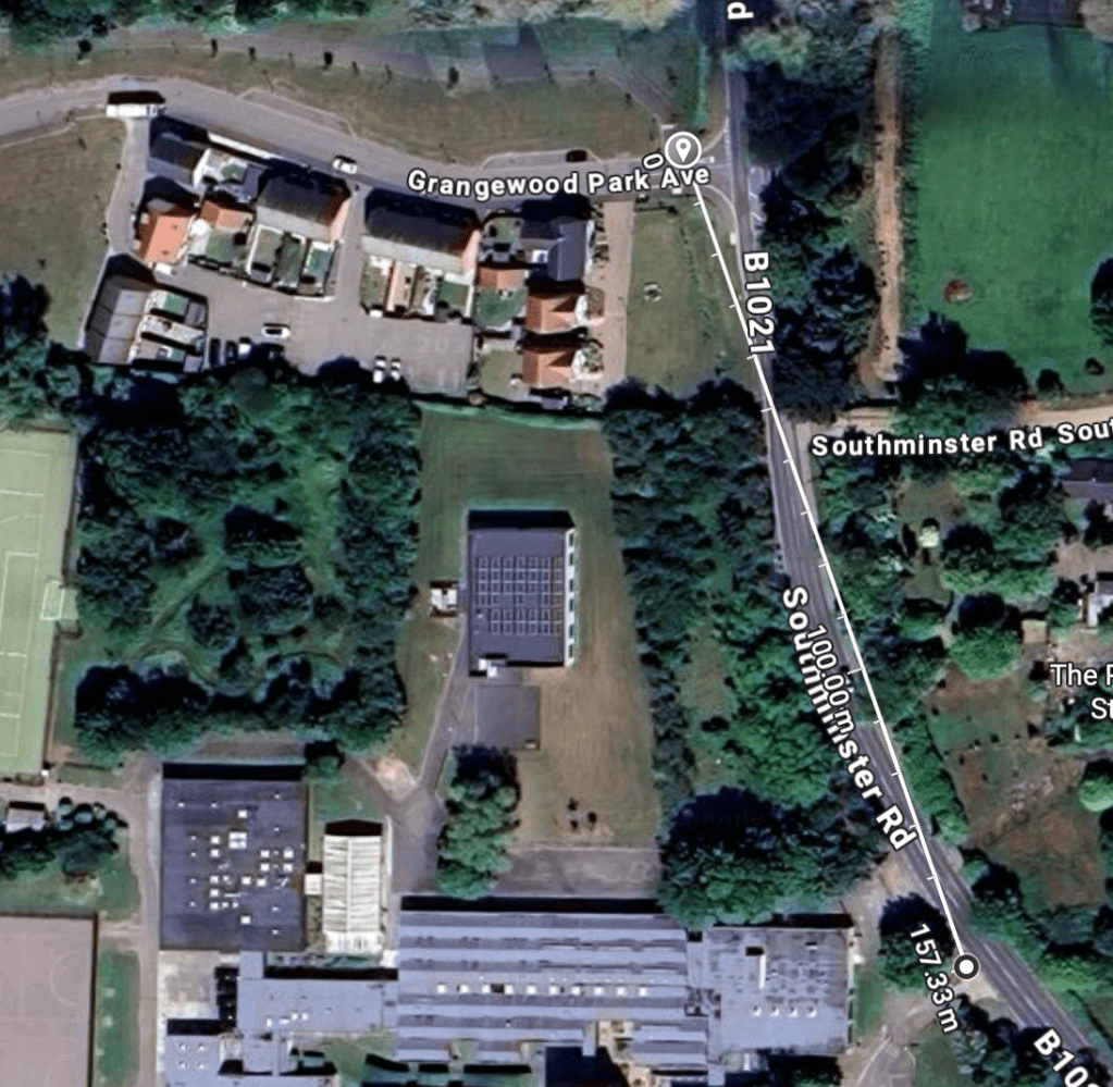
True to their promise, the developers of Grangewood Park delivered the walk/cycle path on their masterplan and the estate includes what is, currently, the best example of active travel infrastructure in the town with an off-road path that connects Southminster Road with Green Lane – but what happens when you get to Southminster Road or Green Lane? What contribution does it make to a safe, active travel network?
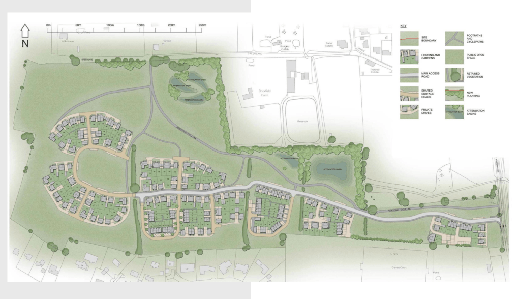
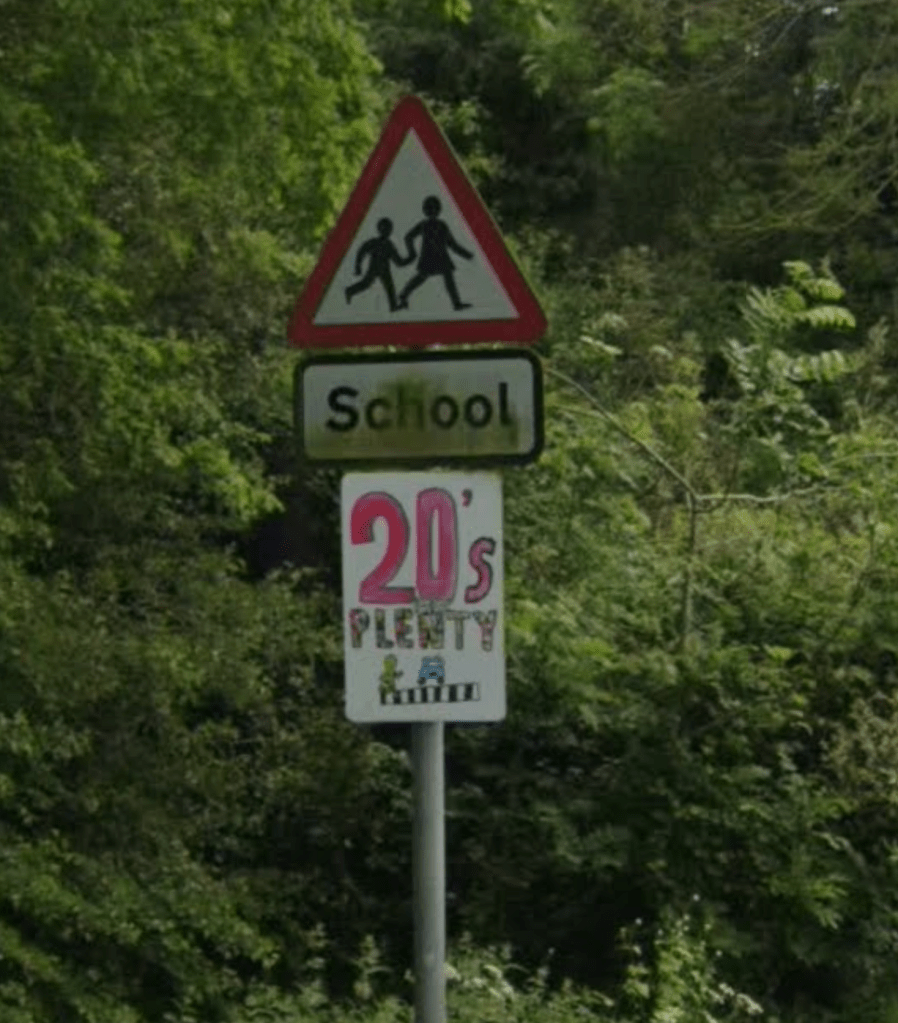
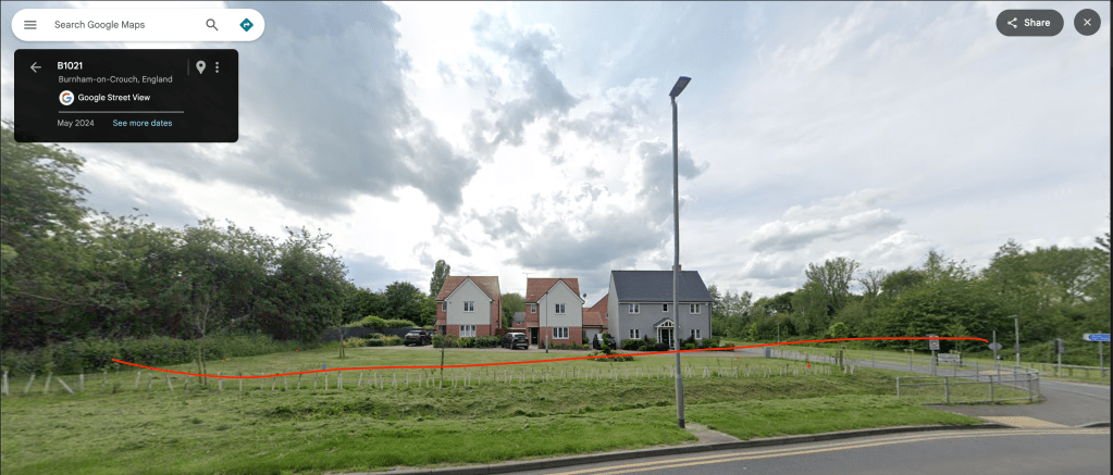
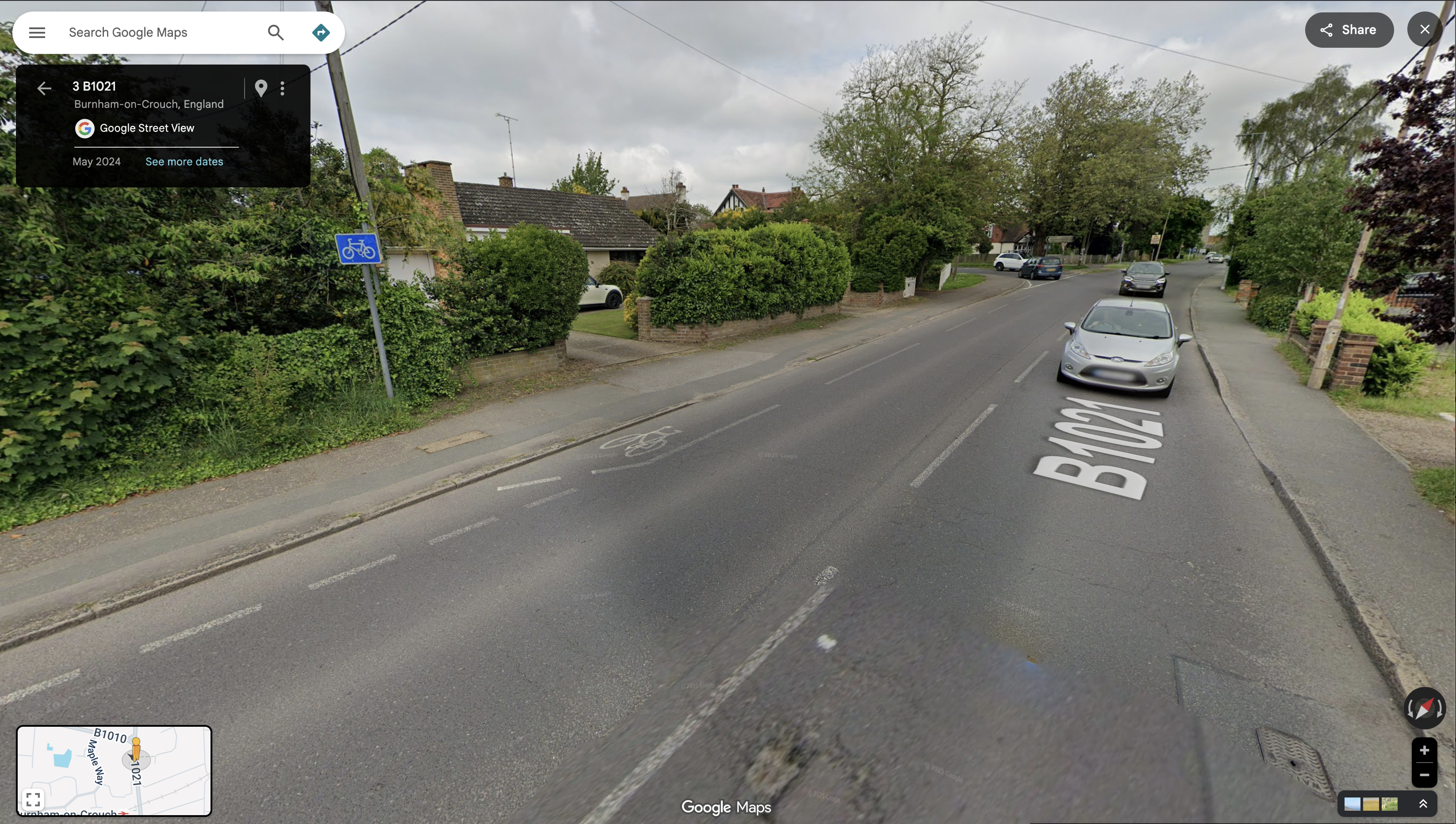
At Southminster Road (B1021) the pathway ends 160 metres north of the entrance to Ormiston Rivers school. A child on a bicycle coming through Grangewood Park must now leave the off-road cycle path, cross a lane of northbound traffic leaving town on the B1021, and join the southbound lane – before turning across the path of northbound traffic again to complete their journey to school. Opposite the Grangewood junction there’s a road sign with the red triangle warning of a school ahead and, beneath it, one of those advisory-only ’20’s Plenty’ signs – but the B1021 has a 30mph speed limit at this point and has limited direct access along this section, a form that tends to encourage vehicle speeds in excess of the legal limit. The common experience of cyclists, of all ages, using this road is driver impatience and an aggressive eagerness to pass.
Meanwhile, pedestrians leaving the off-road path at Southminster Road find there is no footway providing an onward walking route north or south. There is a narrow pavement on the east side of Southminster Road but there is no controlled crossing to reach it (a small traffic island provides some pedestrian refuge).
School children cross the B1021 to reach the Grangewood Park Estate.The junction of Grangewood Park Avenue and Southminster Road, where the foot/cycle path ends
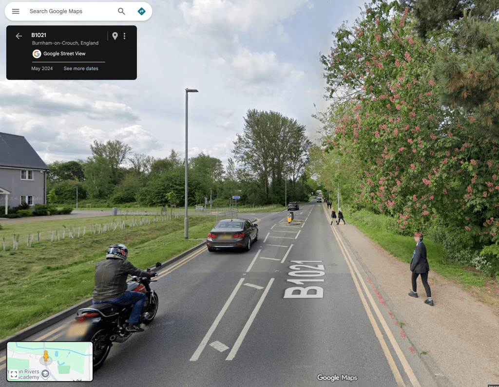
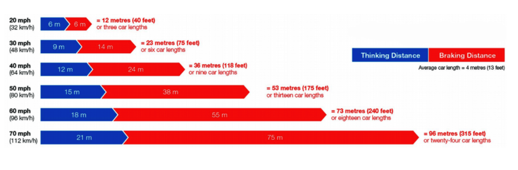
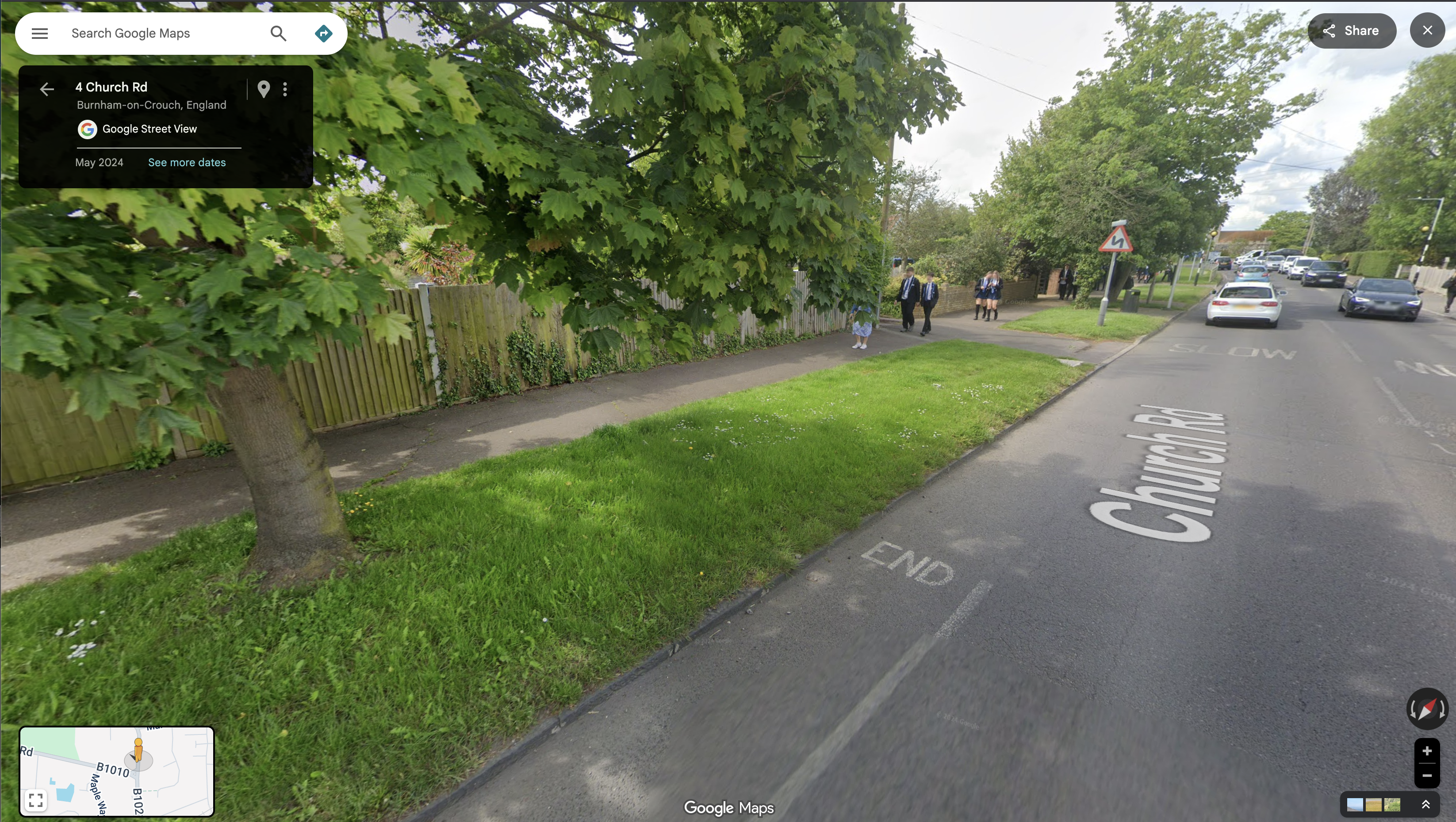
Once the road is crossed, a pedestrian can proceed south on pavement into Burnham. If it’s a child walking to the school they can pass the school entrance on the other side of the road and carry on further south around a bend to cross the road at a zebra crossing, then walk north again up the opposite pavement to reach the school entrance – a distance of 450m. Will they do that though? Of course not!, once they are opposite the school entrance our cyclist used – 160m down, they’ll do what she did and cross the road there. The curve of the road means that drivers travelling south will be blind to a child crossing the road there until they are quite close. The Highway Code calculates the stopping distance of an average car at 30mph in dry conditions to be 23 metres.
Looking north up Southminster Road where a child is liable to crossto reach the schoolCar stopping distances in the Highway Code
‘But there’s no alternative!’ I hear you cry, ‘you just have to make do with what you’ve got’.
‘I know this estate is right next to the secondary school and we agreed in the neighbourhood plan to “plan, build and highlight clearly signposted, direct and safe cycle and pedestrian routes into the Town from new and existing neighbourhoods, between all schools and the town centre” and we agreed that we would “improve the pedestrian and cycle journeys to/from each of the schools” – but really what else could we have done?
Let me tell you!
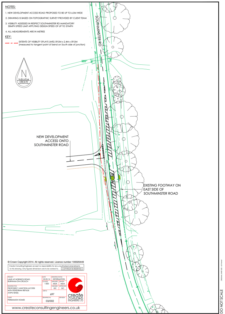
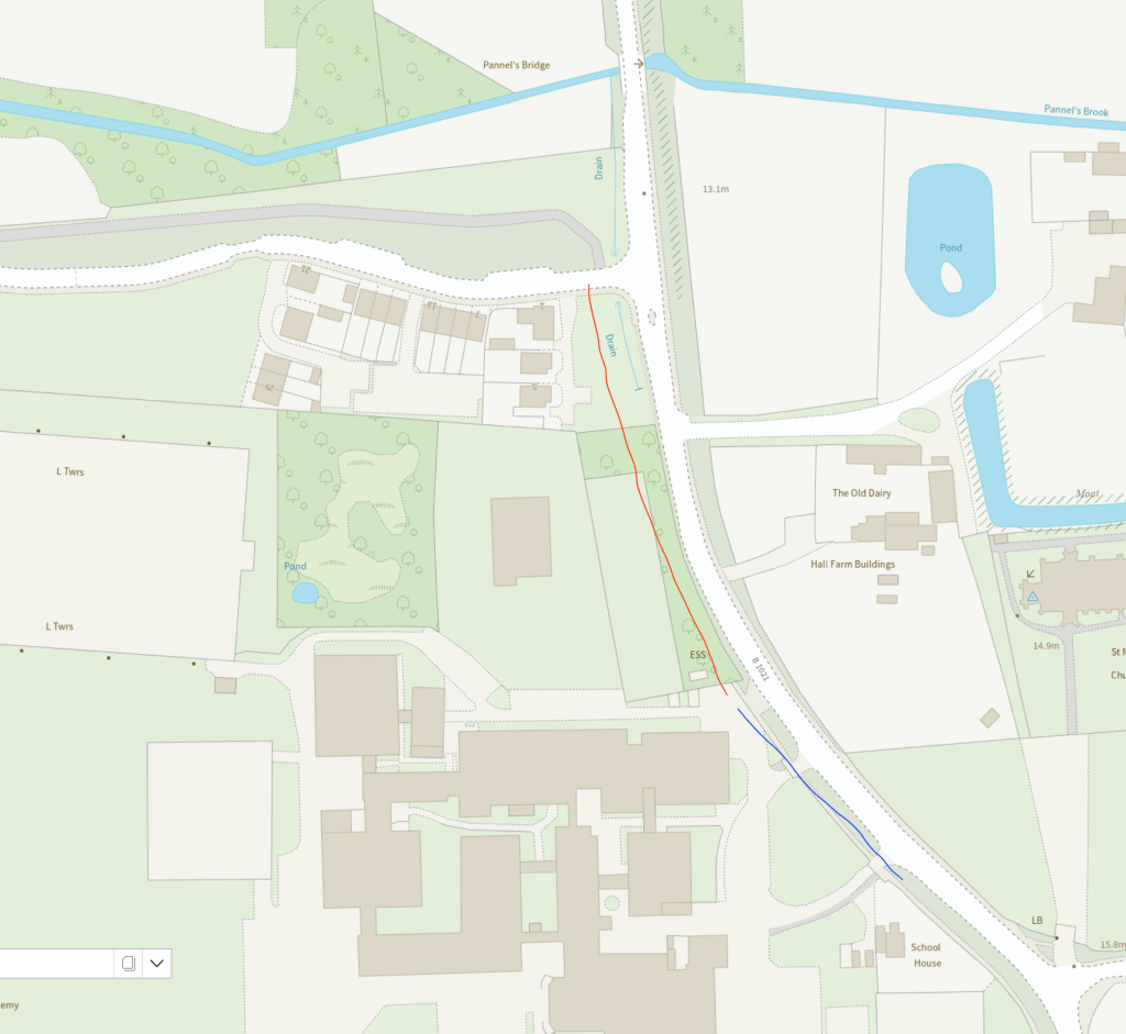
Grangewood Park shares a border with Ormiston Rivers school, their frontage to Southminster Road is contiguous. The foot/cycle path could have gone over Grangewood Park Avenue and continued south over amenity land to the boundary of the school and through the small woodland which separates it from the paved area of the school grounds.
The red line indicates where the Grangewood path could be connected to Ormiston school, the blue line how that could continue to the existing footway
All the land involved either belongs to the developer or to Essex County Council. The developer was on-board with facilitating connectivity, the Town and District Councils wanted connectivity, Essex County Council/Essex Highways wants kids to cycle to school. It should have happened… and it still can!
The current residents of the three houses on Grangewood Park estate facing Southminster Road might prefer the current area of mown grass and small flower bed, but they’d benefit from a walk/cycle/wheel route through it. Improving active travel routes is beneficial for everyone, not just children.
This missing link would facilitate footway access from Burnham’s riverside, urban centre and railway station through to Green Lane by reducing the number of necessary road crossings. It would complete a safe cycle route from the Grangewood Park estate to Ormiston school.
EXTRA CREDIT: The pavement going south from Ormiston School has an area of verge and is wide enough to allow a shared foot/cycle way to the junction with Maldon Road (B1010). Across the B1010 junction, in the northbound lane, there is also Burnham’s oldest piece of cycling infrastructure – a painted cycle lane that begins just south of it and finishes quickly north of it – it’s of spurious utility but nevertheless could easily merge into a cycleway on the west of Southminster Road and gain a connectivity it has never had before!
What happens at the other end of the Grangewood Park estate foot/cycle path though? Can we get anywhere from there? Look out for Stitching the Path: Connecting Disjointed Walk & Cycle Routes 2 – where I will address these very questions!
A couple of days ago, Essex Highways released a press release about their plans for rolling out electric vehicle charging in the county, and used the opportunity to ask people where they thought the chargers should go. Their survey is pretty minimal, but there was enough in it to raise my concern.
I’ve long been frustrated by the pavement parking of cars and how temporary road signs are placed on the footway rather than on the road they relate to. Cars already dominate urban space. In the rural town where I live, especially in the older parts built before the automobile, the streets are cluttered with private vehicles. The nearest pavement to my house is unusable – cars park on its full width to allow free access to vehicles on the road, so pedestrians have to walk on the road too. One of my neighbours has an EV, and the charging cable stretches from his boundary wall across the street to his car.
There’s a sci-fi saw, often attributed to Frederik Pohl, that ‘a good science fiction story should be able to predict not the automobile but the traffic jam’. You don’t have to be a futurist to see the trip hazard in the electric car rollout. Motornormativity —the assumption that car-centric infrastructure is the default—demands that any new space requirements for the automobile be carved from the realm beyond the car. When Essex Highways asked ‘where should the chargers go?’, the assumption is clearly that the person being asked is a motorist, an EV owner seeking on-street charging for their machine. The ‘where’ is not ‘where in the public realm, if anywhere, should we put this new chunk of motorcar infrastructure’, but ‘which streets shall we impose this pile of gubbins in?
Maldon District Council (MDC) is considering charging for the car parks in Burnham-on-Crouch. Some people are annoyed and have started a petition against charging, including friends and people I know. The Town Council has posted a notice promoting the petition on its official noticeboards and some councillors have announced their support for the petition. I take a different position.
Today was supposed to be day one of the new 45 bus service on the Dengie. This would replace the D4 and Dart 5 with a much-reduced timetable combining those two buses. The scheduled services would be reduced to two a day in either direction, Monday to Friday, with the Saturday service lost entirely. The Dengie Hundred Bus Users Group (DHBUG) had intervened to tweak the timetable in Essex County Council [ECC]’s tender as the original proposal gave little time at the route’s destination before returning. As many users depended on the bus to do their weekly shop they would have found themselves with less than an hour to do so. At the DHBUG AGM on 7 June, many attendees were furious about the changes and reduction in service – but ECC didn’t send anyone to the meeting and Arrow Taxis who had won the tender sent a message saying that it wasn’t worth them coming as they didn’t know anything about what was going on past what had been published already.
I am grateful to Tony Fittock (District Councillor for Althorne ) for letting me know that the process of creating a new Local Development Plan for Maldon District has begun. So my previous post on the matter revealed my own ignorance of the Maldon District Local Development Plan (LDP) Review: Issues and Options Consultation, which ran from 17 January to 14 March 2022.
From this, I learned that ‘the Plan Period for the review of the LDP Review is going to be 20 years.’ As the current plan runs until 2029, this indicates that its successor will cover the period up to 2050. As noted previously, the UK government is committed by law to reduce greenhouse gas emissions by at least 100% of 1990 levels (net zero) by 2050. The next Local Development Plan will therefore set out a vision and a framework for the future development of Maldon District that must include complete decarbonisation.