Like me, many of you may have responded to the Essex County Council consultation on the ‘Essex Wide Walking and Cycling Infrastructure Plan’. The results of that consultation were quietly released last August (2025), so you may not have seen them. I’m still working through the documents and I welcome comment and feedback from anyone else who braves them!
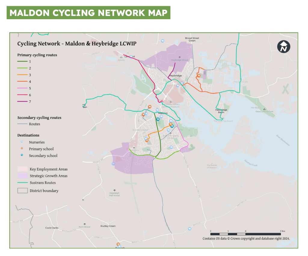
[As a reminder, settlements of 20k+ population each got their own Local Cycling and Walking Infrastructure Plan (LCWIP) while everywhere else in Essex was covered by the ‘Essex Wide’ plan. As no settlement on the Dengie reached the 20k threshold, the entire peninsula is covered by that plan. Maldon & Heybridge’s population combined exceeds 20K so they have a separate LCWIP. One of the maps in that document indicates a ‘secondary cycle route’ from Maldon into the Dengie using the B1010/Fambridge Road and ending abruptly at the Baron’s Lane junction]
The Consultation response consists of three documents :
- A Summary Report [pdf]
- A Consultation Report [pdf]
- A Technical Report [pdf]
Al of these can be accessed here
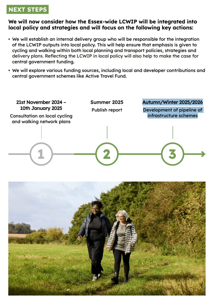
- The Summary Report is not particularly informative. It contains a timeline of three steps which ends with ‘Autumn/Winter 2025/2026 Development of pipeline of infrastructure schemes’ – we are in the last weeks of that period now but I can find no further information on these infrastructure schemes.
- If you commented on the consultation, you should find your remarks reflected in the Consultation Report (the Dengie is poorly represented in the maps included in this document with just a glimpse of the south of the peninsula to the top of the South Essex Map)
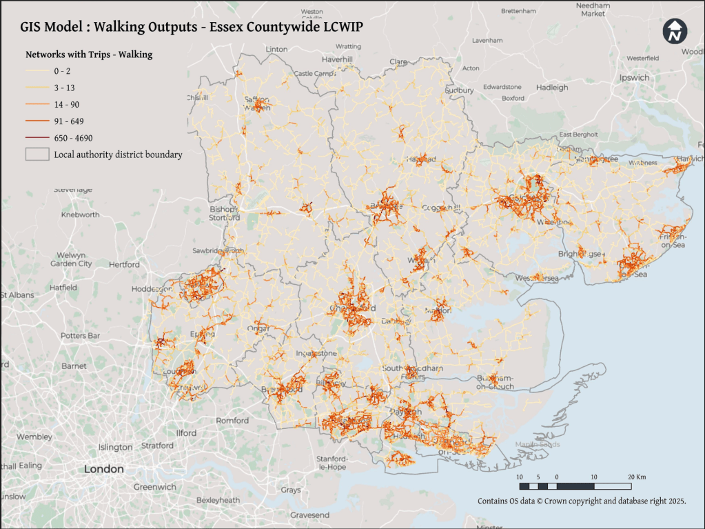
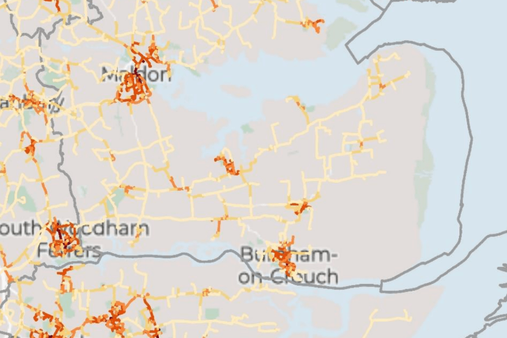
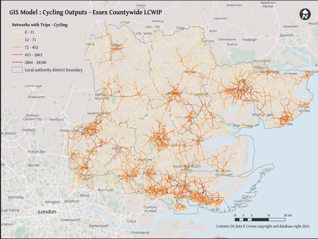
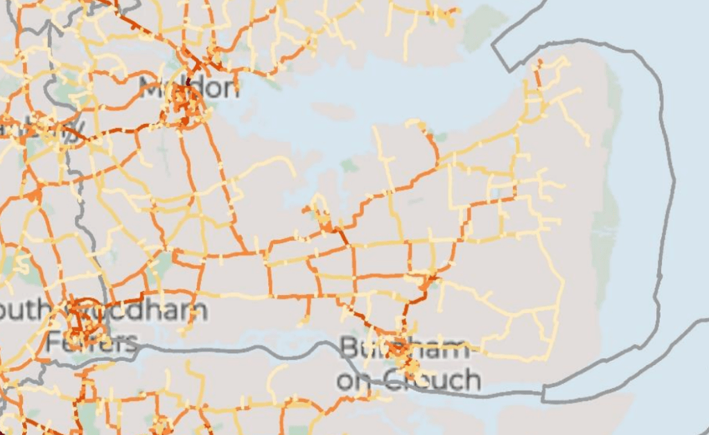
- The most interesting of the three documents is the Technical Report which includes new maps identifying potential key walking and cycling networks which I share below, with zoomed in images of the Dengie.
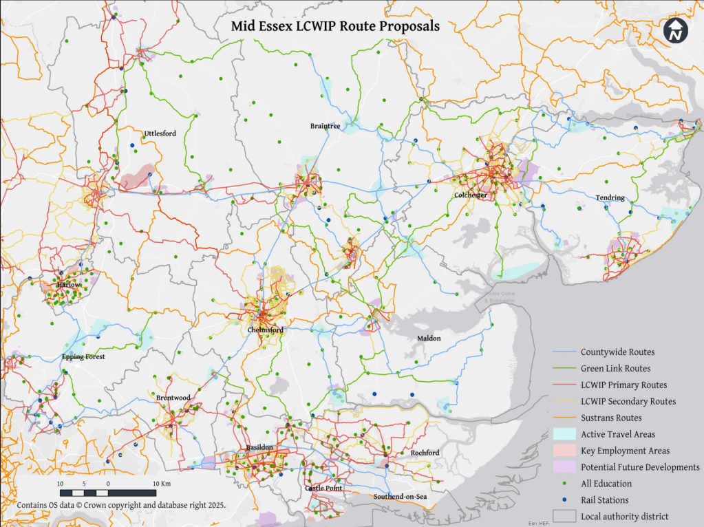
The ‘route proposals’ in the Final Network Plans look identical to those in the Consultation document however, they don’t reflect these key walking and cycling networks, and they follow existing roads without a clear sense of how walking and cycling will be made safe on these highways.
The Technical report notes that:
‘Given the rural nature of the area [Essex], the plan prioritises cross-boundary connections between towns and cities, utilising off-road routes like Public Rights of Way (PROWs) and bridleways, and innovative on-road cycling solutions in constrained networks.‘
The Summary Report expands this slightly in it’s introduction:
‘Given the mainly rural nature of Essex, the Essex-wide plan prioritises links between villages, towns and cities. The proposals aim to make use of off-road routes such as byways and bridleways, alongside innovative on-road cycling solutions on space-limited networks such as quiet lanes to deliver the LCWIPs.’
The nod to rural areas is appreciated but I’m dismayed that the strategy seems to depend on:
- existing byways (there are 3 on the Dengie totalling 2714m in length)
- existing bridleways (there are 8 on the Dengie totalling 9,178m in length)
- existing ‘quiet lanes’ (there are none designated in Maldon District totalling 0m in length)
That’s a total of a bit over 7 miles of ways that already exist and that we know are not fit to provide a continuous cycling route – they are isolated, dispersed, poorly connected and provide no east-west connections. I haven’t yet found any reference to improvement works on these already existing paths, so its unclear what the consultation/strategy/plans have added to the status quo.
It may be that the plan is for new off-road routes, new byways, bridleways and quiet lanes – which would be great! I haven’t found any hint of that in the documents yet though.
You’ll also have noted that the walking and cycling plans often seem to just talk about cycling. New cycling routes would also increase capacity for those walking and wheeling but it would be good to see some more reference to the particular needs of all active transport users in these reports
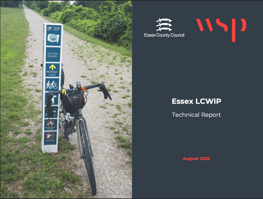
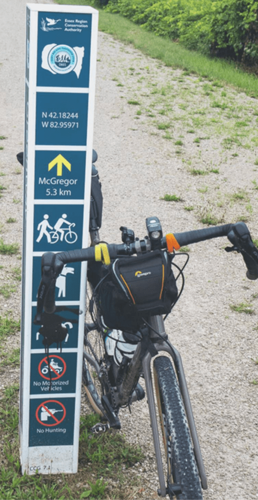
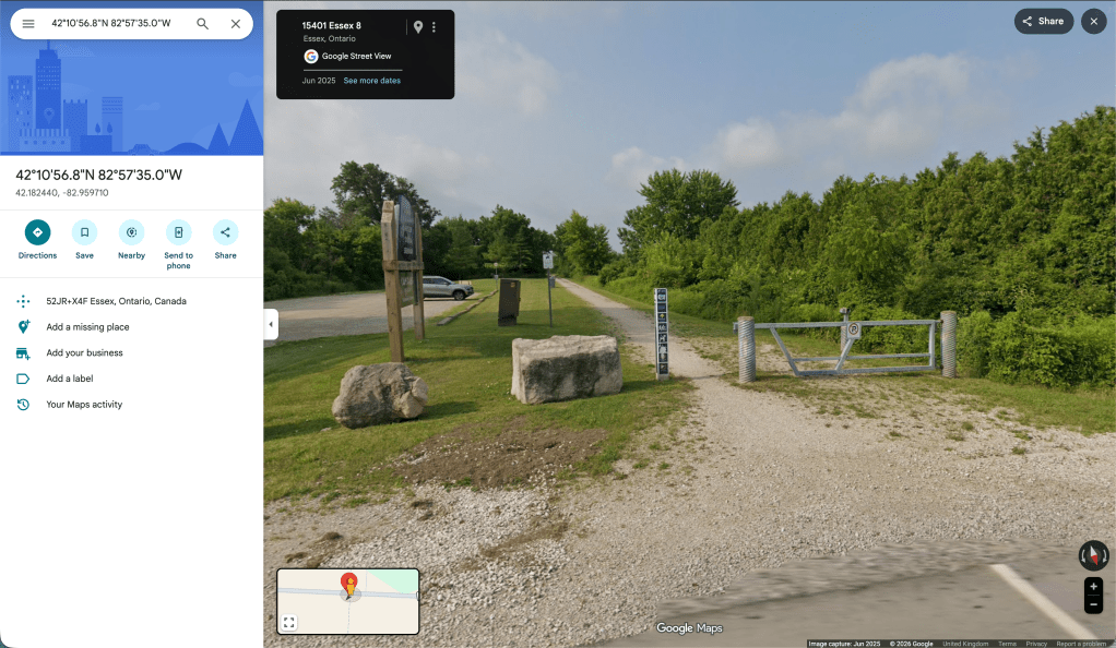
The Technical Report prepared by consultants WSP has a photograph on its first page of a rural cycle path, with a bike propped up against a smart wayfinding post which immediately had me wondering where in Essex this was, as I haven’t seen anything like it in the county before. I zoomed in to see more detail – at the top there’s a logo and text for the ‘Essex Region Conservation Authority’, neither of which I recognise, and the phrase ‘Essex Region’ sounds off. Below this are some co-ordinates that seem off too and a distance marker to somewhere called McGregor. The final square on the post has a person with a rifle on it and the legend ‘No Hunting’.
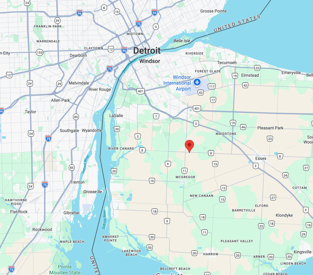
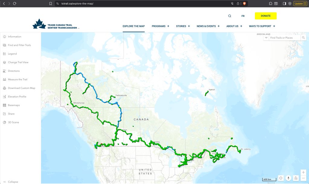
If you hadn’t guessed it yet, this photograph isn’t from the English county of Essex, it’s from 6000km away in Essex County, Ontario, Canada – close to the motor city of Detroit. It’s a photo on the Chrysler Greenway, a 50-kilometre nature trail that comprises the southernmost link of the Trans Canada Trail – at 28,000 km (17,000 mi) the longest recreational, multi-use trail network in the world.
I trust that this indicates the scale and ambition of Essex County Council’s plans rather than a stock photography fail by a WSP intern and I look forward to the Autumn/Winter 2025/2026 announcement of the infrastructure schemes to make it happen!