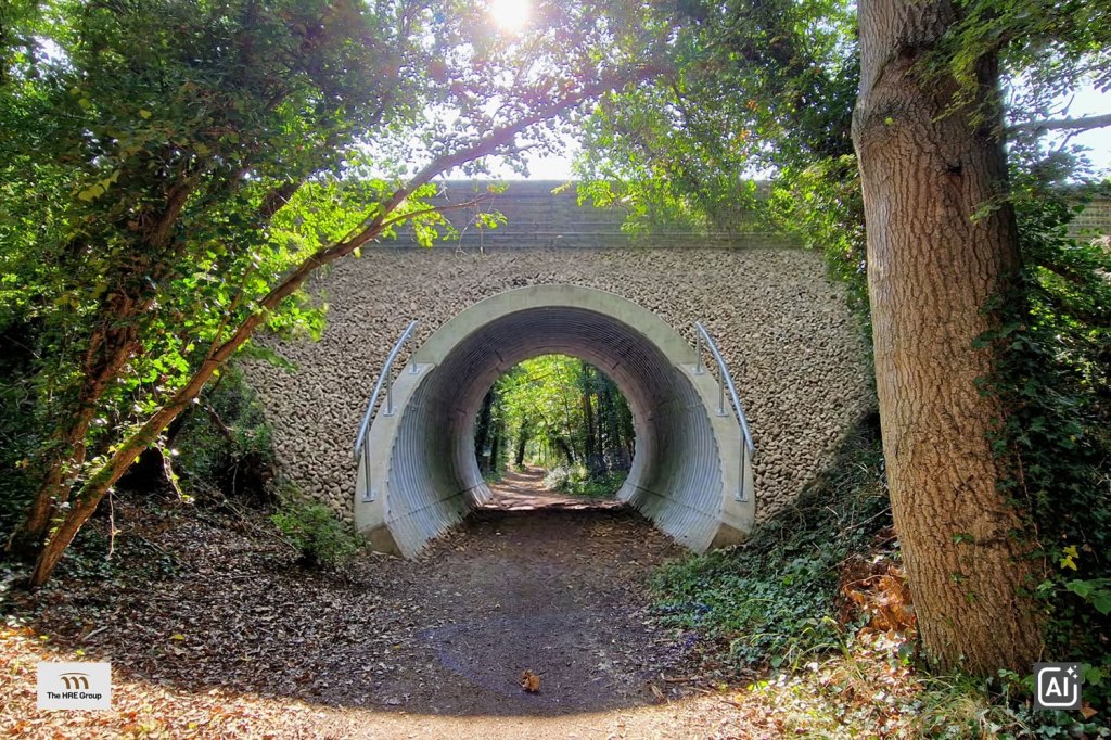
A social media post by the HRE Group alerted me that planning permission has just been granted to partly infill the three-span bridge that carries Church Lane over the Stow Maries Nature Reserve, the route along which the Woodham Ferrers to Maldon railway used to run.
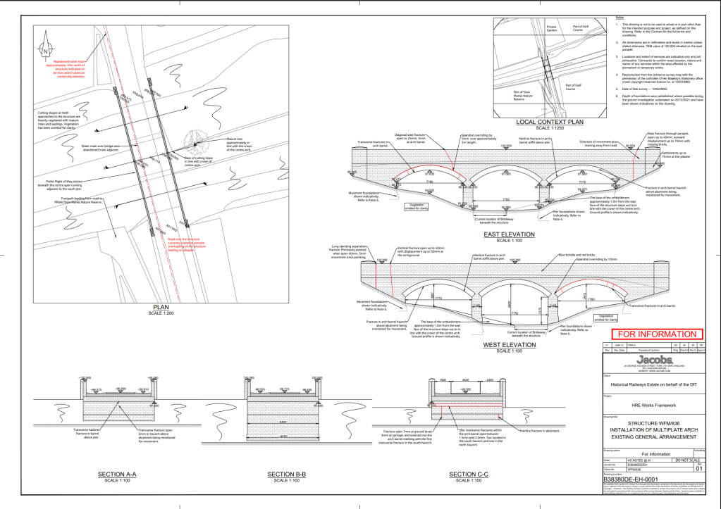
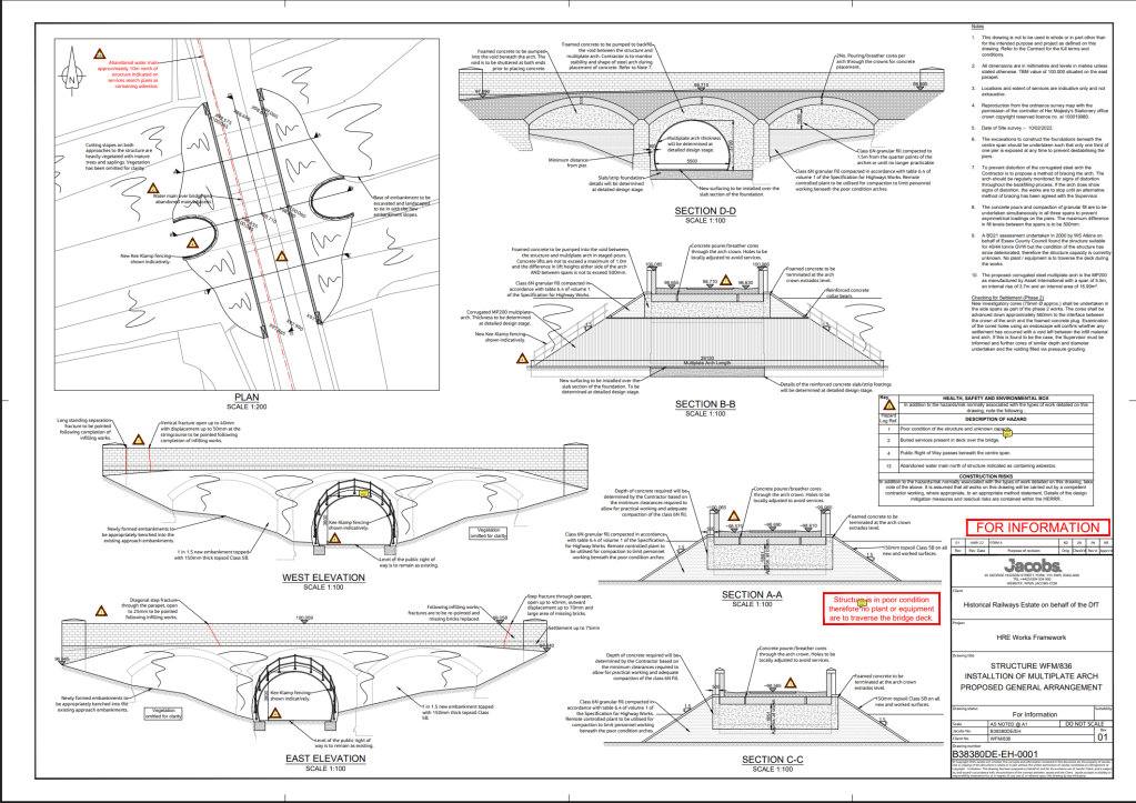
The application by the National Highways Historical Railways Estate (No: 25/00891/FUL PP-14253050) is described as ‘[s]tructural reinforcement works to bridge including installation of steel arch to centre span and infilling of side spans with concrete’. More detail is provided in associated documents:
The structure is a square three span brick arch with brick piers, abutments, spandrels and parapets. There are several transverse fractures in the arch barrels, particularly in the two side spans, with recent movement opening one resulting in the closure of the road over to prevent overloading leading to collapse. There is a public right of way (PRoW) which passes beneath the centre span of the structure. It is proposed to install a corrugated steel arch beneath the centre span infilling the surrounding void with foamed concrete. The side spans will be filled with structural granular fill and foamed concrete. This will maintain access for the PRoW beneath the structure whilst supporting the bridge and road above.
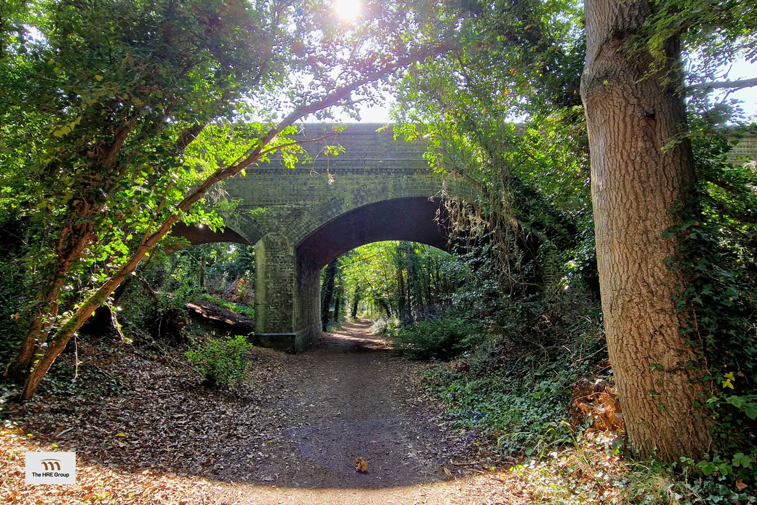
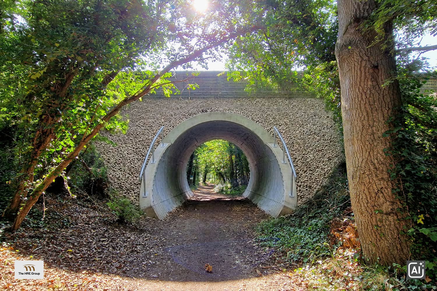
Photograph of the bridge now and an AI visualisation of the proposal created by the HRE Group taken from social media post
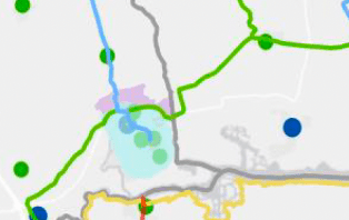
The bridge travels over Bridleway 24 Stow Maries (BR 24 261) a route which appears as a ‘Green Link Route’ on the proposal map for the Essex Local Cycling and Walking Infrastructure Plan (LCWIP) released by Essex County Council less than a year ago. Any intervention here should be used as opportunity to facilitate that plan as part of the National Highways expenditure. The comment on the application from ‘County Highways’ fails to mention the LCWIP Green Link Route.
The proposed intervention is ugly, reduces the access space beneath the bridge and will be disruptive to wildlife along this valuable green corridor and around the Stow Maries Halt nature reserve run by Essex Wildlife Trust (I was surprised to see no comment on the application from EWT and that they do not appear to have been consulted).
Maldon’s Conservation Officer, Tim Hewson, commented that, were the proposals allowed, ‘the bridge’s architectural interest would be severely diminished, and the harm caused would be high’ which echoed local concerns [pdf] that ‘that the plans are not in keeping with the heritage of the bridge and that all the Victorian brickwork will be covered with the new support structure and that residents are not happy with the loss of the aesthetically pleasing historic bridge’. These concerns were ignored by the planning authority.
In a response to the proposal, Graeme Bickerdike of the HRE Group stated that:
the adoption of this scheme design was influenced by financial considerations. The partial infilling scheme set out in the planning application had an estimated cost of £500K and would largely eliminate future maintenance liabilities, whilst repair was costed at £800K and would require ongoing maintenance. The former was selected despite the heritage and landscape impacts.
National Highways Historical Railways Estate state that ‘when a new transverse fracture appeared in the northern arch. A road closure was put in place and it is currently being monitored on a monthly basis due to significant deterioration.’ but that their ‘detailed design proposals [would] keep the Church Lane open‘.
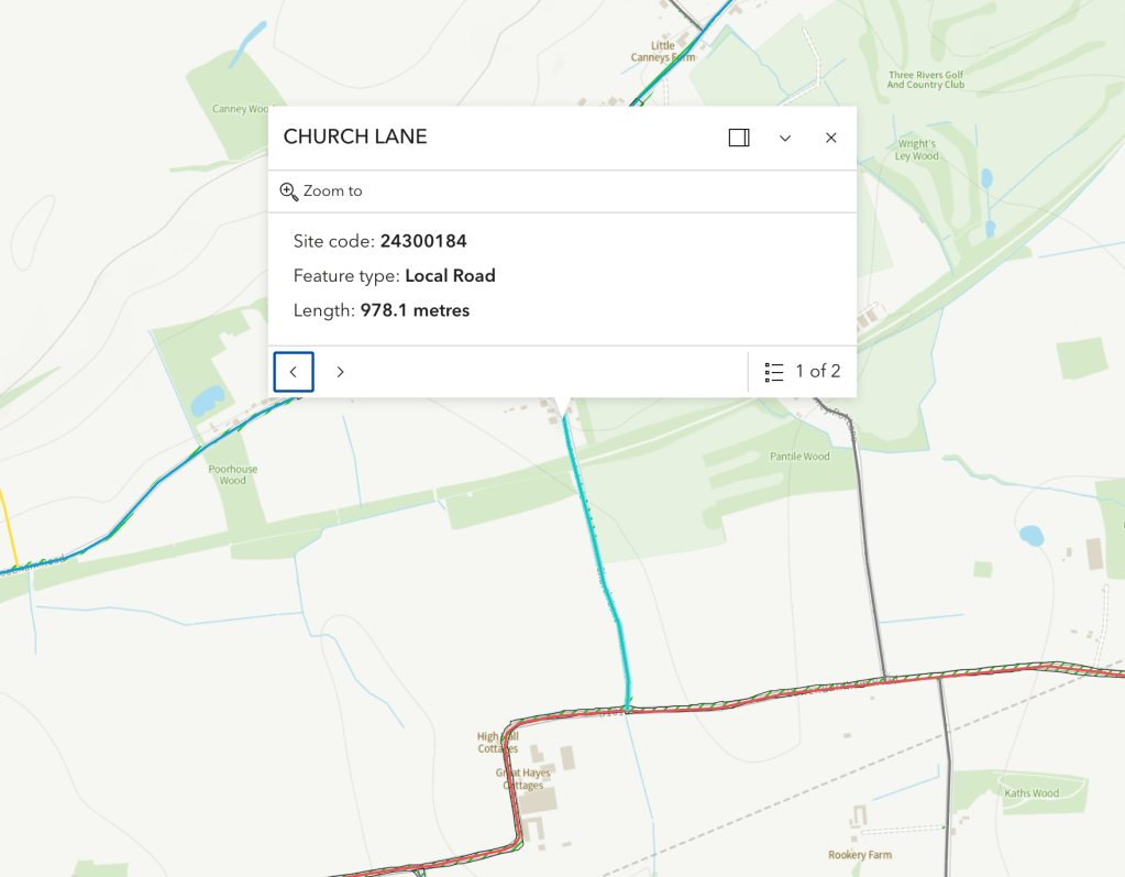
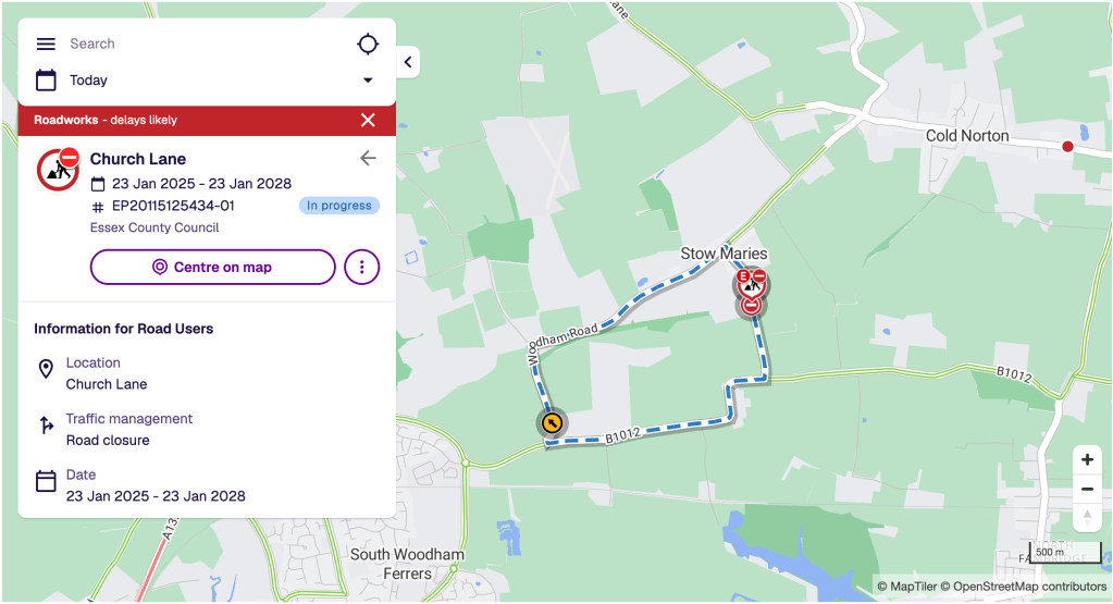
It is worth noting that Church Lane (978m) is NOT closed, it is only the stretch of road (c.50m) over the bridge that is closed, and that just to motorised traffic. Essex Highways state in their Traffic Regulation Order that ‘[a]ccess for emergency service vehicles and pedestrians will be maintained at all times during the closure‘ [pdf] and that the ‘alternative route is via: Church Lane, Lower Burnham Road, Woodham Road and vice versa‘ [pdf]. On their website, meanwhile, National Highways note that ‘the bridge remains open for pedestrians and dismounted cyclists‘.
A solution that retains the aesthetics of the Victorian bridge, produces least disturbance to wildlife and has much lower costs seem obvious: permanently close the bridge to motorised traffic.
Properties on Church Lane would remain accessible, as they are now during the ‘temporary closure’, via the Lower Burnham Road (south of the bridge) or Woodham Road/The Street (north of the bridge). Only rat-run, through traffic is impeded. Church Lane returns to being a quiet lane and is given official status as such. Homeowners on the road have a calmer, less polluted existence. Children have safer streets to enjoy. Walkers, wheelers and cyclists can still use the bridge. A less aggressive intervention, without the same ‘financial considerations’, should be able to be made to secure the bridge for this use and occasional passage by emergency vehicles.
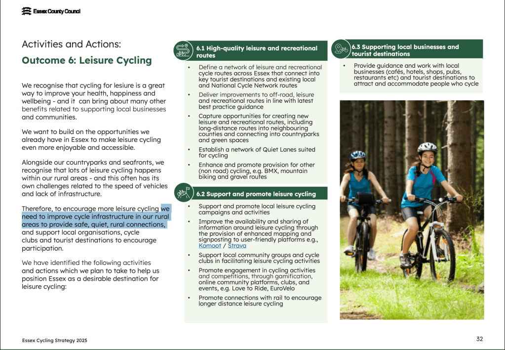
The Essex LCWIP says that quiet lanes are key to its active travel strategy in rural areas, yet Maldon district currently has no roads with that status and therefore ECC must identify which will be thus designated. Here, it has an excellent opportunity to do so. Church Lane is not a priority road in the Essex Highways road hierarchy, it is merely a local road – a means of access not a throughway. At this very bridge, it intersects with a bridleway forming part of one of their Green Link Routes – making Church Lane a quiet lane would aid the creation of a safe walk/wheel/cycle network on the Dengie. This is a key goal of rECOnnectDengie.
It is interesting to note that the damage to this bridge was caused by its use by motorised vehicles. National Highways note that the deterioration followed a diversion in 2019, during which ‘a significant amount of traffic, including a number of HGVs, [were] being diverted over the Church Lane bridge‘. Perhaps intervention and the prospect of infilling could have been prevented entirely.
The HRE Group post comments that
Maldon has a poor record when it comes to infilling. It authorised the retention of an unlawful, emergency scheme at a nearby structure without requiring a retrospective planning application, contrary to Government guidance.
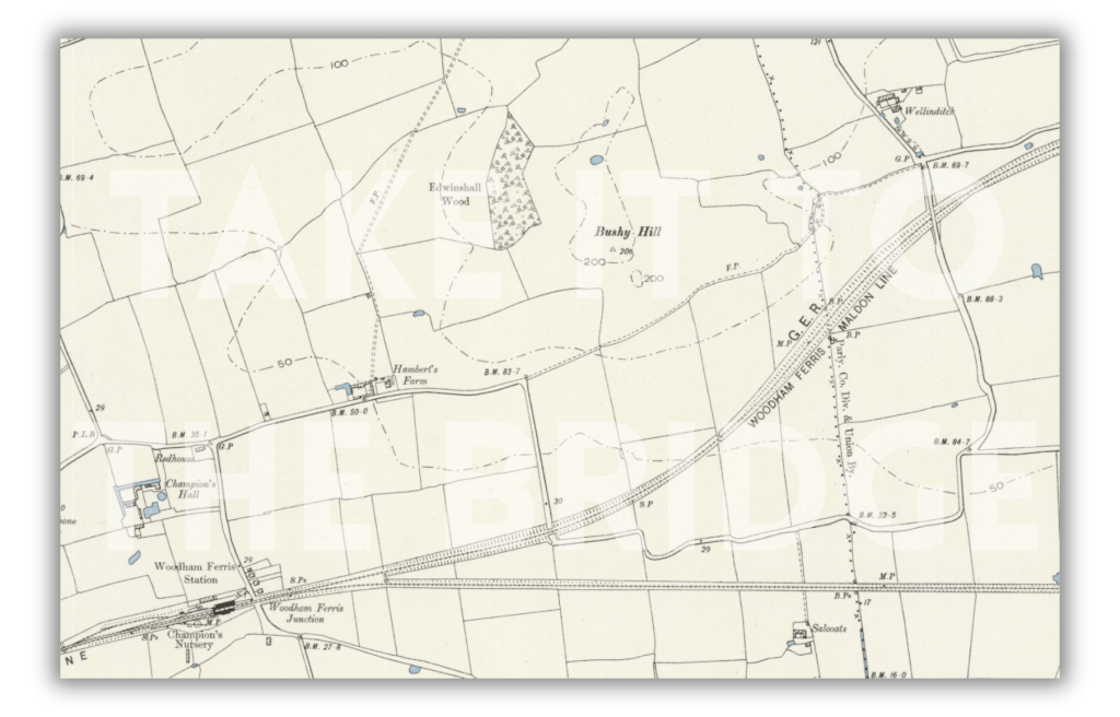
This appears to be refering to the Woodham Road bridge, Stow Maries (NGR TQ820987, EHER 102) (WFM/833).

I had walked beneath this bridge several times prior to its illegal infilling. It is 400m west of Bridleway 24, with the other side of the bridge just 120m south of Bridleway 17 (BR 17 261) along a field edge.
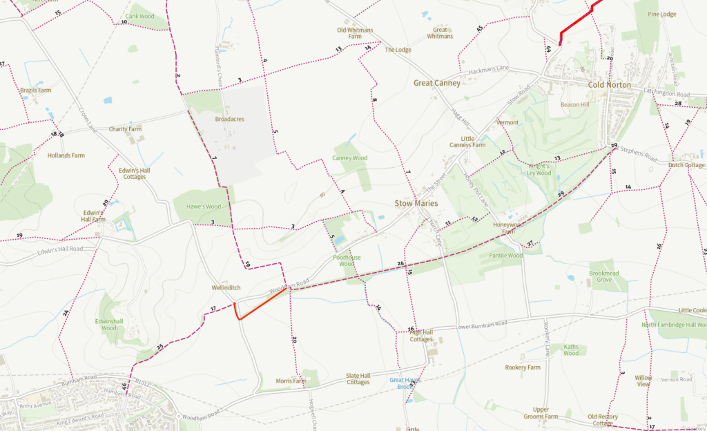
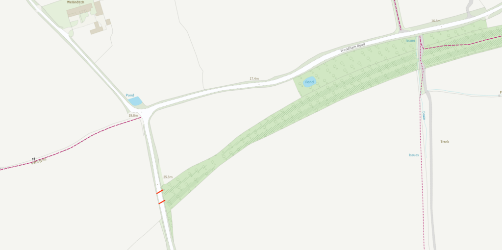
Creating a new PROW (bridleway) here would create a safe connection avoiding both the perilous crossing of Woodham Road and the blind corner at the Crow’s Lane junction. This would then form part of a safe and direct active travel route connecting South Woodham Ferrers, Stow Maries and Cold Norton – a valuable part of a Dengie-wide network, at little cost, that would enhance the LCWIP.
This bridge, which carries a ‘priority road’ (PR2), was unlawfully infilled, and was the cause of the diversion which damaged the Church Lane bridge, is a much better candidate for the intervention proposed at the Church Lane Bridge. Here, bridge works could remove the unsanctioned infill and open up access to walkers, wheelers and cyclists.
One despairs, once again, at the absence of joined up thinking between the highways authorities and planning authority involved. I wish I had seen this application earlier and commented, pointing towards the District and County’s own plans


Leave a Reply