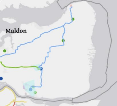
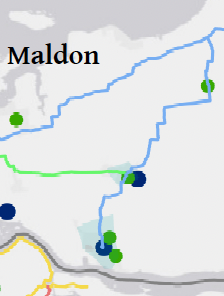
The rECOnnect Dengie project picked up the baton of the proposal to create a safe cycle route between Burnham-on-Crouch and Southminster using the alignment of the continuous walking route formed by the footpaths FP 26 242 and FP 17 259.
We’ve managed to get this into the county strategy. The Essex LCWIP Technical Report (August 2025) includes this routing on their ‘Final Mid Essex Network Plan’ replacing the road alignment seen in the consultation
We await the plans and schedule to implement this but in the meantime it seems a good opportunity to consider what improvements can be made within Burnham-on-Crouch to connect with this route.
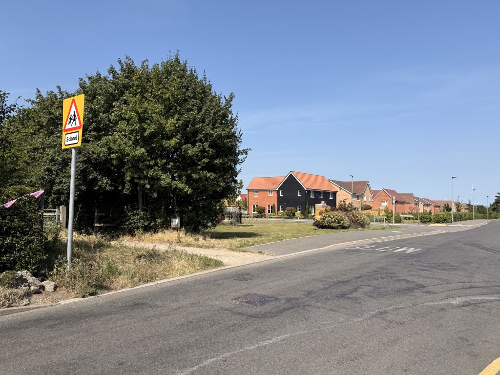
Last weekend I walked from Burnham to Southminster using the proposed cycleway alignment from Marsh Road. My journey began in central Burnham though: by Burnham Quay, somewhat south of Marsh Road. Choosing the lowest traffic route, I made my way along residential streets to Wick Road.
These streets are largely within a 30mph limit area, but ‘national speed limit applies’ on the private road part of Wick Road.
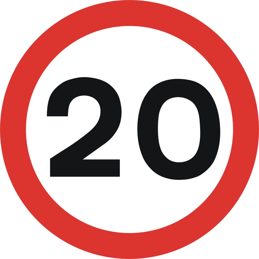
| INTERVENTION NEEDED: Speed Limit in residential area All of Burnham-on-Crouch should be reduced to 20mph reflecting it’s residential nature, retail and school streets and high pedestrian traffic. These streets are generally good for cycling but the poor behaviour of some drivers, especially on Station Road and the High Street, should be mitigated through traffic calming measures and enforced 20mph limits. |
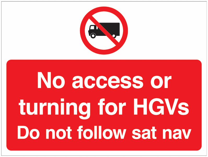
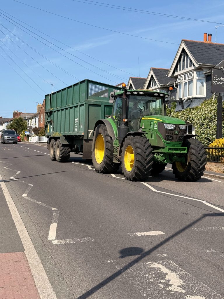
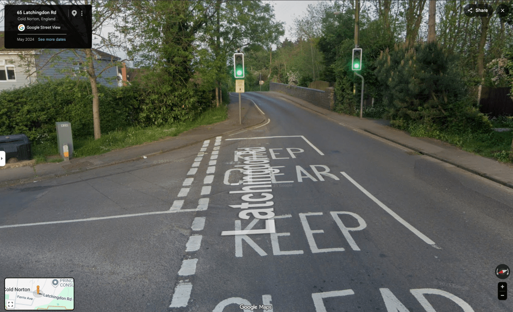
| INTERVENTION NEEDED: time-restrict HGV traffic There is also an unfortunate amount of heavy-vehicle traffic through the centre of Burnham. This includes: * Sludge tankers taking biosolids from Burnham-on-Crouch Water Recycling Centre to Sludge Treatment Centres elsewhere in Essex * Agricultural loads from Wick Farm, largely to Dengie Crops in Asheldham * Transport of manufactured homes to/from Sea End Country Park * Movement of buses and coaches to/from storage facility on Belevedere Road * Delivery of bulk goods to retailers * Construction companies This traffic could be scheduled to avoid hours of active travel in the town and should be restricted to do so – this would improve resident’s experience including ordinary drivers. Agricultural activity has less freedom to time-shift their movements as they are beholden to weather and other factors – but they are time-restricted in another fashion because their peak movement activity is concentrated in short-periods of the year (eg. harvest time). Longer-term, a new route for heavy traffic avoiding the residential centre of Burnham might be implemented |
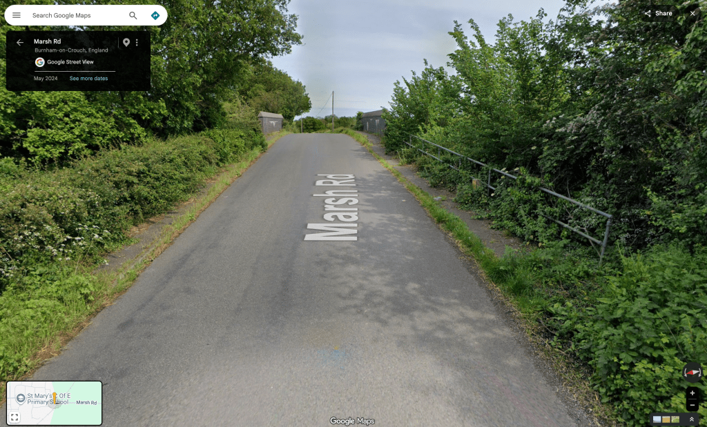
From Wick Road I took the public footpath north, across Wick farm, to Marsh Road exiting by Dammerwick (FP 15 242)
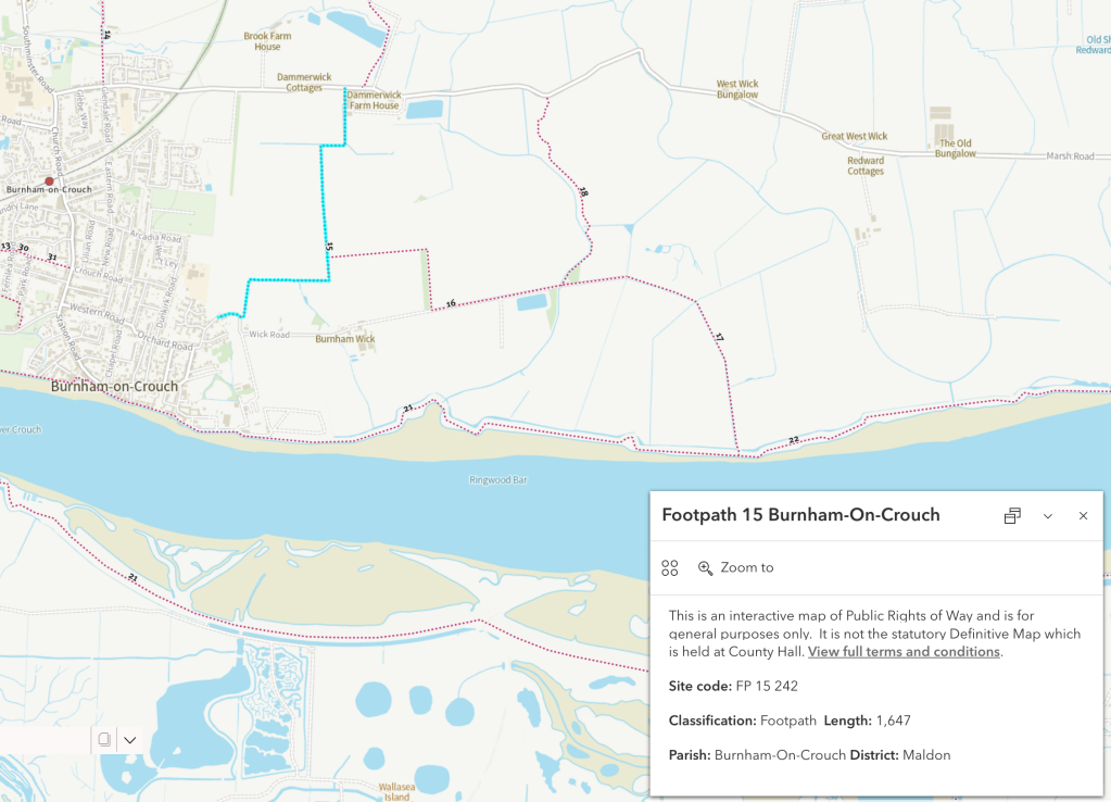
This is a footpath, not a bridleway, so there’s no current right to cycle over it – nevertheless cyclists do use this and the connecting footpath (FP 16 242) which includes paved sections. This practice appears to be tolerated by the landowner. I’ve observed cyclists using this route, and cycle tracks on the path supply evidence of wider use, as does the Strava heat map of cycling activity (which shows where Strava app users have been active over the last year as “heat” on a map [updated monthly]).
Strava users have even recorded this as a named ride segment: ‘Wick 2 Marsh rd via the field‘. The Strava heat map only records routes cycled by the users of their app who are only one sub-section of the cycling community, and direct observation suggests that there is also use by a wider range of cyclists.
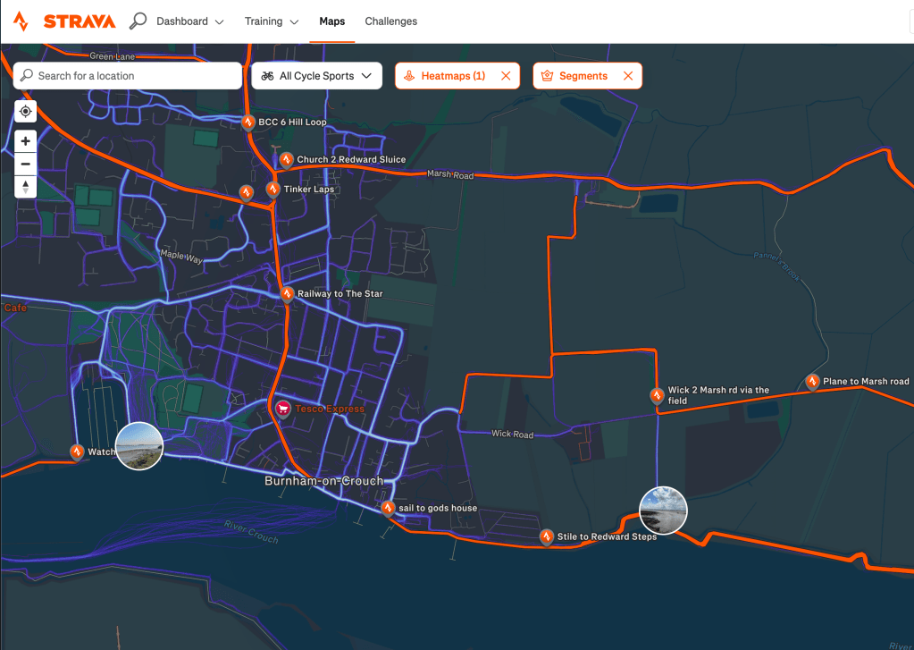
Cyclists are emboldened to use this route by its appearance on Google Maps ‘cycle layer’ which shows it as a ‘trail’.
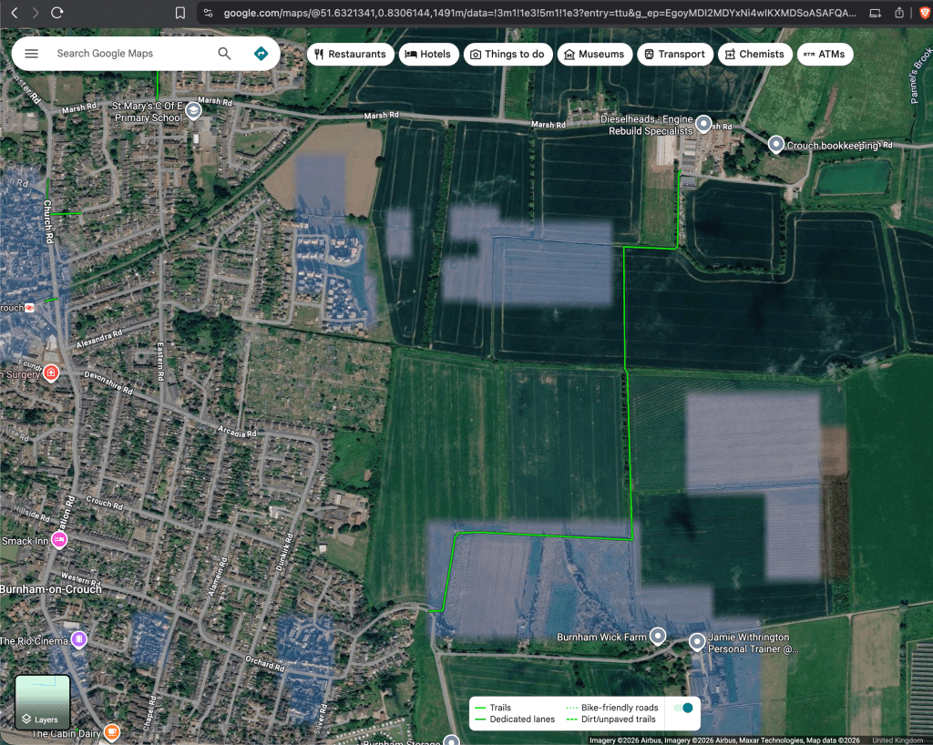
Google doesn’t publish a detailed specification for their cycling layer categories, but their support page indicates that lines marked by a dark green (solid line) represent trails that don’t have auto traffic. Notoriously, this is a mixed-provenance layer in which rural and off-road infrastructure (bridleways, byways, informal tracks) is often missing or miscategorised. The provenance of routes may includes ‘user contributions’ via the Google Maps community editing features, where local cyclists can submit corrections, add missing paths, and flag errors. So there’s an element of folk mapping here but I think that it remains useful as a guide to de facto usage which may run counter to the de jure rights of access.
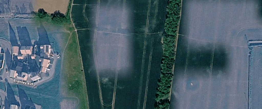
Another de facto route for walkers and cyclists connected to these routes, without any current PROW status, leads east from Bramley Avenue on the new housing development on the Pippins Estate to join FP 15 242. This well-trodden route is clearly visible in the aerial photography on Google Maps. Bicycle tyre tracks are evident if you walk this way.
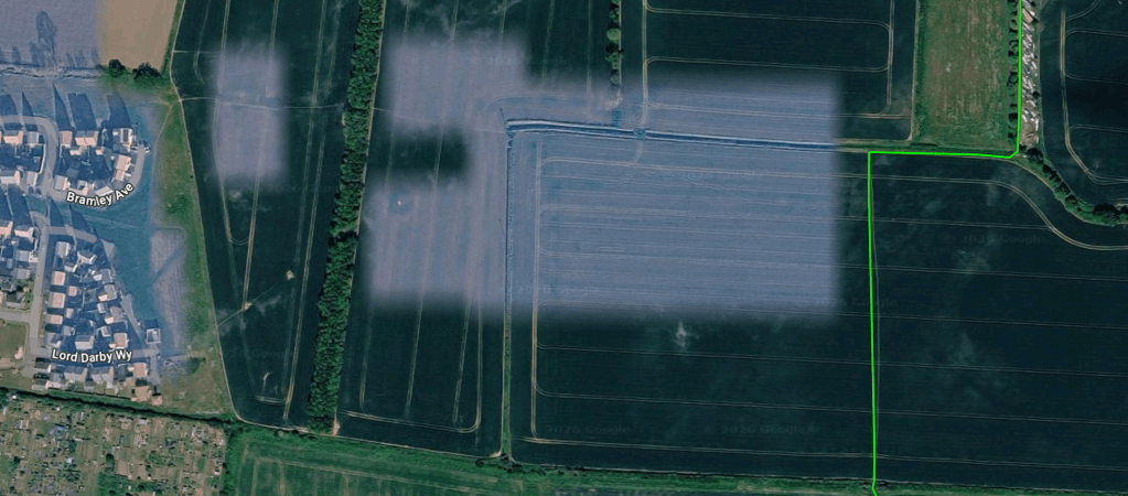
This desire line clearly demonstrates an otherwise un-met need to access Marsh Road. For some users, this might be to the employment hub at the Dammerwick industrial estate, for others the connection to the footpath on to Southminster. For travellers in the opposite direction it may be affording easier access to Burnham-on-Crouch Primary School on Dunkirk Road, Burnham-on-Crouch railway station or the Burnham shops.
While the new housing was being built, a temporary access road for construction traffic was laid down from Marsh Road. Former Town and District Councillor Nick Skeens argued that this road should be retained after construction was complete to afford an alternate route for emergency vehicles to Burnham south of the railway. As it stands, any blockage or disturbance of the Church Road bridge over the railway would hinder access to the town and prevent Burnham’s Ambulance and Fire stations’ emergency vehicles from getting out.
This construction road did last longer than the construction phase and for a while afforded a walking and cycling route to Marsh Road – another benefit to its retention. Unfortunately, at an earlier stage, the vociferous local anti-development lobby saw this construction road as a potential beach-head for further housing to be built on the adjoining fields and insisted on its removal. Another local Councillor, Wendy Stamp, took their concerns and staked political capital on ensuring the road would be excised – which it was.
It’s unfortunate that we lost a hard surface route connection here which would have provided a mixed-use route for active travel. This would have fit very well with policy expressed in the Burnham-on-Crouch Neighbourhood Development Plan (2017) [pdf]
Sadly, I cannot find any evidence of this policy being implemented in the last 9 years. It would be great to see a network plan.
| INTERVENTION NEEDED: Maintain and enhance an active travel network with new routes The local authorities need a bolder approach to active travel, they must reflect on the failure to deliver and create a plan which is SMART: Specific, Measurable, Achievable, Relevant, and Time-Bound. We cannot have another wasted decade. Town and Parish Councils need to understand and design how cycle and pedestrian routes within settlements connect to other settlements and contribute to a peninsula-wide network. * enhance rights on footpaths to make mixed-use paths * formalise de facto walk/cycle routes |
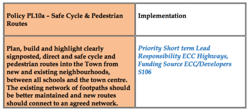
Pedestrian and cycle infrastructure on Marsh Road appeared in another Policy listed in the Burnham-on-Crouch Neighbourhood Development Plan:
Again, I can sadly find no evidence of work to implement this policy. It is useful that both pedestrian and cyclist needs were considered here but the last 9 years have not seen any action to address them.
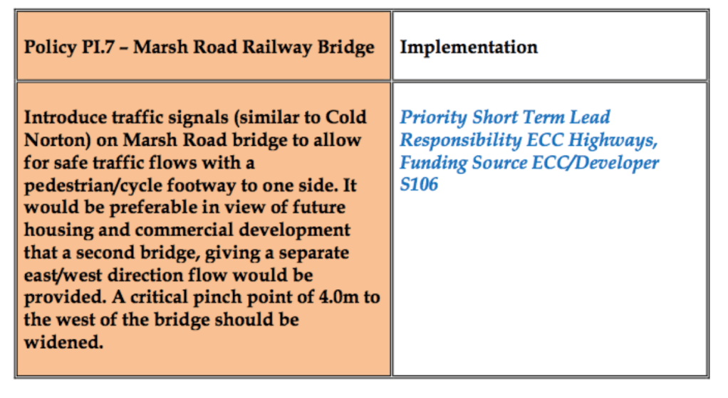
Marsh Road Railway Bridge is 200m east of St Mary’s Primary School, and 600m east of Ormiston Rivers secondary school (and the potential shared foot/cycle way on Church Road referred to in Stitching the Path: Connecting Disjointed Walk & Cycle Routes 1 and Finbar Tubby’s proposals for for improving active travel between the railway station and Ormiston).
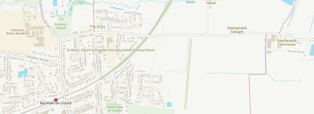
It is 900m west of the footpath connection to Southminster and the putative new cycleway. The road also hosts a place of worship (St Mary’s Church) and a children’s play area.
In the third cycling and walking investment strategy (CWIS3) published by the national government last week (12 June 2026) it commits:
Over the 5 years of this strategy, we will focus first on enabling millions more children to walk, wheel and cycle to school by providing safe, coherent networks that connect schools, high streets and homes. Giving children the freedom to walk, wheel and cycle in early life will set habits and deliver health benefits for generations to come.
It’s first listed target objective is that: ‘60% of children aged 5 to 16 will usually walk or cycle to school by 2035‘
It seems clear to me that the Marsh Road nexus is a key part of achieving this in Burnham.
| INTERVENTION NEEDED: Implement the Marsh Road Railway Bridge changes in the Burnham NDP This would also act as a traffic calming measure, reinforcing and increasing awareness of speed limits. |
| INTERVENTION NEEDED: Speed Limit on Marsh Road Schools, place of worship, road intersects with footpaths (FP 14 242, FP 15 242, FP 26 242) and putative cycleways, also active travel route up Glendale Road from iron bridge (footbridge). |

Leave a comment