
Last weekend I walked the two new local sections of the King Charles III England Coast Path (KC3ECP) that I mentioned in the previous post. As pre-warned, these were open but unfinished. In this post I review the WIB4 section: Clementsgreen Creek, South Woodham Ferrers to The Quay,
North Fambridge [pdf]
North Fambridge section
This begins on pre-exisisting rights way:
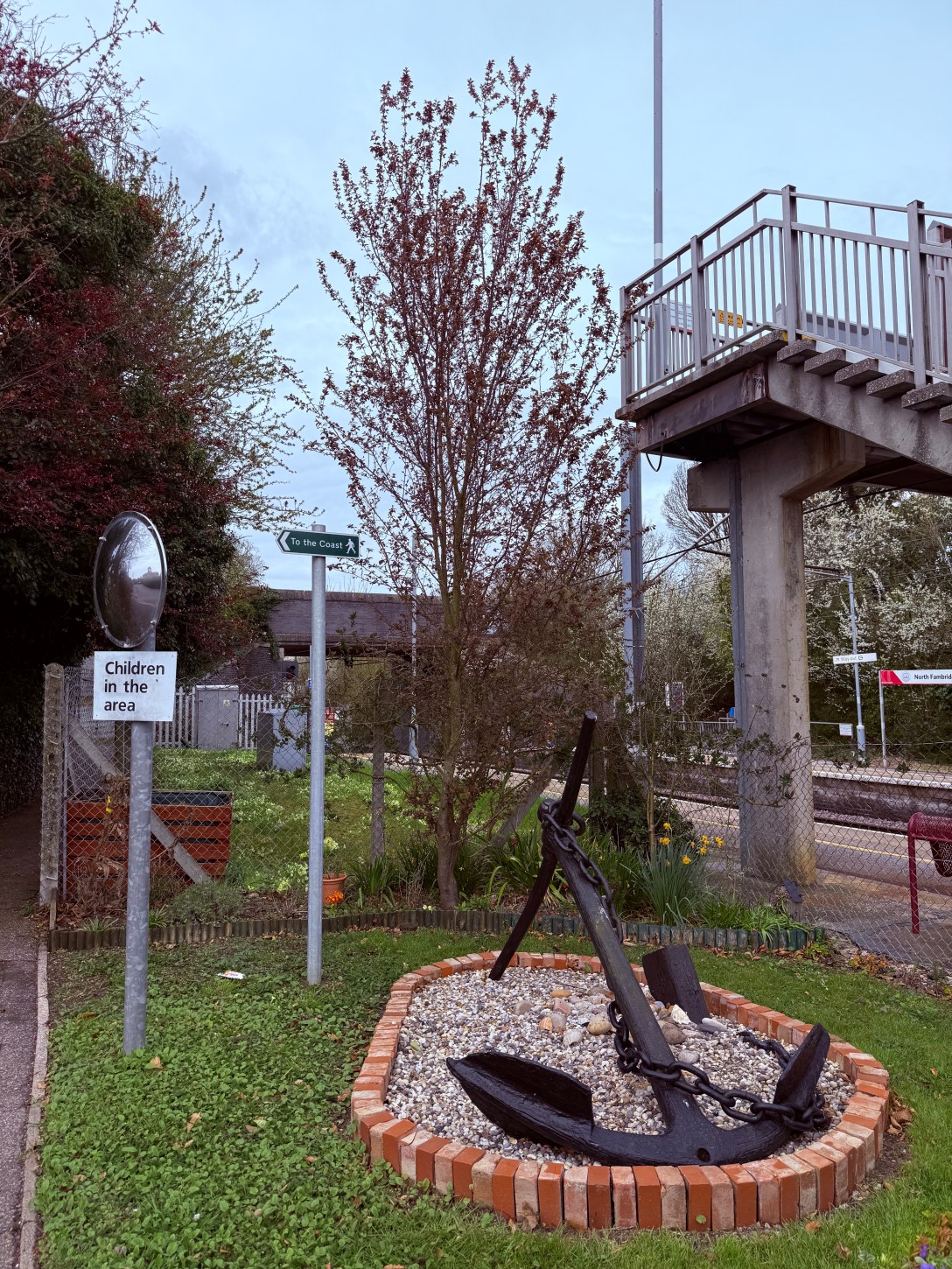
I travelled on the train bus replacement from Burnham-on-Crouch to North Fambridge railway Station, took the stairs to the road bridge from the westbound platform and went north on Fambridge Road.
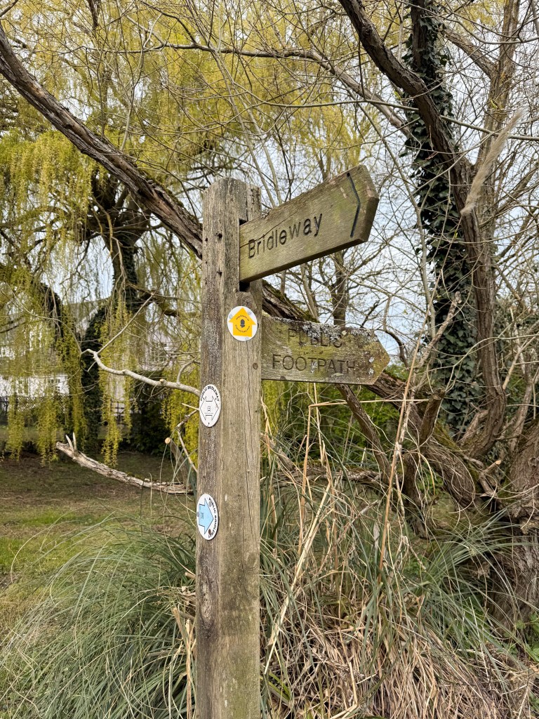
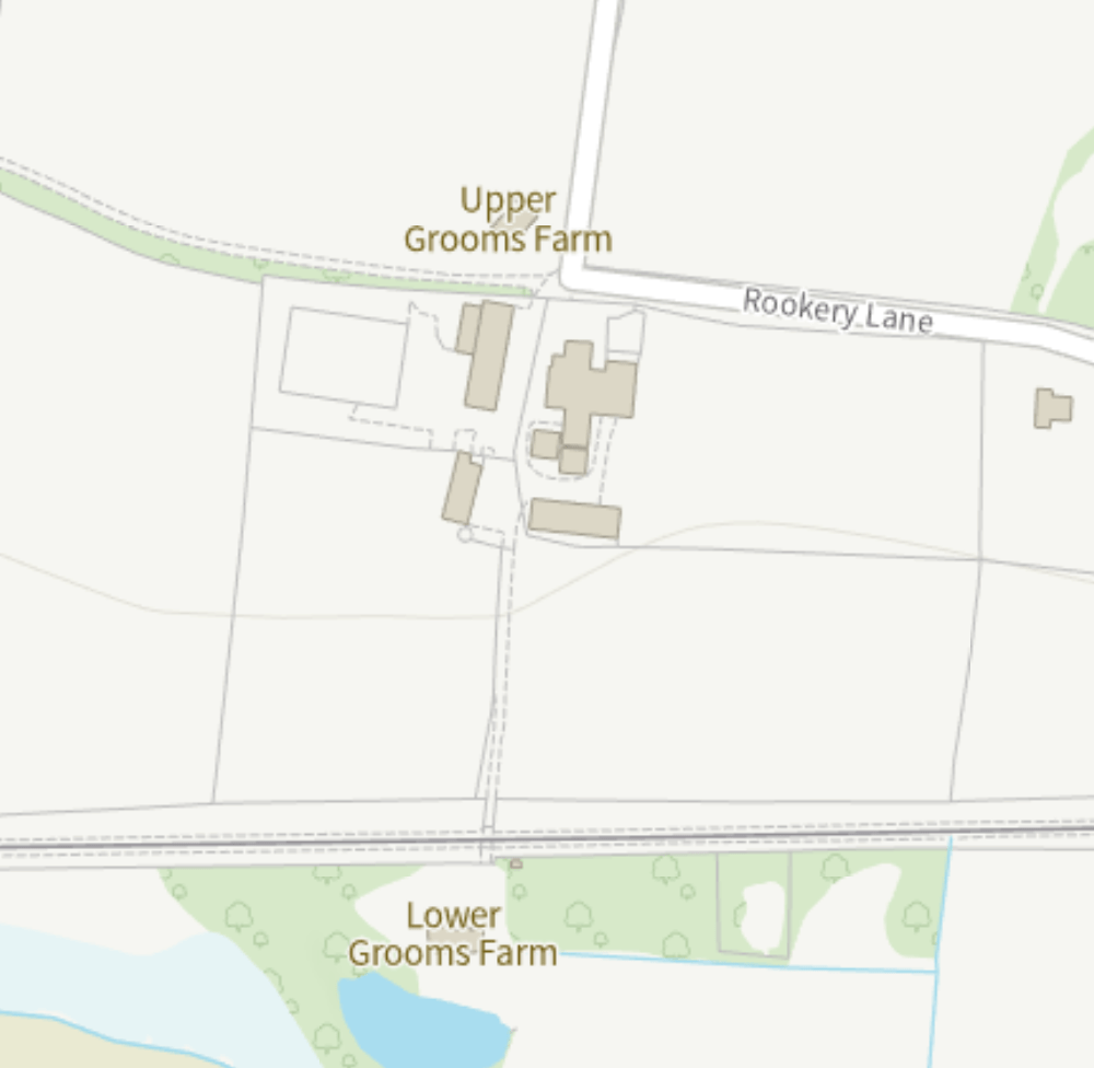
Footpath FP 5 256 goes west off Fambridge Road, opposite Franklin Road, on a short paved path leading on to Rectory Road. Rectory Road’s metalled surface peters out as it becomes the bridleway BR 17 256 which connects it to the metalled surface of Rookery Lane. A KC3ECP waymark disc appears on a post at teh start of Rookery Lane – the first seen on this route, and also the last for some time.
Apart from the 41 metres of Footpath FP 5 256, this already provides a good cycle route west out of North Fambridge.
[It’s also a potential walk/wheel/cycle connection route through to Stow Maries and the dismantled railway line using bridleways, residential streets and country lanes. Some attention would need to be paid to improving the Rookery Lane junction with the Lower Burnham Road (B1012), so as to afford safe access to Honey Pot Lane. Rookery Lane and Honey Pot Lane are only 100 metres apart but there is currently no footway, cycleway or controlled crossing facilitating safe transit.]
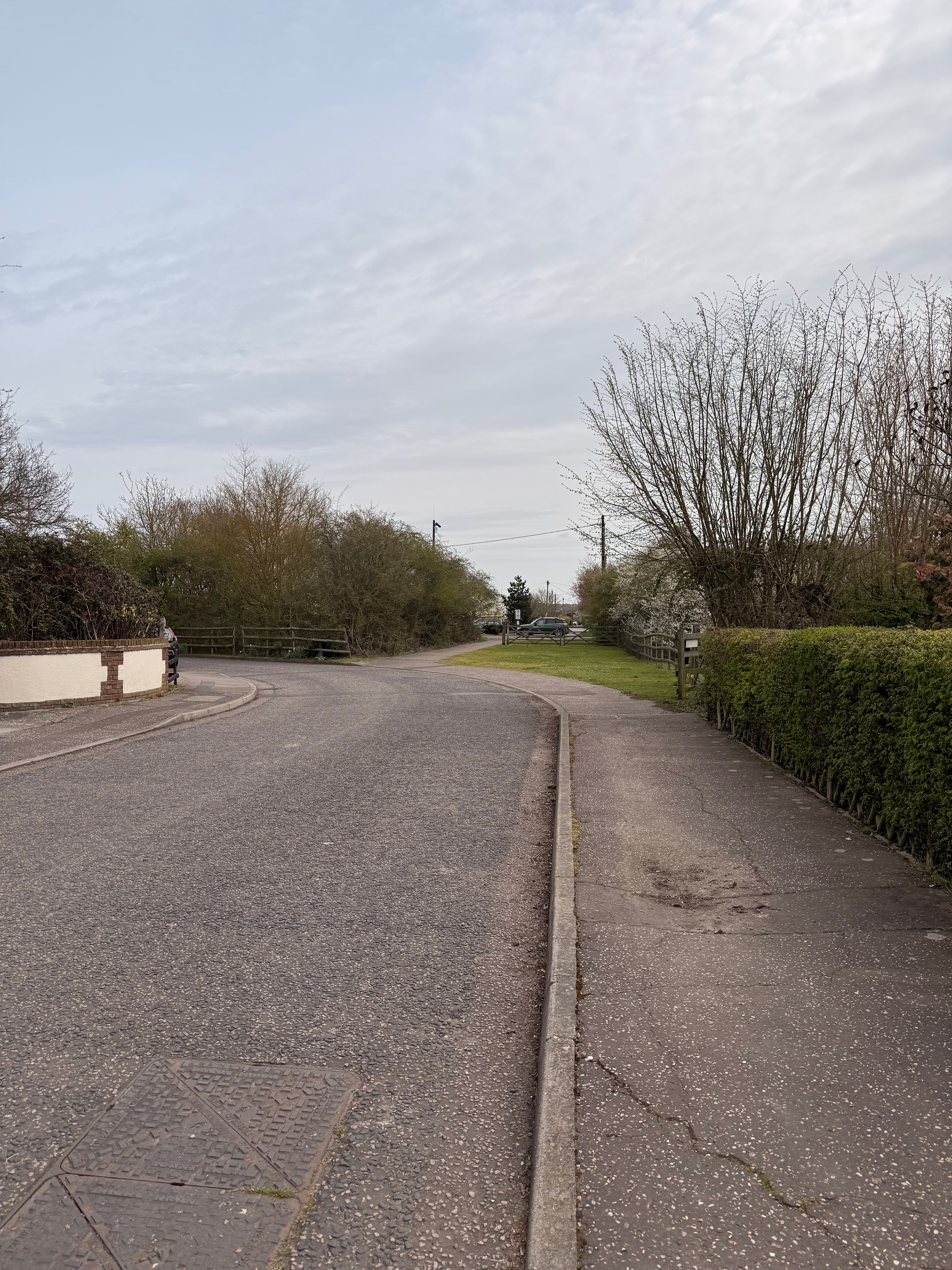
The new section of Right of Way begins where Rookery Lane takes a right angle turn north at Upper Grooms Farm (///fully.blushed.lecturers). The new Right of Way instead proceeds straight on along a farm track. There is no sign to be seen though, no fingerpost or waymark disc anywhere evident. This is exactly where a walker needs confidence, both on the route direction and that they have permission to go forward. The new Right of Way does not appear yet on the Essex Highways PROW interactive maps.
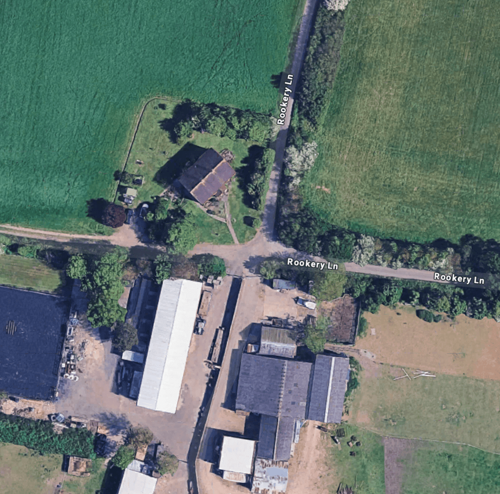
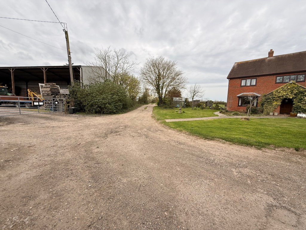
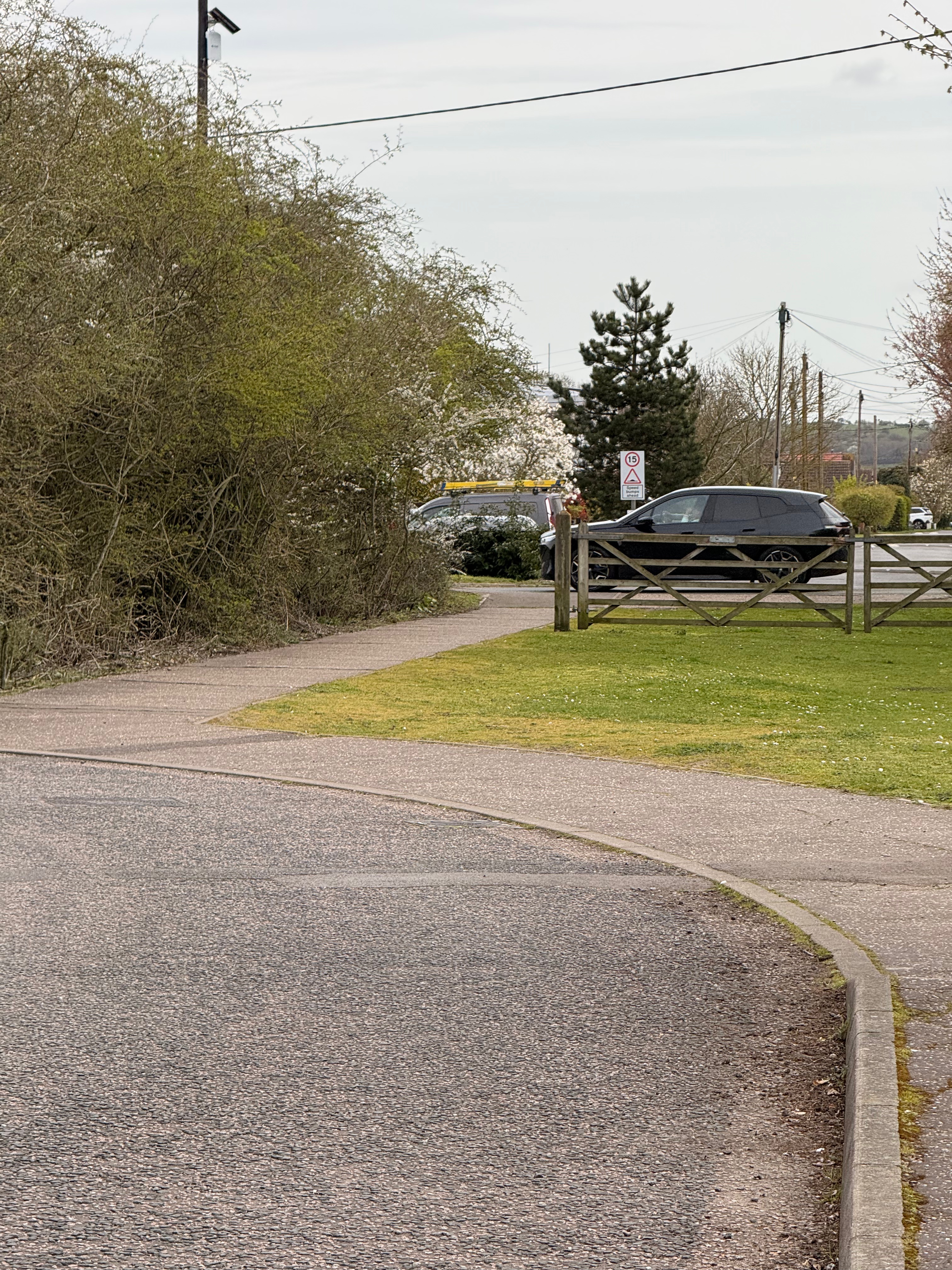
The route immediately ahead is simple enough if you are brazen enough to take it following a gravelly farm track westwards for about 200m until it opens up into a defoliated area with a metal pole barn to the north and a static caravan to the south. Logic would suggest that you proceed directly across this area and through the hedgerow ahead. There’s no signage anywhere however. The hedgerow hints at having once had a path though it, but there is both side and surface growth preventing easy passage. North of the pole barn a farm track goes through the hedgerow and I took this. Reviewing the Natural England map for this section however, it is clear that the intended route is through the hedgerow where it was overgrown and that an existing field gate should be here but is not. (///utensil.monorail.submits)
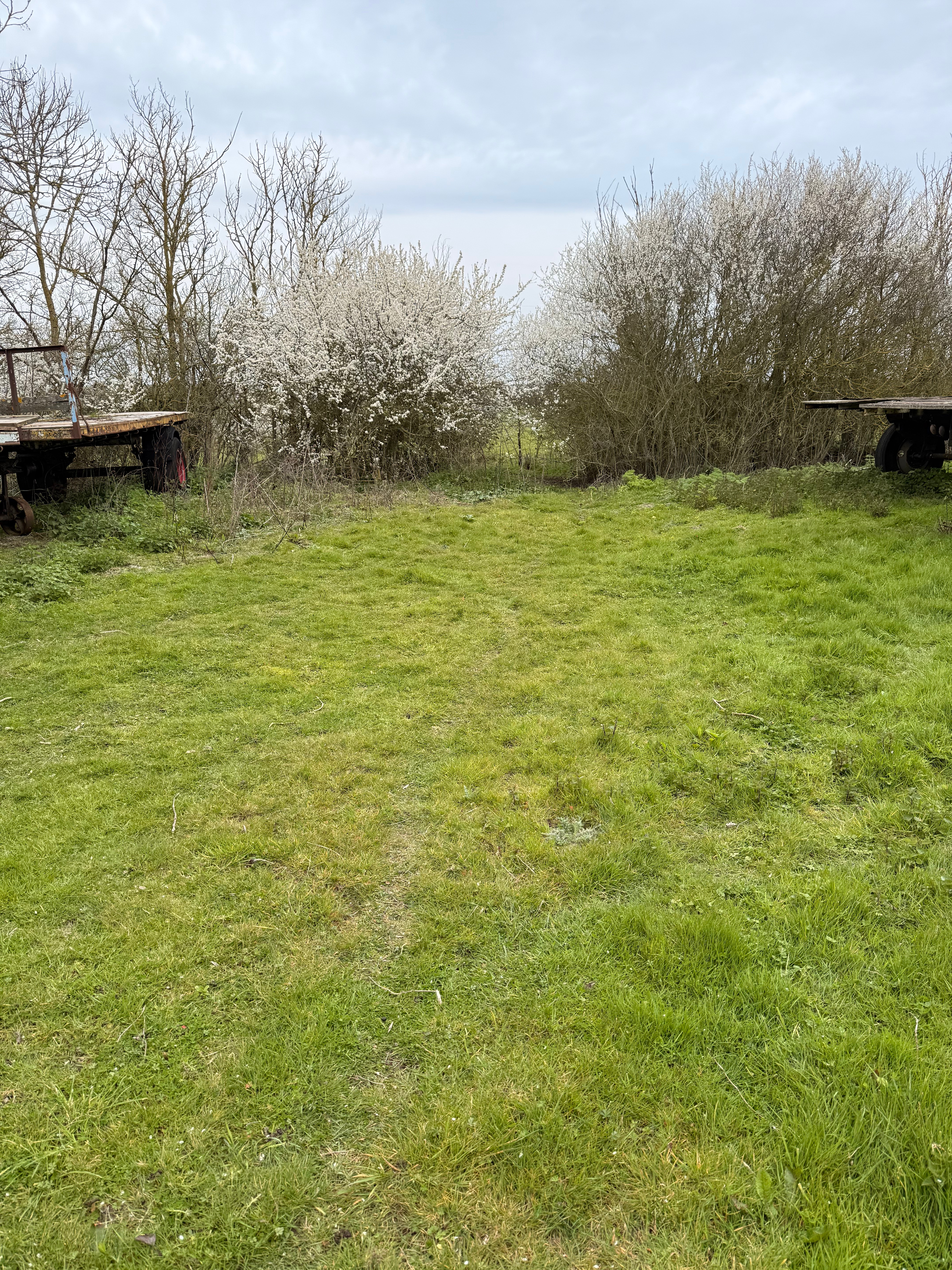
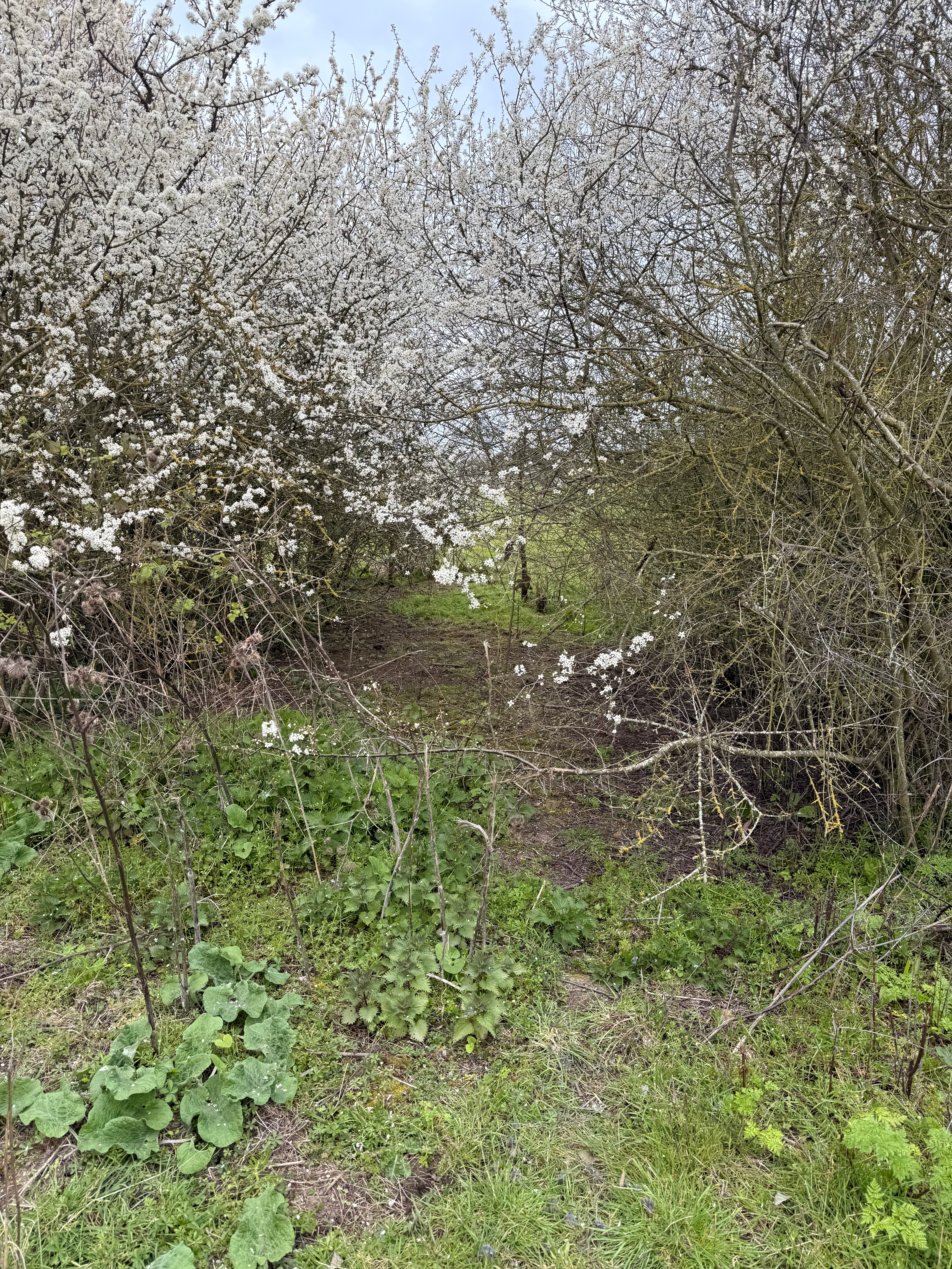
The overgrown gap in the hedgerow.
To this point, the route from North Fambridge seems usable by both walkers and wheelers, and could be used by cyclists were higher rights allocated.
On the west side of the hedgerow, the route proceeds south-west along the field edge, turning north-west when it meets a land drain and the south field edge. A 1.5m width of trail is to be established on the field edge, but there’s currently no evidence of that. The field is laid to grass and slopes southwards from the hedgerow entrance, dropping about 12m over 180m to the drain. This section could be improved in a way that would improve access for wheelers and also make it suitable for a cycleway.
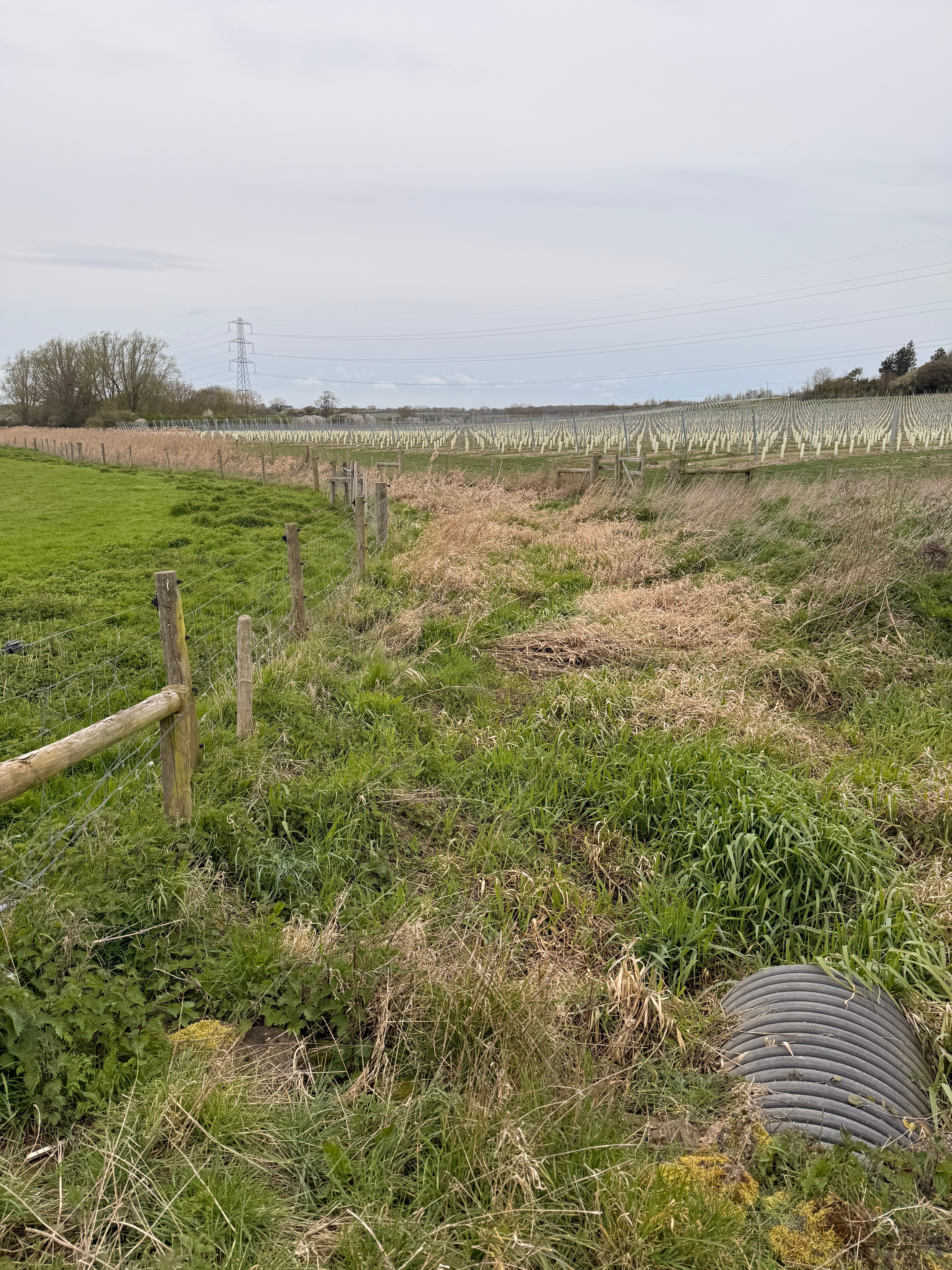
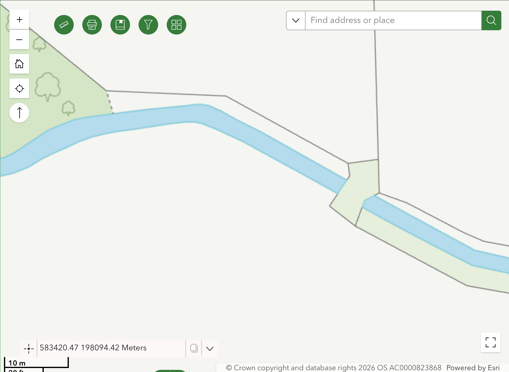
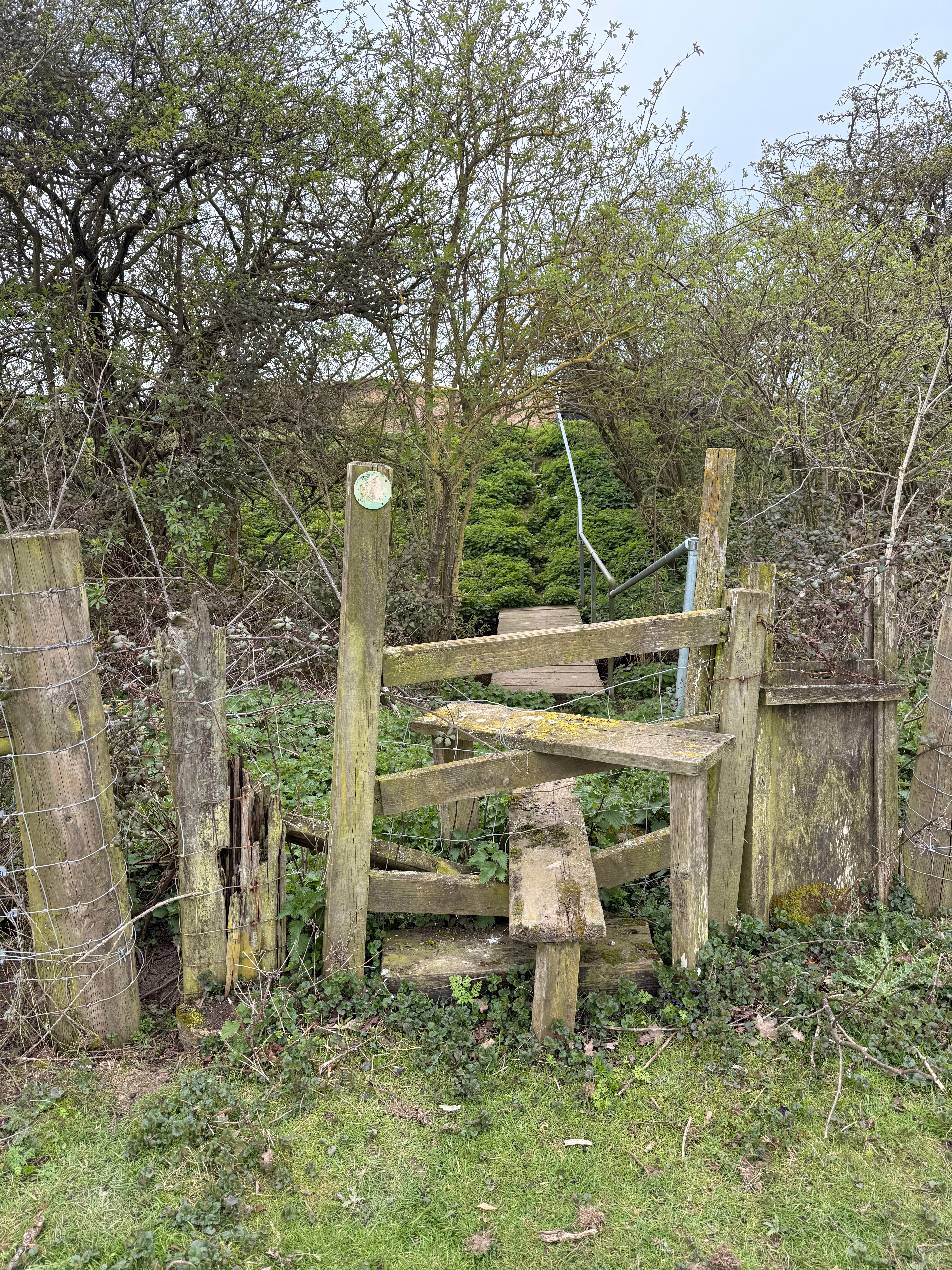
The route leaves this field at an intersection of gates, stiles and a footbridge where the need for construction work is most clearly evident. What isn’t clearly evident is where you are supposed to go. There’s no signage, the Essex Highways interactive PROW map remains useless and the Natural England map is not detailed enough (///powerful.truckload.balconies). A farm gate leads into a field to the south, but the Natural England map suggests that the route goes north of the drain and involves a new footbridge and a new farm gate.
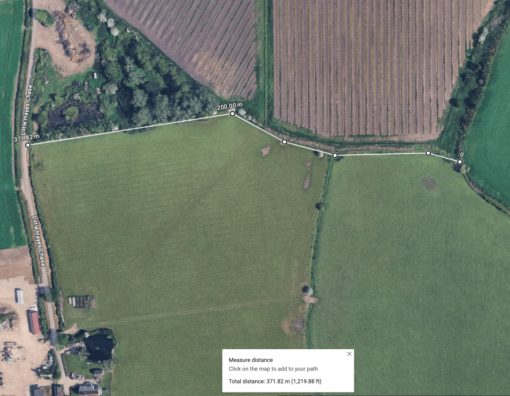
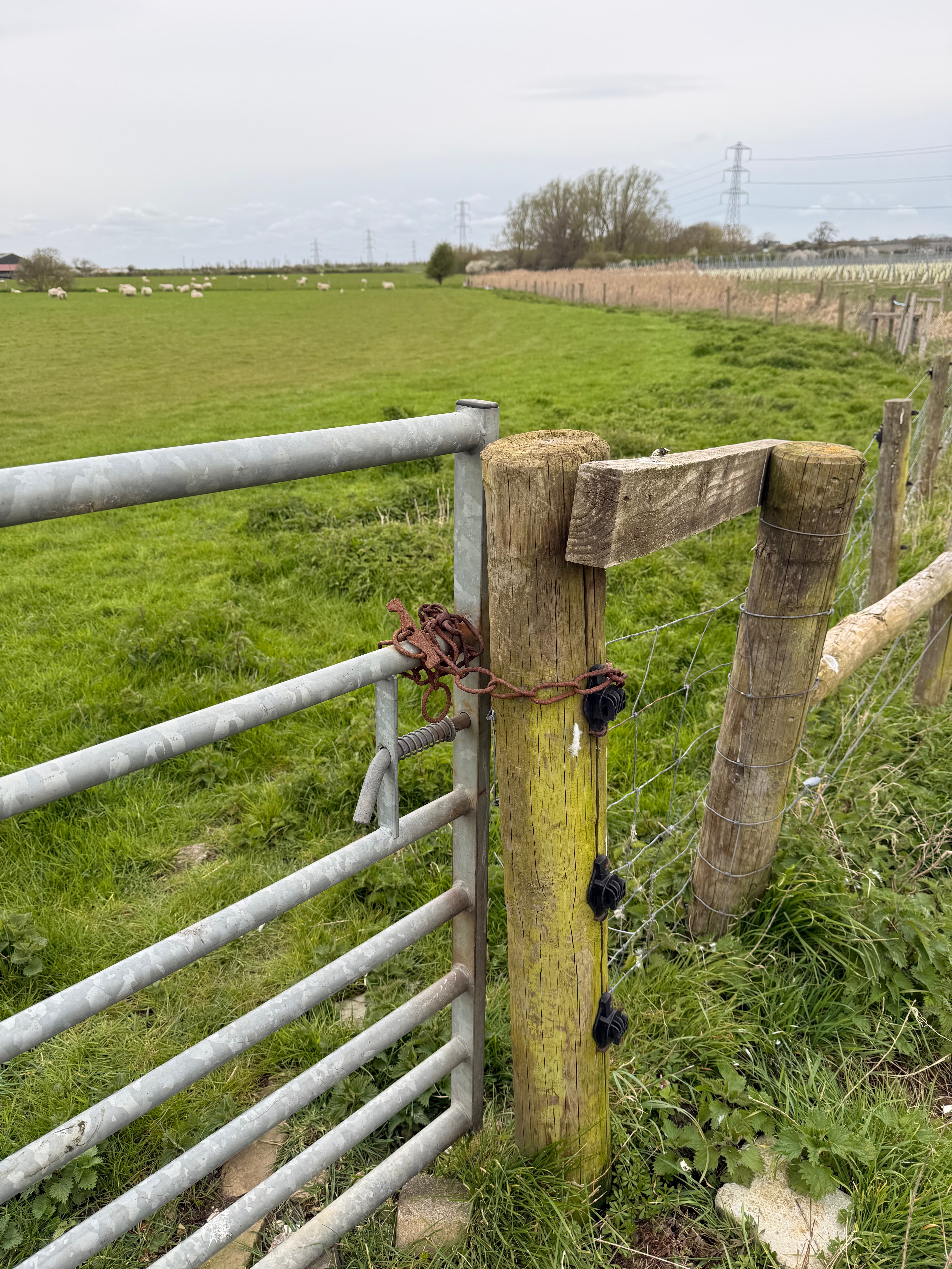
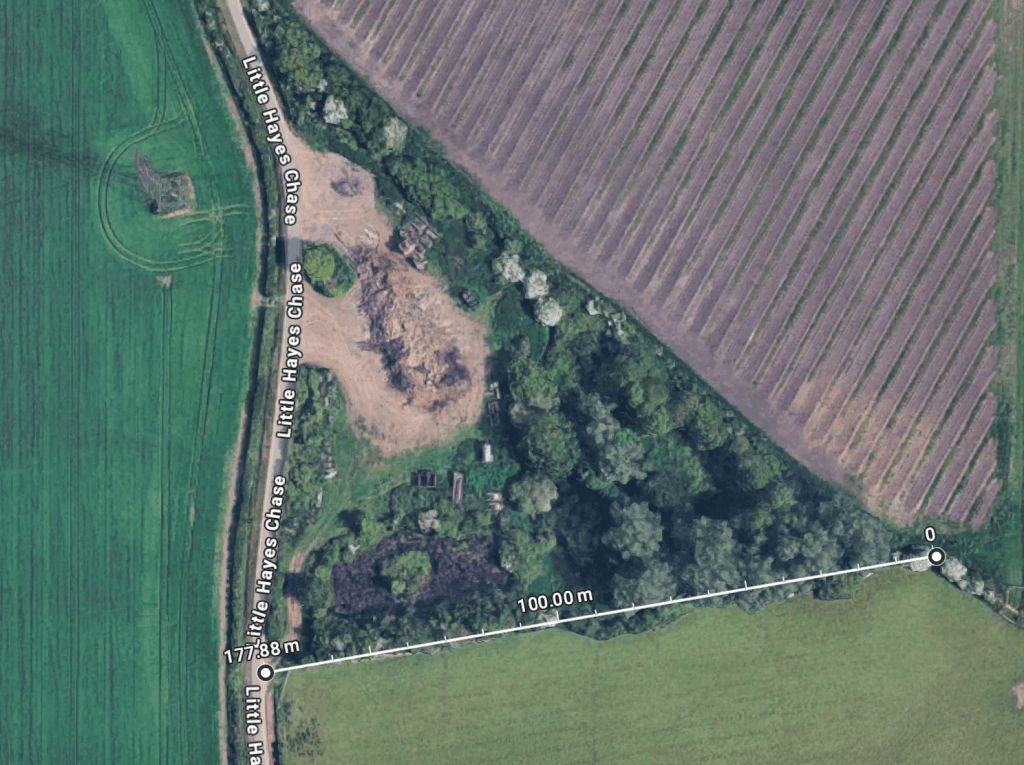
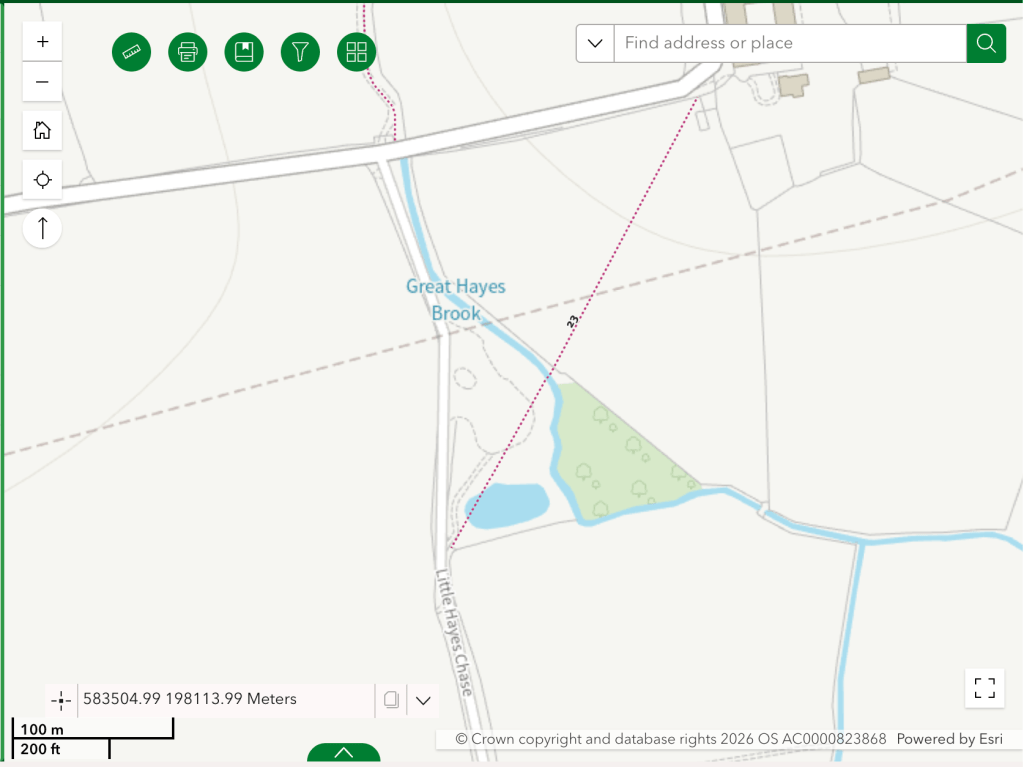
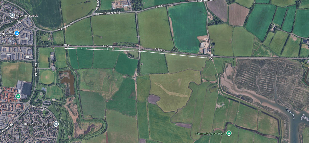
Directly to the west, about 360m as the crow flies, is the road Little Hayes Chase which forms part of the KC3ECP. Following the north field edge, its about 370m away. The only evident way forward from the last field is through the metal farm gate (which was chained shut) and into the field to to the south, where the logical way forward would be to follow that north field edge to Little Hayes Chase. This is a relatively flat route that could provide a good walk/wheel/cycle route.
I clambered over the farm gate into the south field from where I could see a nearby step stile on the north field edge leading towards a filed of vineyards. Comparing my GPS position on an electronic version of the OS175 map with the Natural England map, this appeared to be the route to take. It led on to a footbridge over a land drain. Once again, there was no signage to help here and the infrastructure is in a poor state. Both the step stile and the footbridge are in stages of decay and are unsafe, they lead to a pedestrian gate with broken fittings that provides access to the vineyard field. It’s a very fussy nexus, in need of redesign as much as repair or replacement. It’s unclear why it is proposed to have replacement pedestrian gates here rather than wheelchair/mobility device gates or, thinking ahead, bicycle-friendly gates.
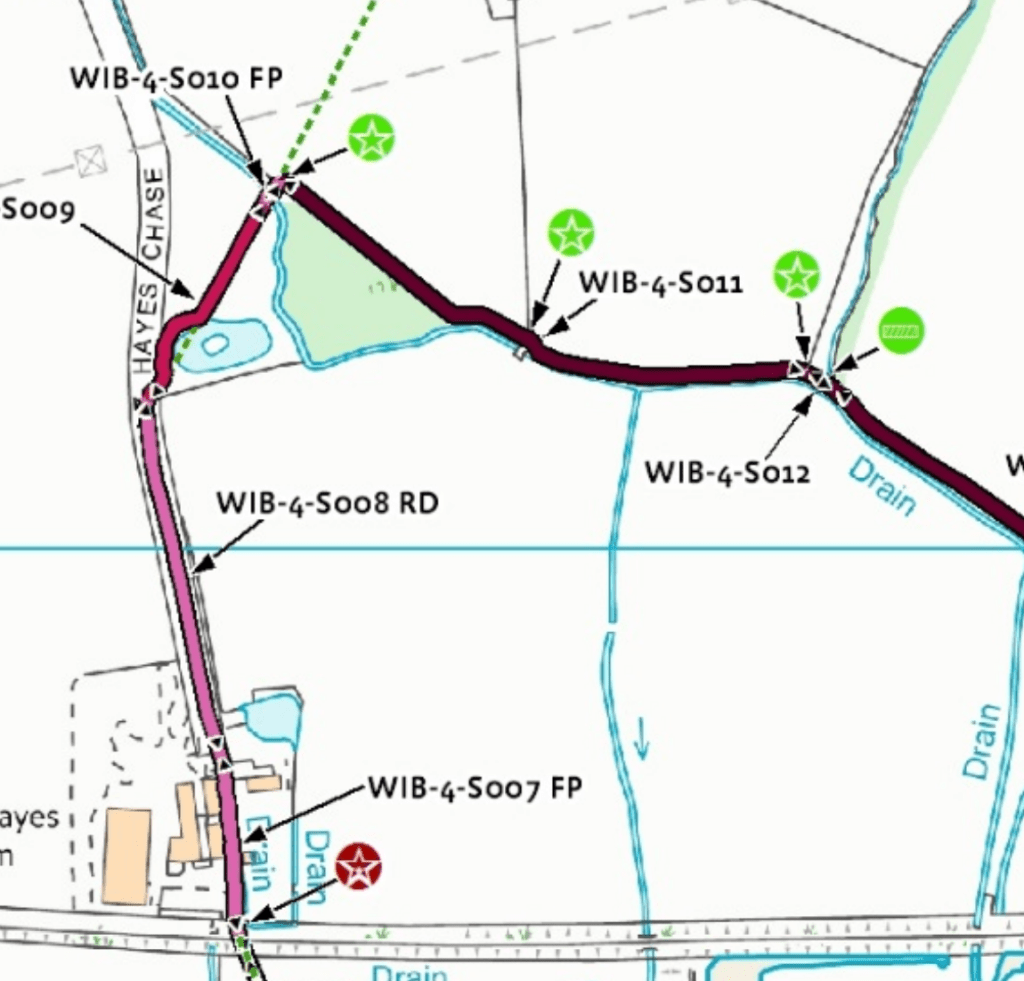
From here the new route follows the south edge of the vineyard field. This runs parallel to the route described above on the other side of the drain until it reaches a copse, whereupon it follows the field edge north west until it meets footpath FP 23 261. The descriptive text in the natural England documents states that they opted for the proposed route because ‘it utilises existing rights of way, readily links land uses over several properties and generally follows a permitted route for an
annual long distance running event’. I think this event is the Stow Maries Trail Challenge, but it’s unnamed in the document and the Stow Maries Trail Challenge route is not public. The ‘other options considered’ in the document do not include a more direct route to Little Hayes Chase.
A break from the described route at the copse, to go more directly west to Little Hayes Chase could produce a more accessible option suitable for upgrading to a cycle way.
Around the point that a new pedestrian gate is proposed, there is a bridge over Great Hayes Brook and gate access into the field that leads to Little Hayes Chase (///widely.courts.fixtures).
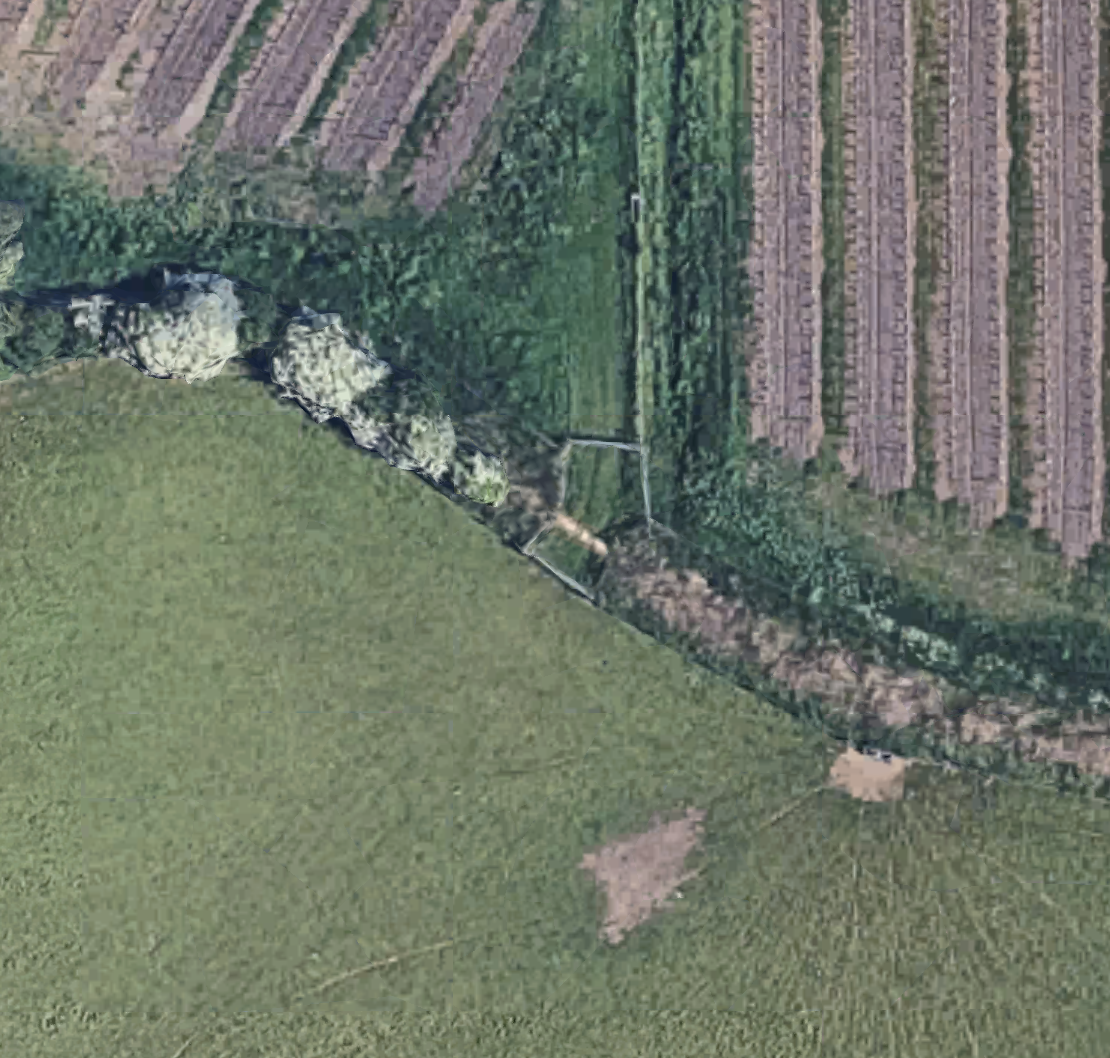
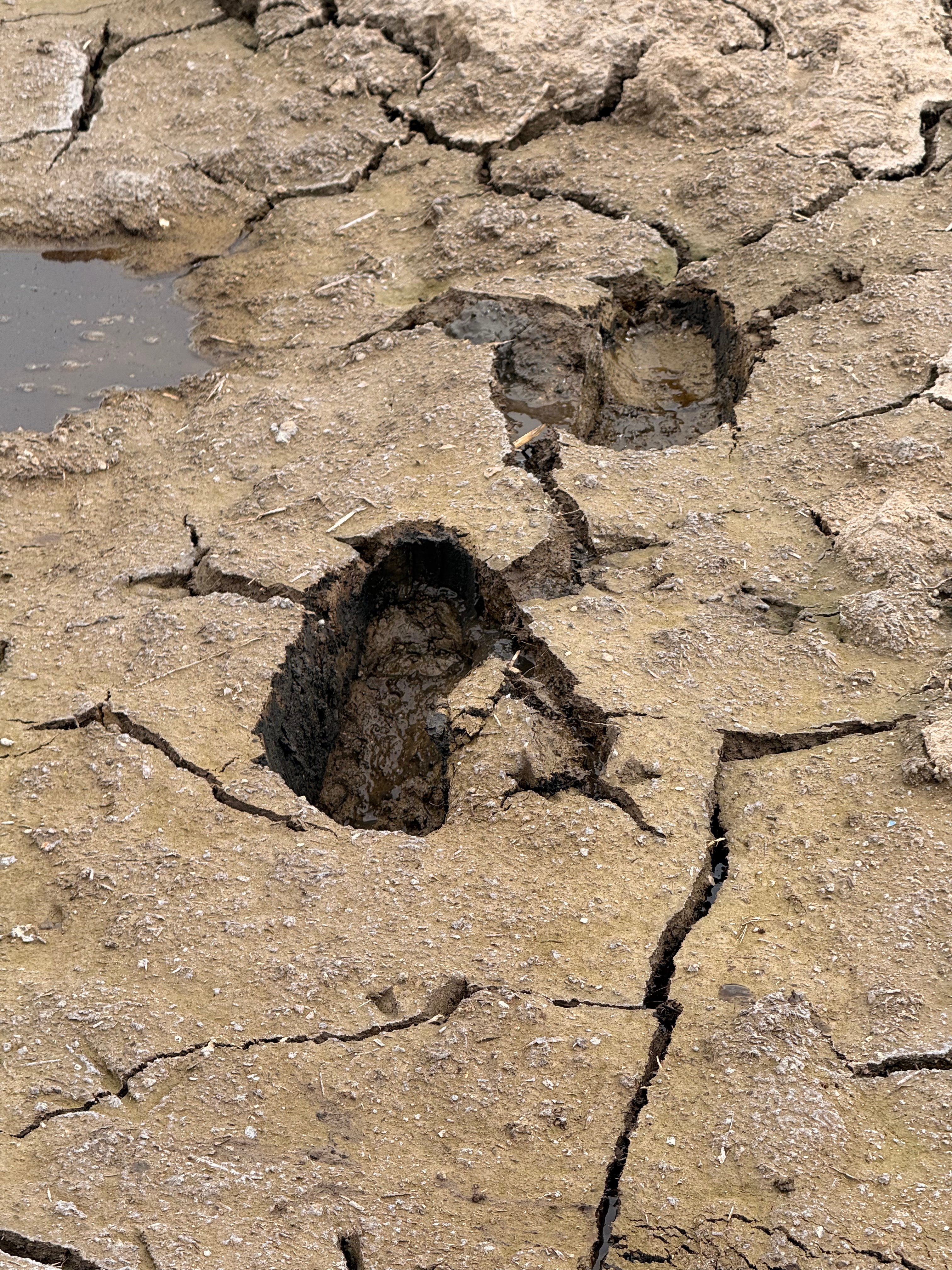
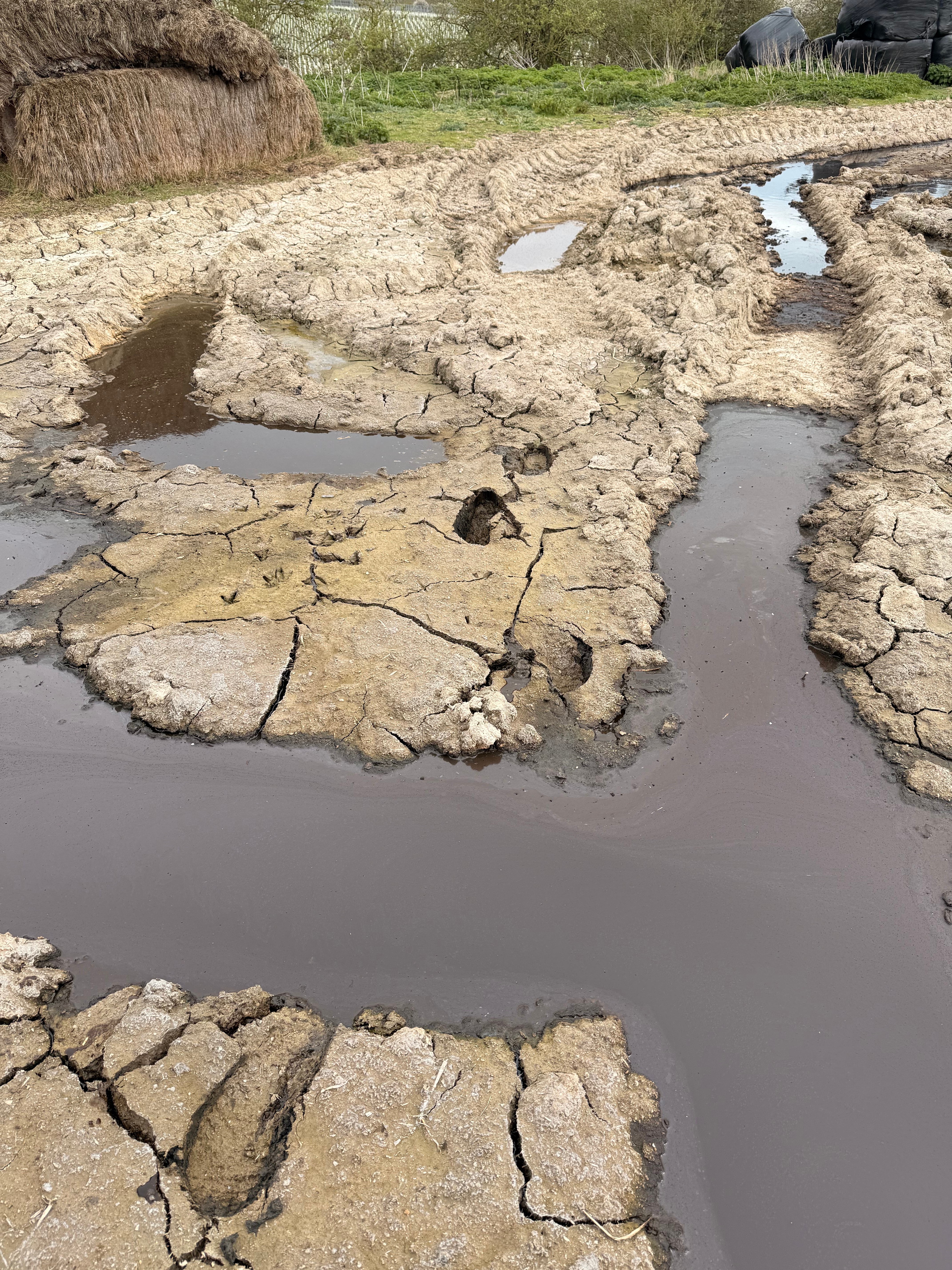
I can see the attraction of connecting with, and utilising, an existing Right of Way (footpath FP 23 261) as the new route does, but this produces its own problems. When FP 23 261 leaves the vineyard field, it crosses Great Hayes Brook at a more difficult spot which involves a step stile, steps down to the brook, a footbridge and more steps up from the brook. This limits the accessibility of the route. The infrastructure here is, again, in poor condition. At the top of the steps the footpath proceeds across an area used by the local farm as a store of manure and a general dump. The route through this is poorly marked. When I walked it, the surface was very uneven and apparently solid earth was actually an unsound crust on fluid runoff from the manure pile into which feet began to sink. The route as shown on the Essex Highway PROW map goes through a body of water.
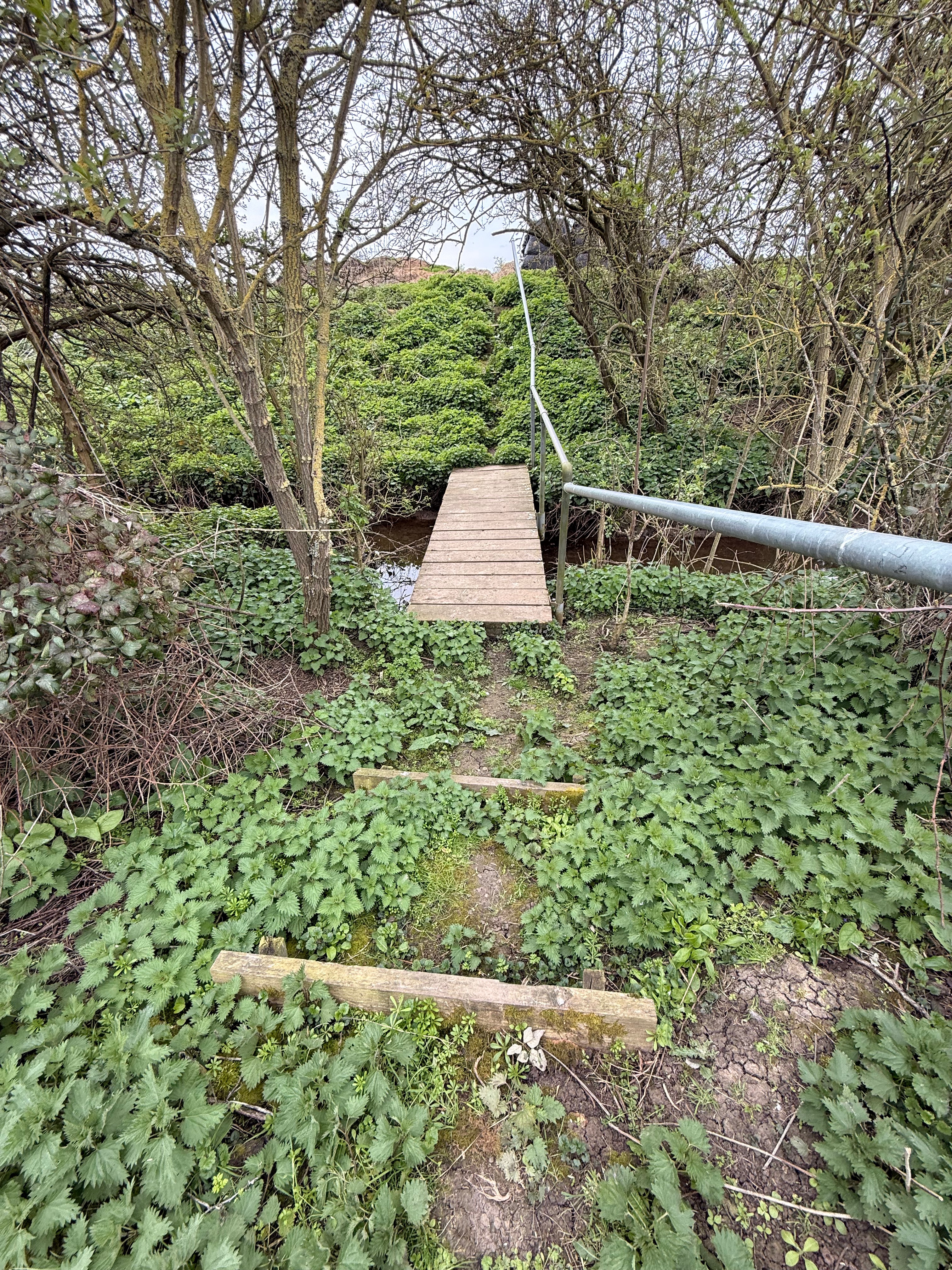
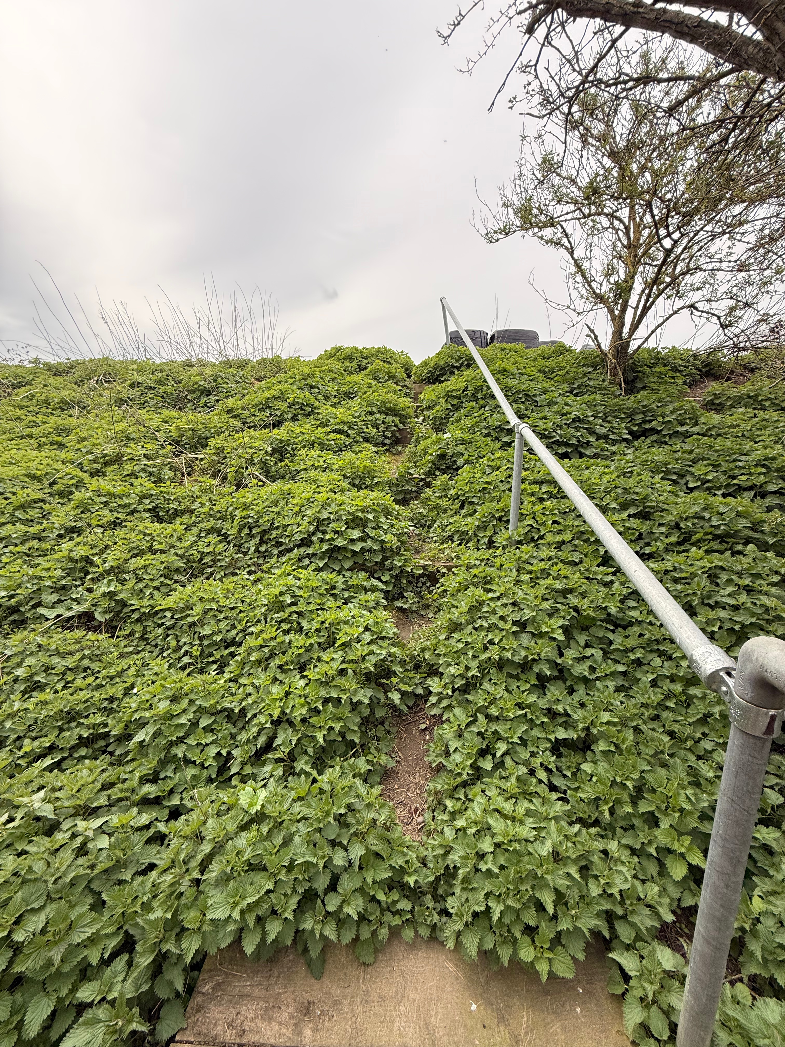
The step stile, footbridge and steps down to and up from the brook on FP 23 261
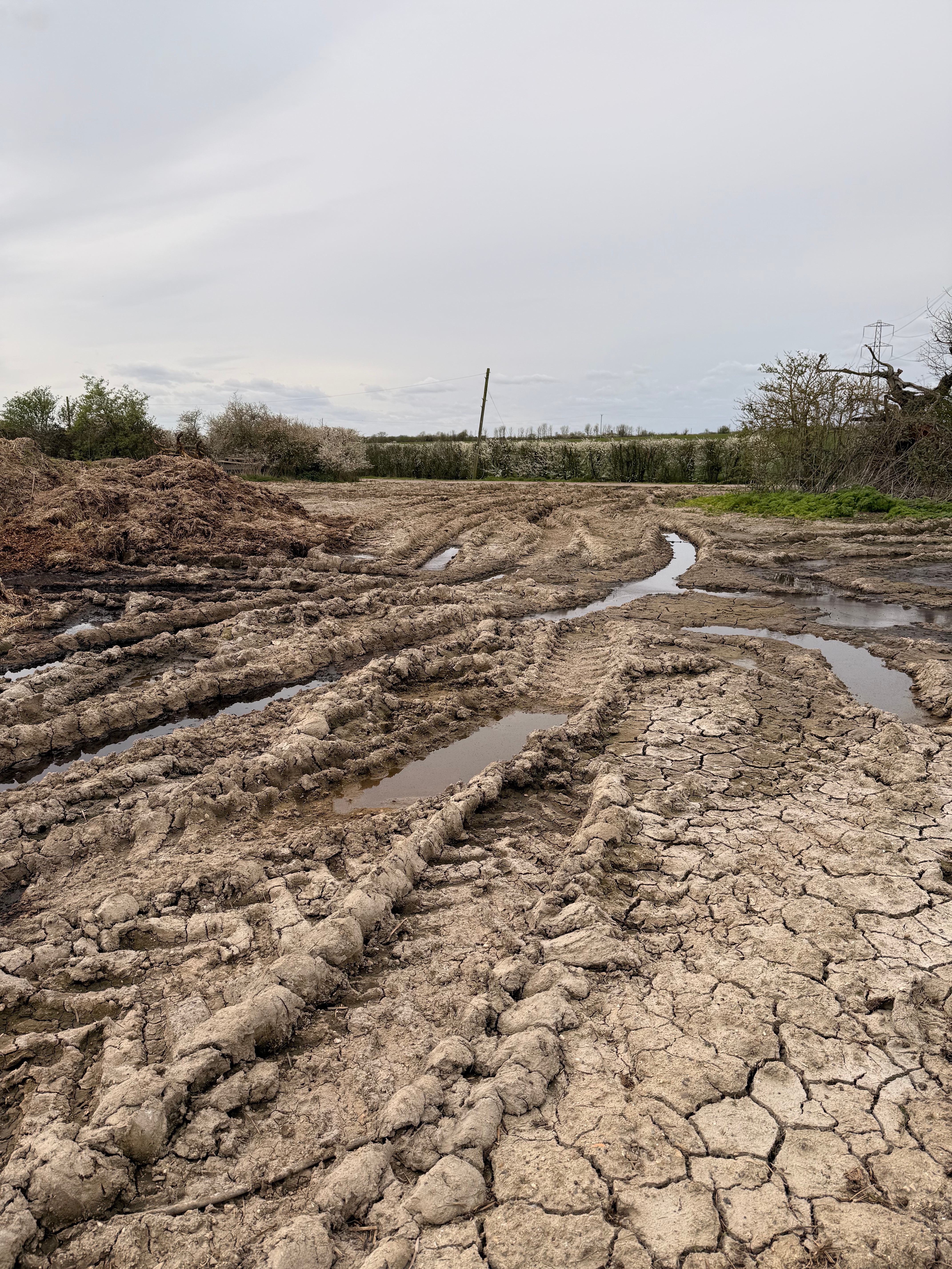
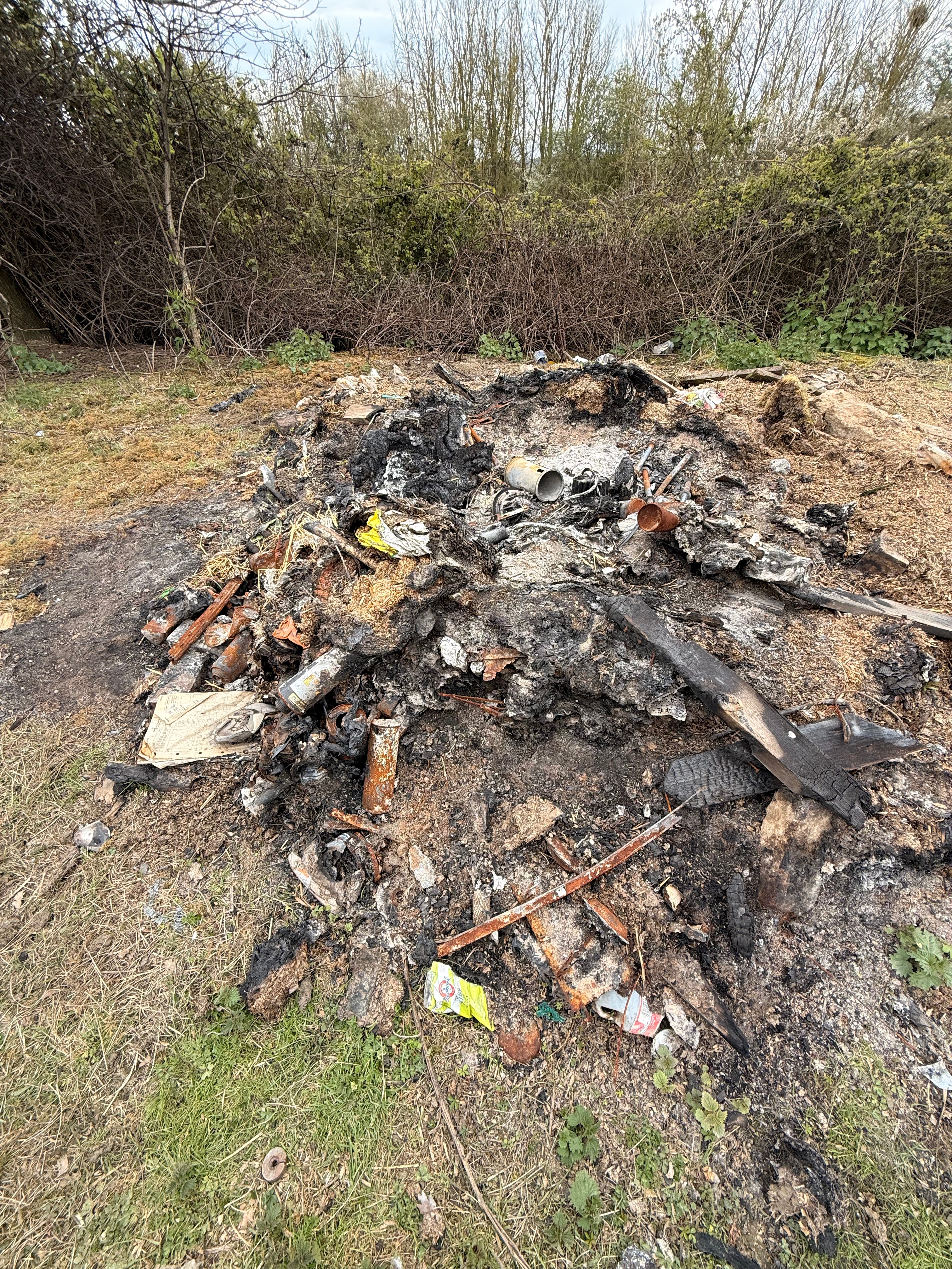
The unwelcoming manure swamp and dumping ground at the top of the steps
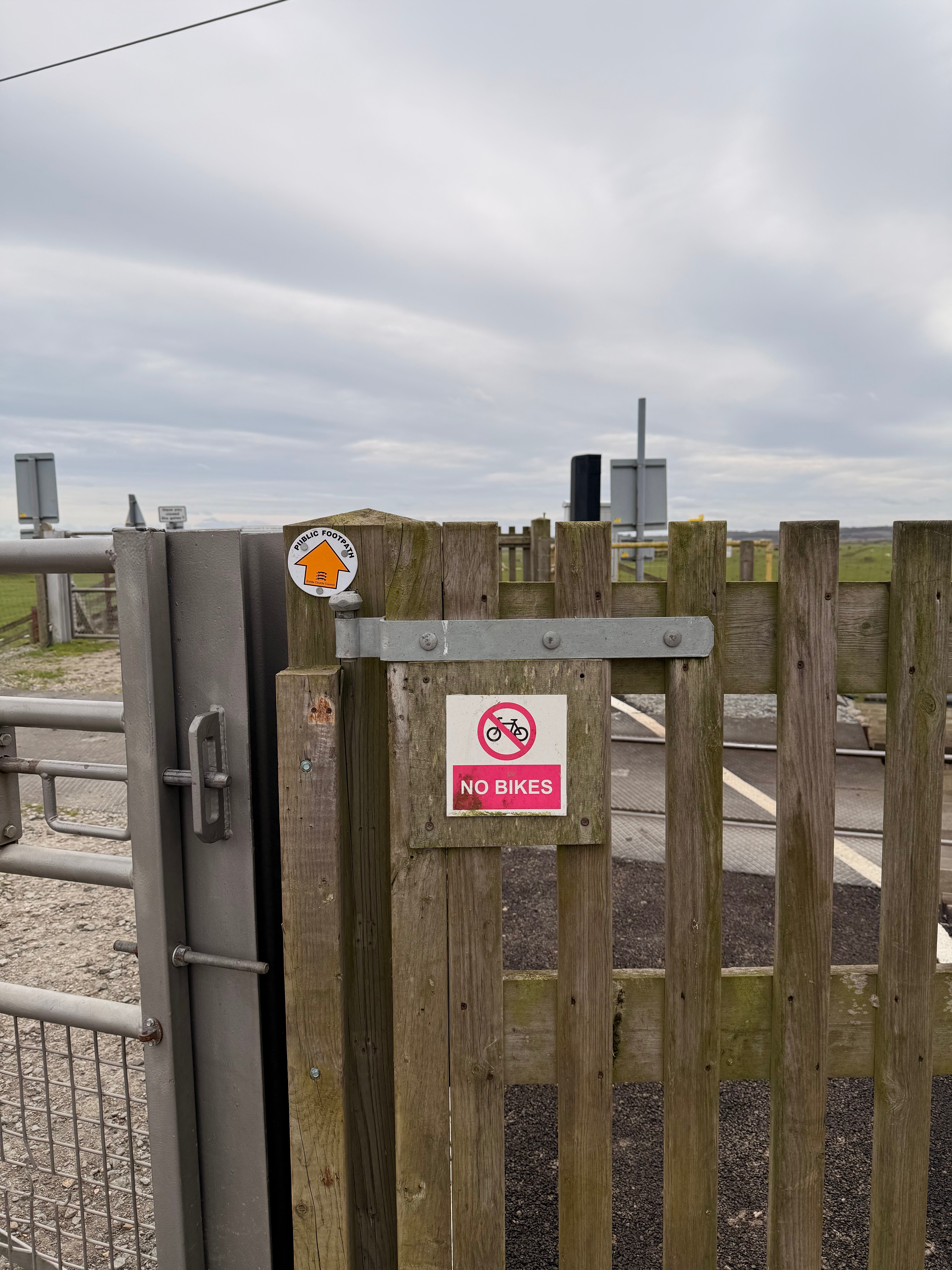

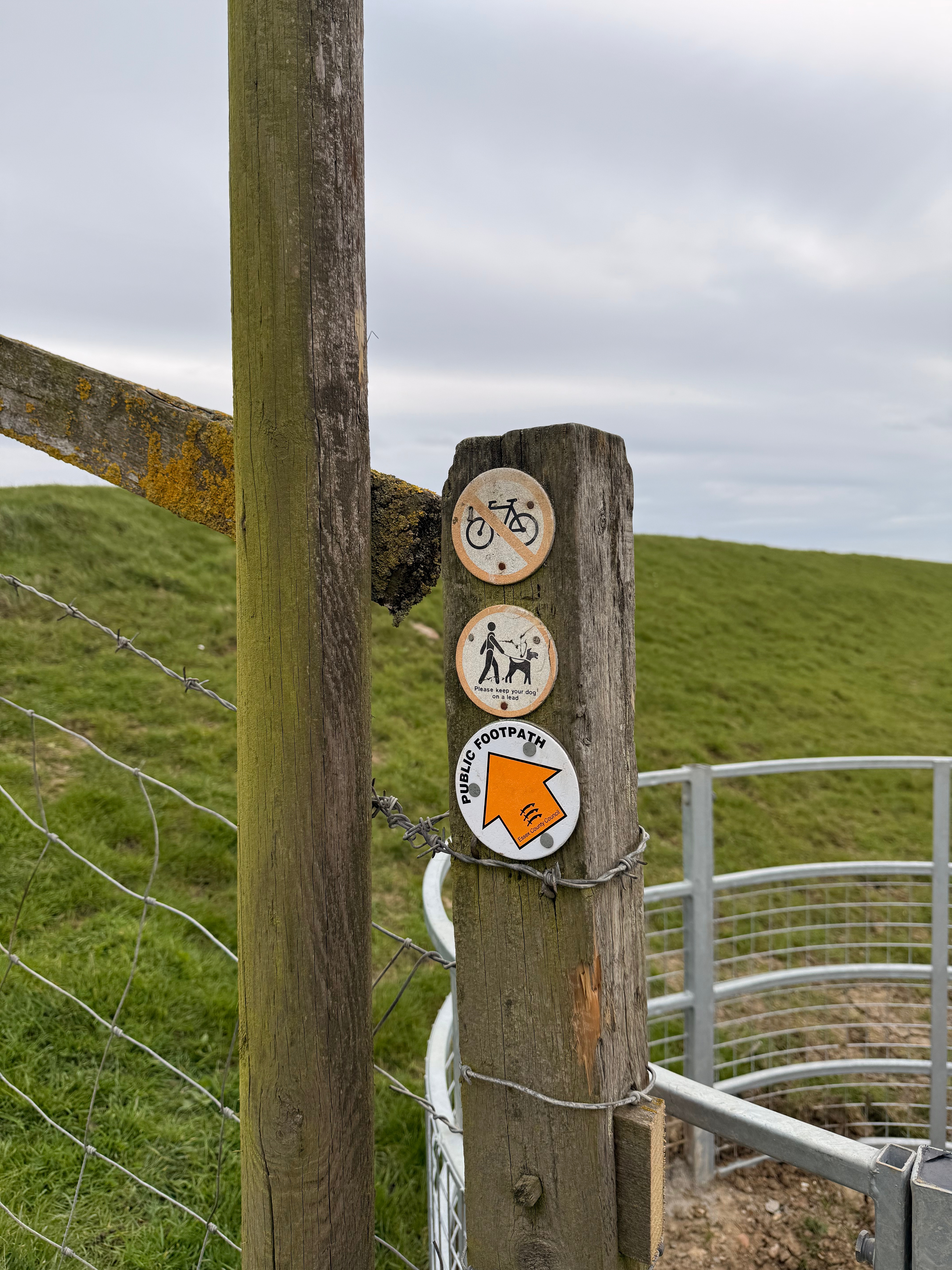
Cyclists unwelcome ahead
The ongoing route is all on pre-existing rights of way. Little Hayes Chase is a metalled road down to the railway crossing, beyond which a gravel track leads to a kissing gate and a slope up to the sea wall around Stow Creek (neither the gate or the slope are accessible for those using mobility aids). To travel onwards to South Woodham Ferrers, you must walk the sea wall along Stow Creek and Clements Green Creek. This serves the purpose of a coastal path well, keeping you close to the water. The purpose of the KC3ECP diverges here from the needs of the person simply travelling between North Fambridge and South Woodham Ferrers. The KC3ECP route is therefore frustrating if you are walking for utility rather than leisure. An additional westward route aligned seaward of the railway line from the crossing to Saltcoats Park would provide a useful quicker route here.
Where Little Hayes Chase reaches the railway crossing there is lots of communication warning off cyclists from going forward. Warnings repeated at the kissing gate by the sea wall. A new westward route from the crossing could take cycle traffic however. A small amount of work improving transfer from the Saltcoats Park entrance to Cutlers Road/Saltcoats Industrial Estate (just 67m away) would afford onward cycle journeys a connection with the Chelmsford City Council promoted cycling route around South Woodham Ferrers, including the fully segregated cycle path into the town centre.
There’s clearly still work for Essex Highways to do on this new section of the Coast Path, including signage, gates, stiles, steps and bridges on the ground, as well as adding the route the Essex PROW map. It’s frustrating that in the week the KC3ECP was announced as fully open, a section approved over two years ago is incomplete because of the recent illness of a contractor. This delay provides an opportunity to think more creatively about the possibilities offered by this route however and to ensure it is accessible to the widest set of users.
The Mid Essex Local Cycling and Walking Infrastructure Plan failed to identify a route connecting the settlements along the north bank of the Crouch Valley. As I’ve noted previously, the Essex Local Cycling and Walking Infrastructure Plan states that rural routes will draw on bridleways, byways and quiet lanes – but we have don’t have much of that locally and a broader approach to identifying routes needs to be made. This will necessarily include upgrading rights and infrastructure on some footpaths to form shared use paths accessible by walkers, wheelers and cyclists. It will also require the establishment of entirely new rights of way, just at the England Coast Path has done here.
There’s more on this to be said in relation to the other new section of the KC3ECP I walked last weekend. The section between South Woodham Ferrers and Battlesbridge, but that will have to wait for the next post.
