
[This article develops a recent Facebook post with more maps and discussion of cycle route potentials]
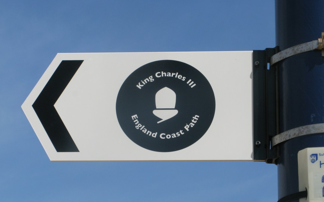
I received communication this week that ‘the King Charles III England Coast Path (KC3ECP), and its associated accessible coastal margin is now open around the full Dengie peninsula.’
There were some caveats in the communication, which I copy below
‘the King Charles III England Coast Path between Wallasea Island and Burnham-on-Crouch opened this morning.
Unfortunately with 2 weeks to go before the commencement date one of the contractors working for Essex County Council, on the north side of the Crouch, fell seriously ill. This has meant that although we continued with the commencement of the access rights, there may be a few pieces of infrastructure to finish off. Essex County Council are managing this as best as they can. It shouldn’t stop the onward journey, but under foot conditions may not be ideal at this point in time.
Now that the stretch is open, and in common with all other open stretched of the National Trail, responsibility for maintenance and related issues lies wholly with Essex County Council. If you ever have any concerns, I’d encourage you to reach out to Essex Council Highways/Rights of Way teams.’
There were 2 useful additions approved locally:
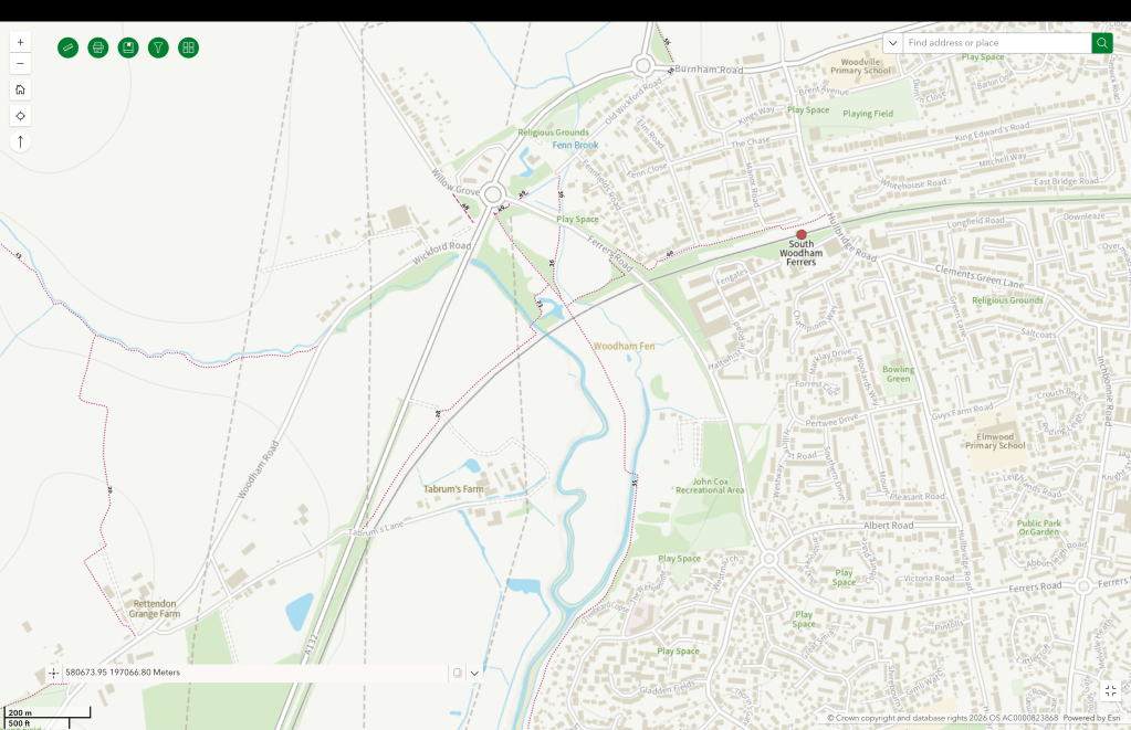
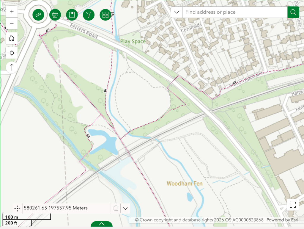
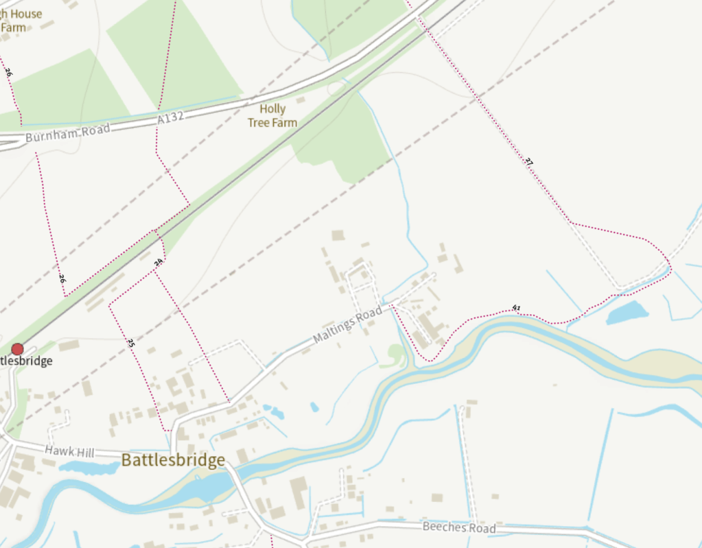
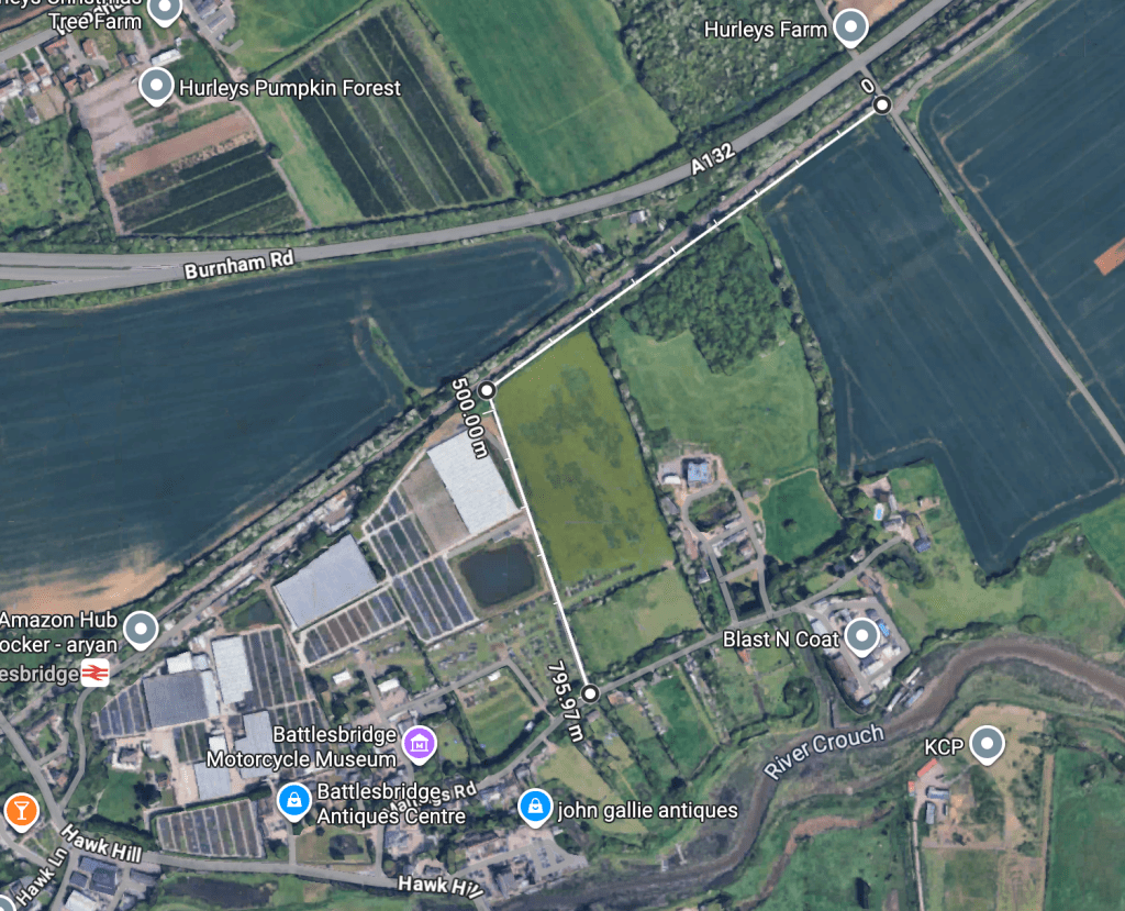
Read more: Way to Go- a path alongside the A132 Burnham Road connecting South Woodham Ferrers and Battlesbridge.
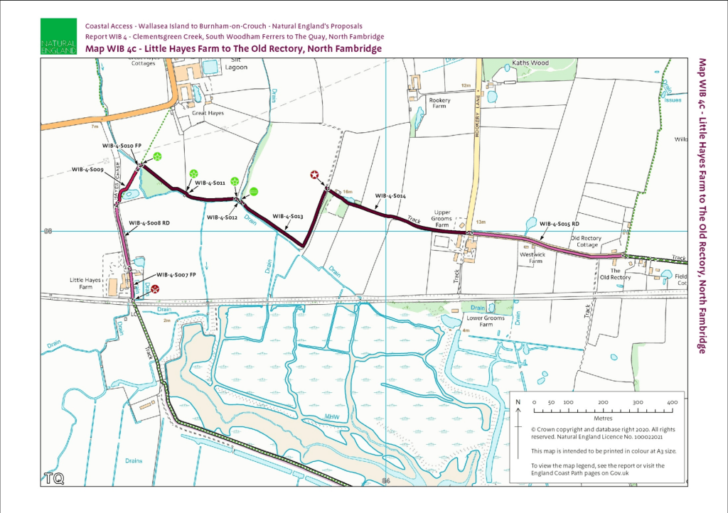
- new permissions over a farm track between North Fambridge and Little Hayes Farm – allowing the route between North Fambridge and South Woodham Ferrers to avoid the long detour up around Stow Maries which involved crossing the B1012.
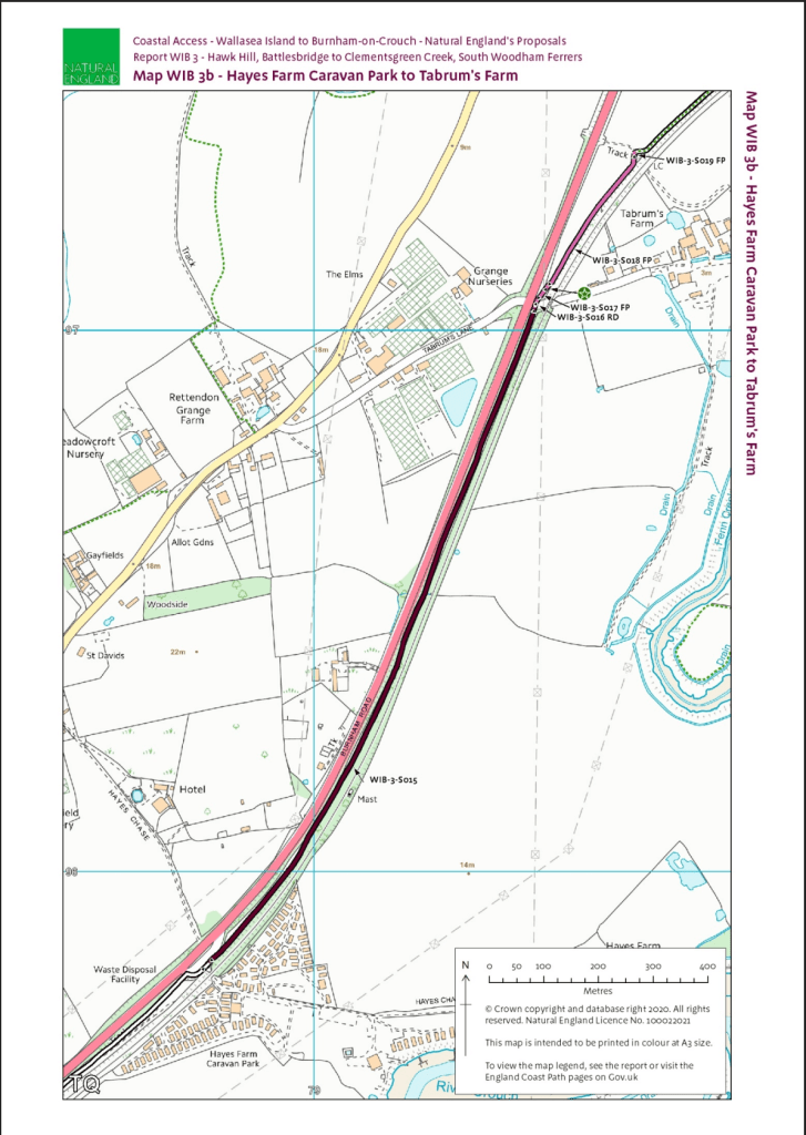
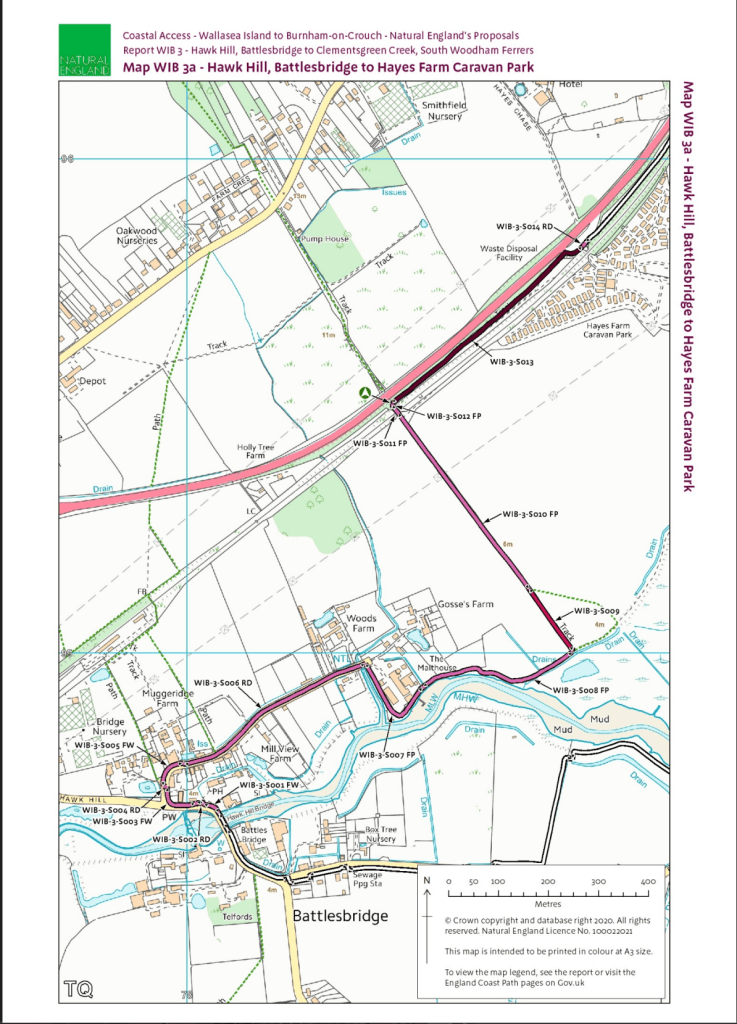
I hadn’t seen much action on the A132 section last time I passed, so it might not be more than cutting foliage back on the verge. I’ll take a look at both the South Woodham Ferrers and North Fambridge this weekend, but I welcome comment from anyone else too!
UPDATE: I had confirmation from Natural England regarding the A132 section:
‘The major works undertaken along the sections WIB-3-S012 and S016 is the clearance of the vegetation and the creation of a route within the scrub, which I know has happened. There were some bridges and I believe some steps (at the S012 end) and these were being installed by the contractor that has fallen ill.
That said I believe the route is passable. I certainly managed to walk it this time last year in low walking boots and managed to pass without any bridges being in place.
I have previously discussed with colleagues at ECC that just clearing the scrub may not be sufficient and that there may need to be some form of surfacing (not metalled) if as I believe the enclosed nature means the ground lies wet for longer. The newly cleared areas will also encourage more vigorous side growth and spread of the likes of bramble and nettle. I encouraged them to consider seeding the length and then cutting it frequently (at least 4 times a year) to encourage a good grass cover but I don’t think this was undertaken. I hope they keep an eye on the condition of this section. It will not be Natural England’s responsibility to do so.’
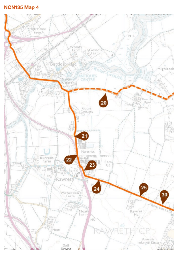
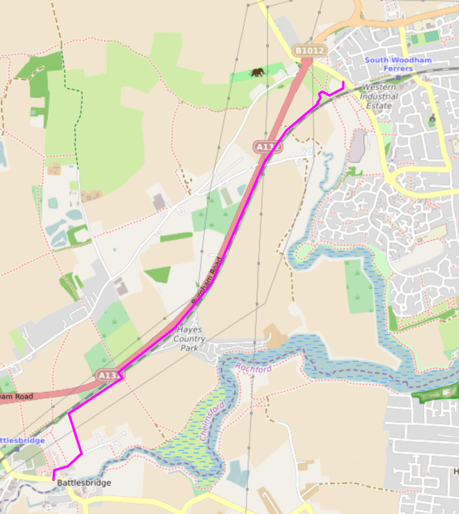
Improving the surface of A132 section to make it suitable for cycle traffic could provide part of a useful connector between the SWF/Dengie and the proposed National Cycle Route 135 at Battlesbridge.
If higher rights allowing bicycle use were allocated to footpaths FP 40 298 (772m), FP 23 298 (119 m), FP 28 229 (650m) and a short section of FP 35 298 (connecting FP 40 298 and FP 23 298) then South Woodham Ferrers, and its railway station, would have a safe, segregated, westward route out for cyclists (the footbridge in Woodhasm Fen might also need some adjustment).
Similarly, where the new A132 path meets FP 27 229, some higher rights for bicycles on FP 27 229 (670) and FP 41 229 (654m) would provide access to Maltings Road, Battlesbridge allowing connection to the proposed National Cycle Network route 135 and Battlesbridge railway station at Hawk Hill.
Higher rights on specific footpaths to allow use bicycles, whether by upgrading to bridleways or otherwise, is one thing – but this doesn’t in itself ensure that the route is suitable for cycling. Soem surfacing work may also be necessary to achieve that.
At the Battlesbridge end, I’m not convinced the footpath route described above is ideal. It would be better I think to create a new track, on Dons Farm land, from the bridge – parallel to the railway, before going South on the existing farm track to Maltings Road. Dons Farm belongs, I believe to DJ Fisher Farms.

[…] two new local sections of the King Charles III England Coast Path (KC3ECP) that I mentioned in the previous post. As pre-warned, these were open but unfinished. In this post I review the WIB4 section: […]
LikeLike