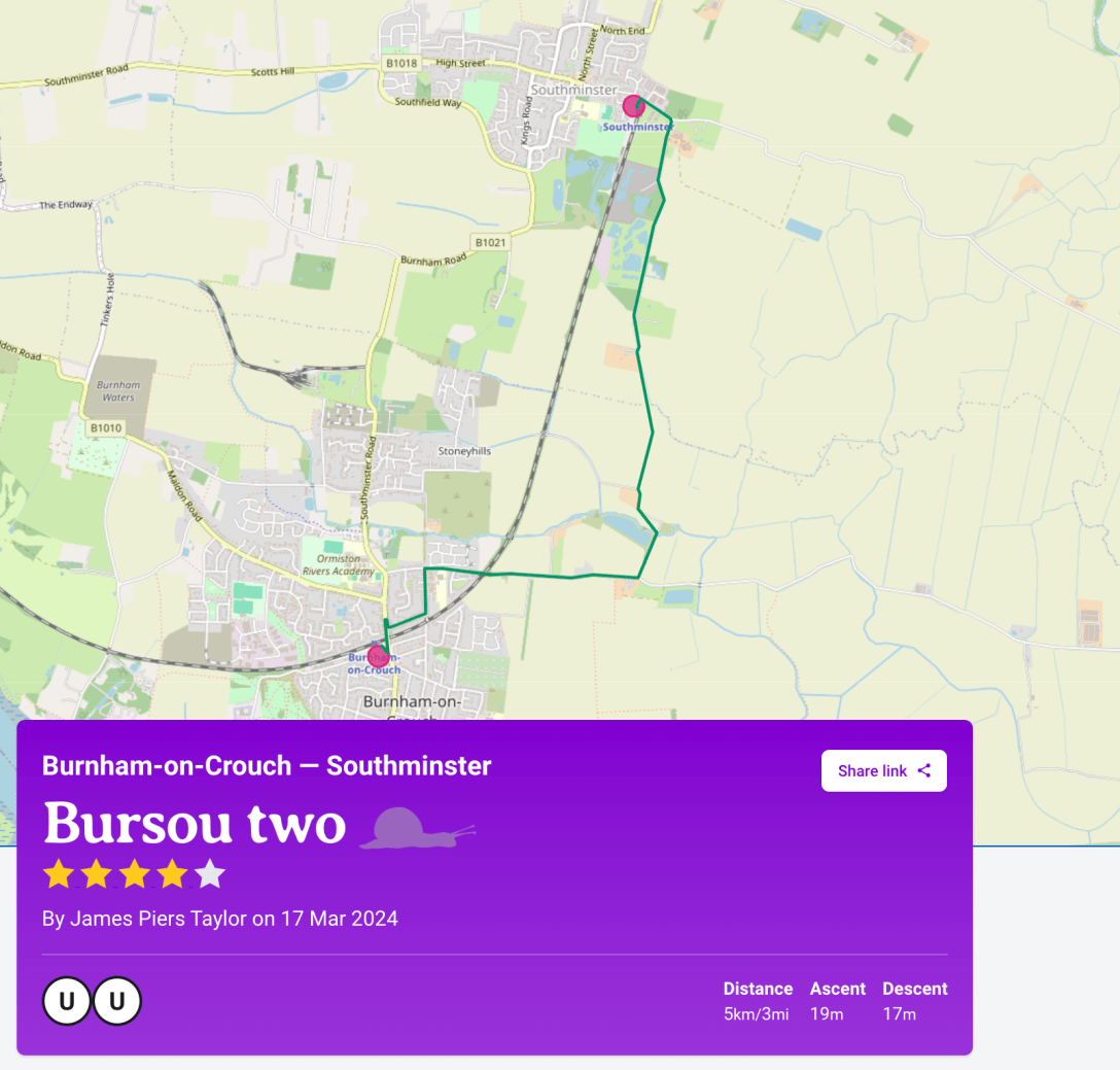
In the previous post, I mentioned that the Slow Ways route Bursou One is one of three footpath-orientated ways between Burnham and Southminster. I committed to adding my preferred walking route between the two as an additional Slow Way. It’s now been added as Bursou Two. Below, I have appended my route description from the site, plus a review of walking it on Sunday 17th March.
My neighbour John McCarthy has recently been campaigning for a safe cycle route between Burnham and Southminster. Local people have been demanding one for nearly a quarter of a century now and John has valiantly picked up the baton. In his efforts to find a suitable location for a cycleway, a route roughly coterminous with Bursou Two has emerged as the best candidate. Making this a cycleway would, at a minimum, involve reclassifying the public footpath sections as a bridleway – thereby adding permission for bicycles to use the route (this is an upgrade that could be achieved if the highways authority [Essex Highways] were willing to pursue the planning process). Going beyond the minimum would involve addressing the stile crossings mentioned below, introducing surfaces suitable for cycling, considering the needs of wheelers and horseriders – and connecting this to a wider cycling network. John and I are currently working on a proposal for such a cycling network on the Dengie which I’ll discuss in a future post.
I am determined, however, that cycle routes do not conflict with walking routes; we should expand access and opportunity rather than squeeze walkers and riders into competition for space. Decarbonising mobility requires the development of additional infrastructure. CyclingUK’s ‘Missing Links‘ campaign and Slow Ways’s ‘Make Ways‘ project offer inspiration here.
Back to the walking:
Route Description
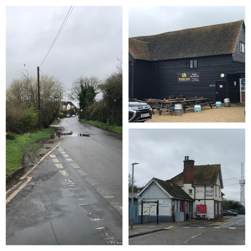
An alternative route between Burnham-on-Crouch and Southminster which takes a more rural route than Bursou One but is about the same distance. It follows the same route as Bursou One until Glendale Road meets Marsh Road. This route proceeds east along Marsh Road to Dammerwick Farm where it turns onto the public footpath going past Newman’s Farm and across a couple of fields to meet Goldsands Road. It continues north along Goldsands Road past Wibblers Brewery and Taproom to meet Southminster’s Marsh Road where a short walk westwards takes you to Southminster station.
/
Route Review 17th March 2024
I walked on a drizzly March day. but the route remained passable. I prefer this route to Bursou one as it is more rural and avoids walking through suburban streets and pavements beside busy roads. There’s a good chance of seeing hares going this way and a welcome watering hole on the edge of Southminster.
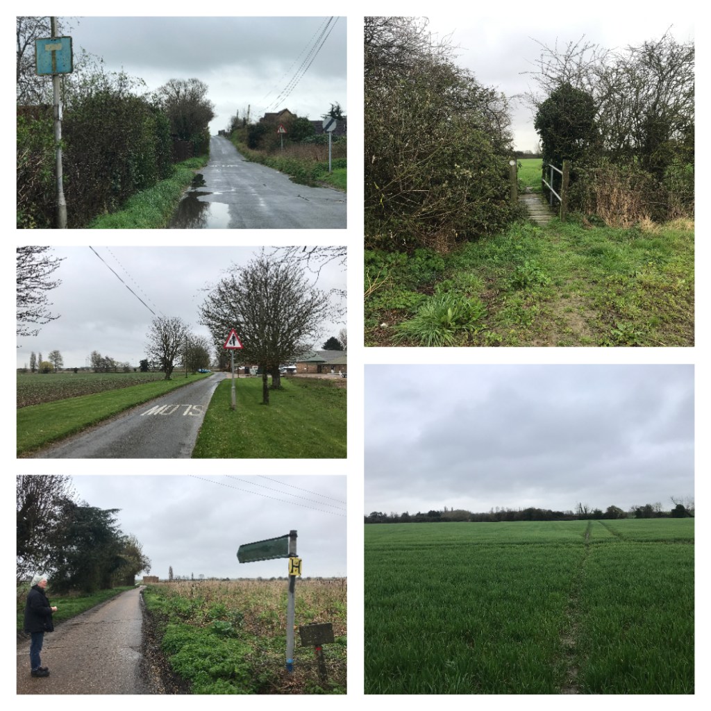
The route begins with pavemented suburban streets. When Glendale Road meets Marsh Road this route diverges from Bursou one and heads east on Marsh Road. The pavement runs out at The Leas and you must then walk on the road up the bridge over the railway line, the bridge itself is pavemented. This is a low-traffic road and motorists are warned to be aware of pedestrians.
Once over the bridge, it’s road walking again, but after a short distance, there is a grass verge on the south side of the road. which is suitable for walking This verge steadily becomes wider and is generally mowed to lawn length. Visibility is good as there are open fields on either side.
After reaching the outbuildings of Dammerwick Farm (now a small industrial estate) you must walk a little further east. Opposite Dammerwick Farm House a public footpath leads northwards on a hard farm track towards Newmans Farm. The metal public footpath sign is very faded. The track passes an embanked flight pond to the west (in season wildfowlers may be using the hides around the pond). After the pond, the public right of way takes a diagonal path across a field to re-meet the hard farm track, most walkers eschew the field route and simply proceed along the track.
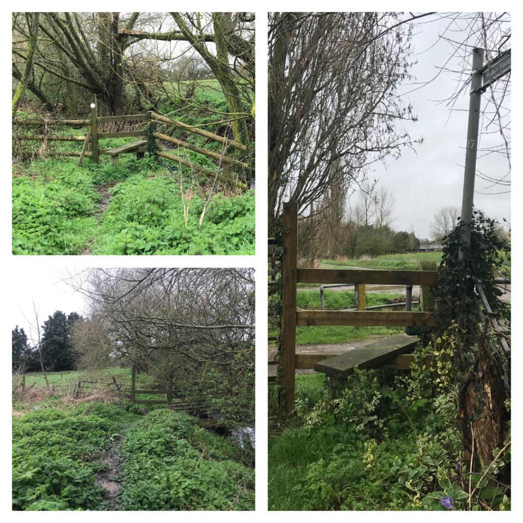
At Newmans Farm the route continues northwards along a field edge, this is unpaved and can be rough underfoot. A narrow footbridge pierces a hedgerow leading into a second field. Here, the right of way continues straight across the field towards the corner of another hedgerow. This route is often not maintained by the farmer and, depending on the time of year and planting, can be impossible to discern. A pragmatic approach suggests using tractor tracks through the crops or sticking to the field edges whichever seems appropriate at the time. The right of way continues alongside the hedgerow leading northwards. A step stile provides access to a paddock and the path continues northwards beside a drainage ditch and line of willows. A step-less stile provides access to a second paddock which is exited by another step stile onto Goldsands Road. The ground is uneven on this section and many locals seem to avoid it by instead using the field edge on the other side of the ditch.
Goldsands Road is without pavement but is a very quiet, dead-end road. It continues northwards through an area of former quarries which are now fishing lakes – check out the curious wet woodland! Shortly before it reaches Southminster’s Marsh Road it passes Wibblers Brewery, a useful comfort stop with a taproom and kitchen. Taking a left turn on Marsh Road will, very shortly, deliver you to Southminster Railway Station. Shops and pubs can be found further along the road.