
After writing about the role public transport, particularly the railway, must play in planning local decarbonisation, I will next write about the role of active travel – walking, wheeling and riding. Before I return to the desk-bound dissection though, it’s time to get outside.
Yesterday, I walked from Burnham to Southminster as a #SlowWays wayfarer on the Slow Ways route Bursou One. I’m a big fan of this project and signed up as a wayfarer to help create a network of walking routes connecting Great Britain. It’s also a useful lens through which to examine the local walking provision (‘Bursou One is one of three footpath-orientated routes between Burnham and Southminster – I covered the other two in an earlier post]).
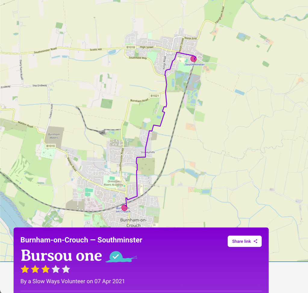
Here’s my review of the route which I’ve uploaded to Slow Ways:
‘A functional and direct route between Burnham and Southminster. It’s easy to follow and a safe way to walk. After wet weather, the unpaved parts will have the typical muddiness. I’ve marked it down for the rather dull sections of suburban pavement and the stretch walking parallel to the B1021. I walked it on a dry day in early March.
The route begins with pavemented suburban streets. When Glendale Road meets March Road the route continues on a public footpath directly ahead. This is unpaved, so it can get muddy after wet weather. The footpath crosses Pannels Brook by a narrow footbridge and becomes a concrete track going slightly uphill to meet Romans Farm Chase, an unmade farm road. This quickly exits into Mill Road.
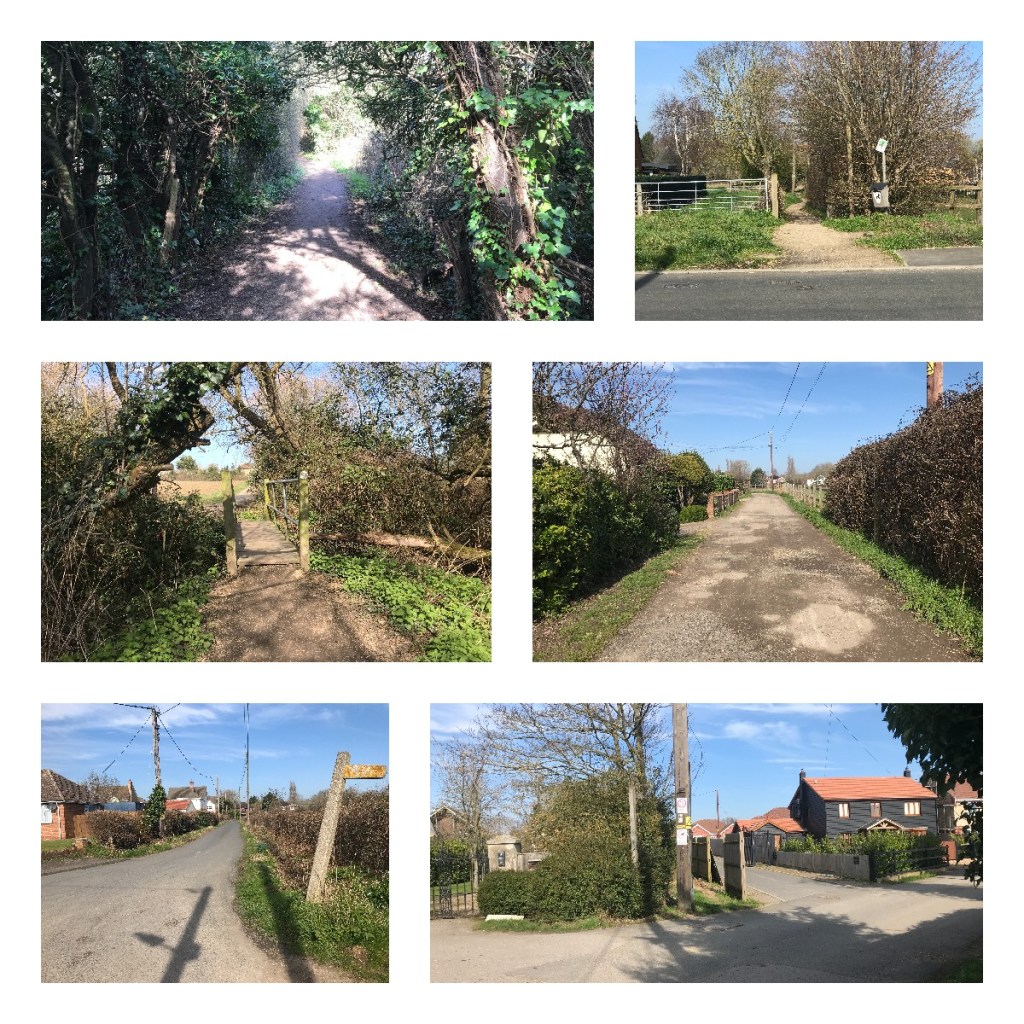
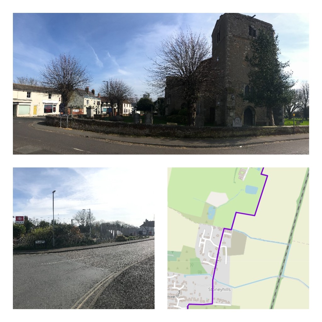
Mill Road has no pavement, so it’s road walking here but it’s a low-traffic route. A road sign for Stoney Hills indicates where to make a left turn. Do not be put off by signs indicating this is a private road as this is a public right of way. This straight road goes largely north, when a westerly bend appears, a public footpath carries on northwards. The path is canyoned between privacy fencing and is wide enough. When the housing on either side peters out there’s a right angle turn eastwards along a fence line, don’t carry on north here onto a private track belonging to Ratsborough Farm.
The next section of the route is more rural and hugs field edges as it skirts around Ratsborough Farm. Southminster begins to become visible to the north. Walkers closely following the public right of way will see that Footpath 15 259 proceeds across the body of a field, but the sensible route here is to follow the east field edge instead.
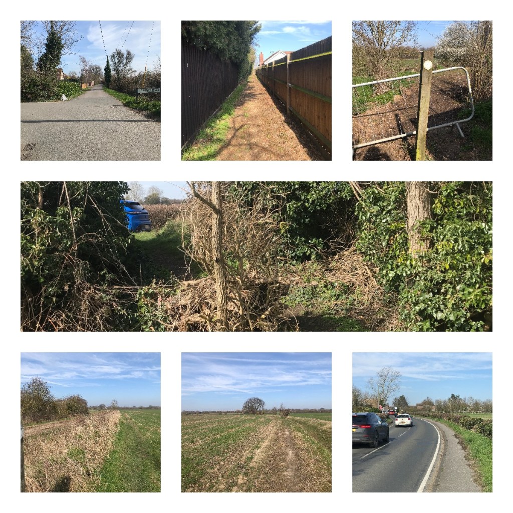
This footpath ends at a hedgerow and a slightly ramped rise to pavement alongside the Burnham Road (B1021). From here on in it’s continuous pavement to the settlement boundary of Southminster, carrying on to pavemented suburban streets for the rest of the route to the village centre and railway station.’
This isn’t my preferred walking route between Burnham and Southminster. Taking the footpath from Marsh Road that connects with Goldsands Road is far more pleasant. My next task, therefore, is to create this as an alternative route, ‘Bursou Two’ on the Slow Ways site. I need to work out how to create a .gpx file (for free!) and then upload this with another review.

[…] the previous post, I mentioned that the Slow Ways route Bursou One is one of three footpath-orientated routes between […]
LikeLike