
My friend Graham Burnett recently posted on Facebook that: Continue reading “Engage with, Protect, Regenerate and Re-enchant the places where we are “
My friend Graham Burnett recently posted on Facebook that: Continue reading “Engage with, Protect, Regenerate and Re-enchant the places where we are “
Mixed-bag of weather today that made walking far undesirable, especially after yesterday’s puddlicious Southend trip. Burnham’s little library has a small local history/topography collection with enough in it to hold one’s attention quite a while – including a copy of the book of the great Chapman/André 1777 map of Essex.
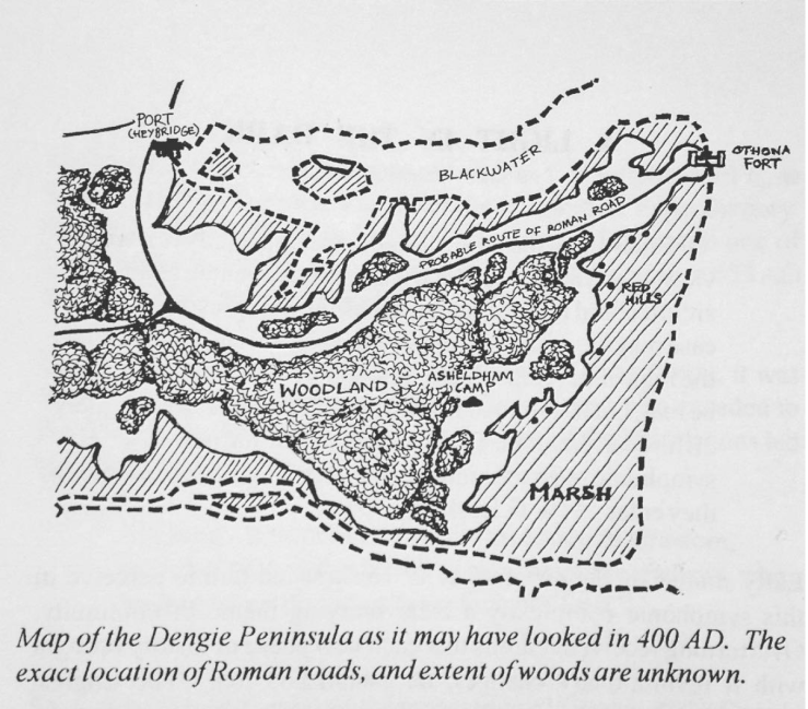
Another map has captured my imagination more recently however, the one above taken from A Popular History of the Dengie Hundred by M.J. Ayres, R.J. Blaney & T.J. Wood. This map is a highly speculative rendering of how the Dengie might have looked in a period for which we have no good contemporary rendering. I’m attracted by the suggestion of woodland on the higher ground, as it gives some impression of what might have been lost locally (only 2% of Essex is covered by ancient, semi-natural woodland, Essex is the second least wooded county in England – and Maldon district has only 3% woodland cover of any kind), and because it visualizes a suggestion made by P.H. Reaney as to the etymology of the name Dengie itself: Continue reading “Desk Research: Dengie Woodland”
