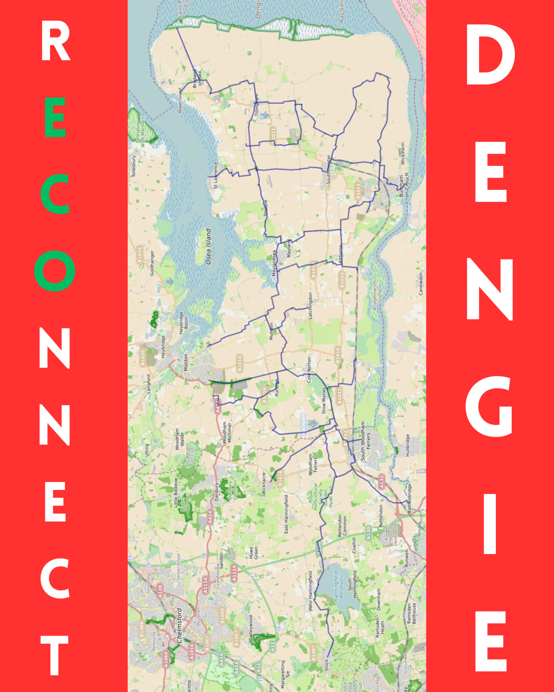
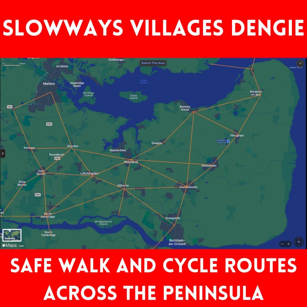
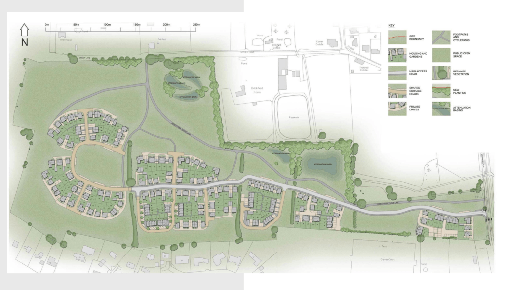
The recent and successive cycle strategy documents from Essex and Maldon have failed to suggest what cycle routes on the Dengie could look like – so, I’ve had a go…
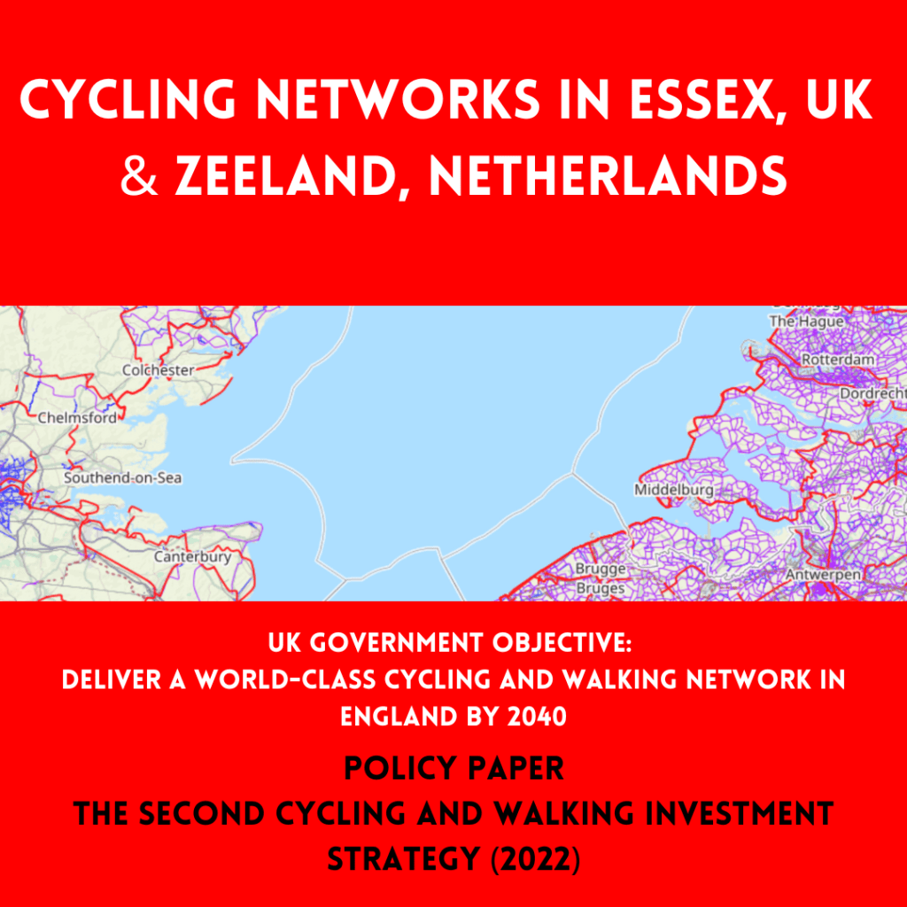
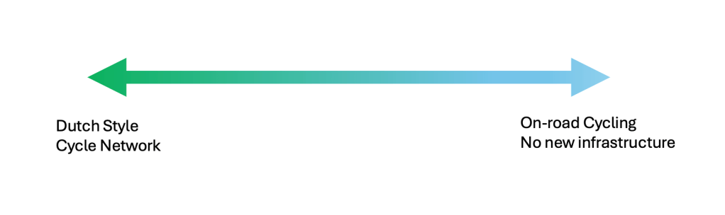
[I should start by stating that the ideal situation would be a Dutch style network, including completely new cycleways taking the most direct line between settlements. This is the only option that would achieve the aim to ‘deliver a world-class cycling and walking network in England by 2040’ expressed in ‘The second cycling and walking investment strategy (CWIS2)’ published under the 2019 to 2022 Johnson Conservative government.
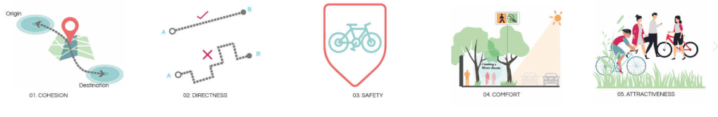
The Dutch CROW Design Manual for Bicycle Traffic considers five basic design principles for network design: Cohesion, Directness, Safety, Comfort and Attractiveness
Despite this being the only option that would meet the national objective, if we place it at one end of an excellent-to-useless-spectrum, then the other end is no-change and cyclists left to fend for themselves on the existing road network. (A bit of signage and some lines painted on the road would be barely better.)
I’ve started with the rECOnnect Dengie aim that every settlement on the peninsula should be connected with a safe active travel route. Railway station and ferry routes should be connected to the network.
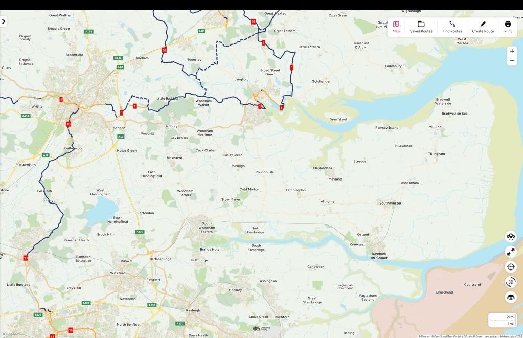
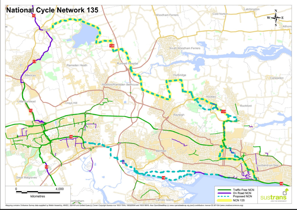
I’ve also looked for how Dengie routes could be connected both to the urban cycle networks in Maldon town and South Woodham Ferrers, and to the National Cycle Network (with connections to NCN 1 at Maldon, NCN 13 at Stock, and the proposed NCN 135 [pdf] at Battlesbridge.
Existing National Cycle Network routesProposed National Cycle Network route |(NCN 135]
I began with using the few bridleways and byways we have, but we don’t have many of them.
We have a better footpath network, and footpaths can be awarded ‘higher rights’ (e.g. use by bicycles) so I’ve tried to fill gaps with them but this still leaves a lot missing.
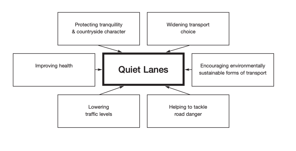
Maldon District currently has no roads designated with Quiet Lane status but I then proceeded to use roads which I think would be appropriate for such a status (avoiding the ‘priority’ PR1 and PR2 roads). Quiet Lane status should being slower speed limits and traffic calming infrastructure.
This still doesn’t provide a network that meets the objective of connecting every settlement, so I’ve then proposed sections over land that currently has no public rights of way (PROW). This will always be controversial and argued over – but cannot be avoided. Here I have prioritised old railway alignments, solar/wind farm access roads and existing farm tracks.
This still leaves some things unaddressed – Latchingdon, for example, is hard to link into a network using existing PROW and avoiding ‘priority roads’; Similarly, connecting North Fambridge and Althorne, other than by the indirect seawall route – bolder plans are necessary here.
The map in the first image is purposely large-scale to avoid instant arguments over routes but I’m happy to share more detailed mapping with anyone who wants to get involved with planning and proposing a network. More local knowledge would certainly improve the routing.
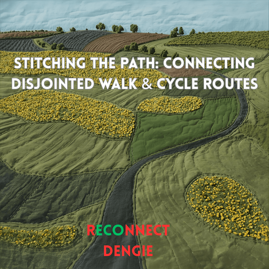
A mission objective of the rECOnnect Dengie project is to improve the active travel infrastructure on the Dengie and get a safe network of routes connecting all the settlements. As I’ve noted previously, there are lots of good words about achieving this sort of thing in the strategy documents produced from the national level down to the parish – but what happens next? How does it happen?
This in the first in a series of posts where I’ll look at where there are opportunities on the Dengie to connect up existing routes and how we might turn document objectives into objective fact. I’m starting close to home in Burnham-on-Crouch.
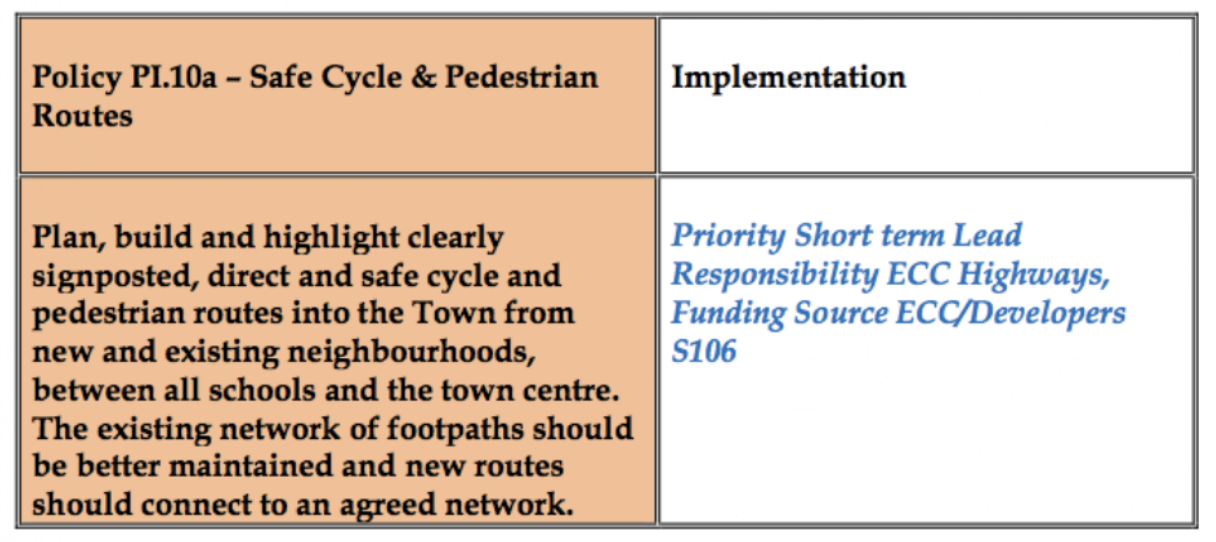
‘5.3 Make Burnham-on-Crouch a More Pedestrian and Cycle Friendly Place to Live
The Town should have a friendlier environment for cycling and walking. Its main and secondary roads are dominated by vehicles. New pedestrian and cycle routes should be provided that link the town centre with existing and new neighbourhoods, schools and recreation areas via quieter roads.’
It substantiates this objective with policies including:
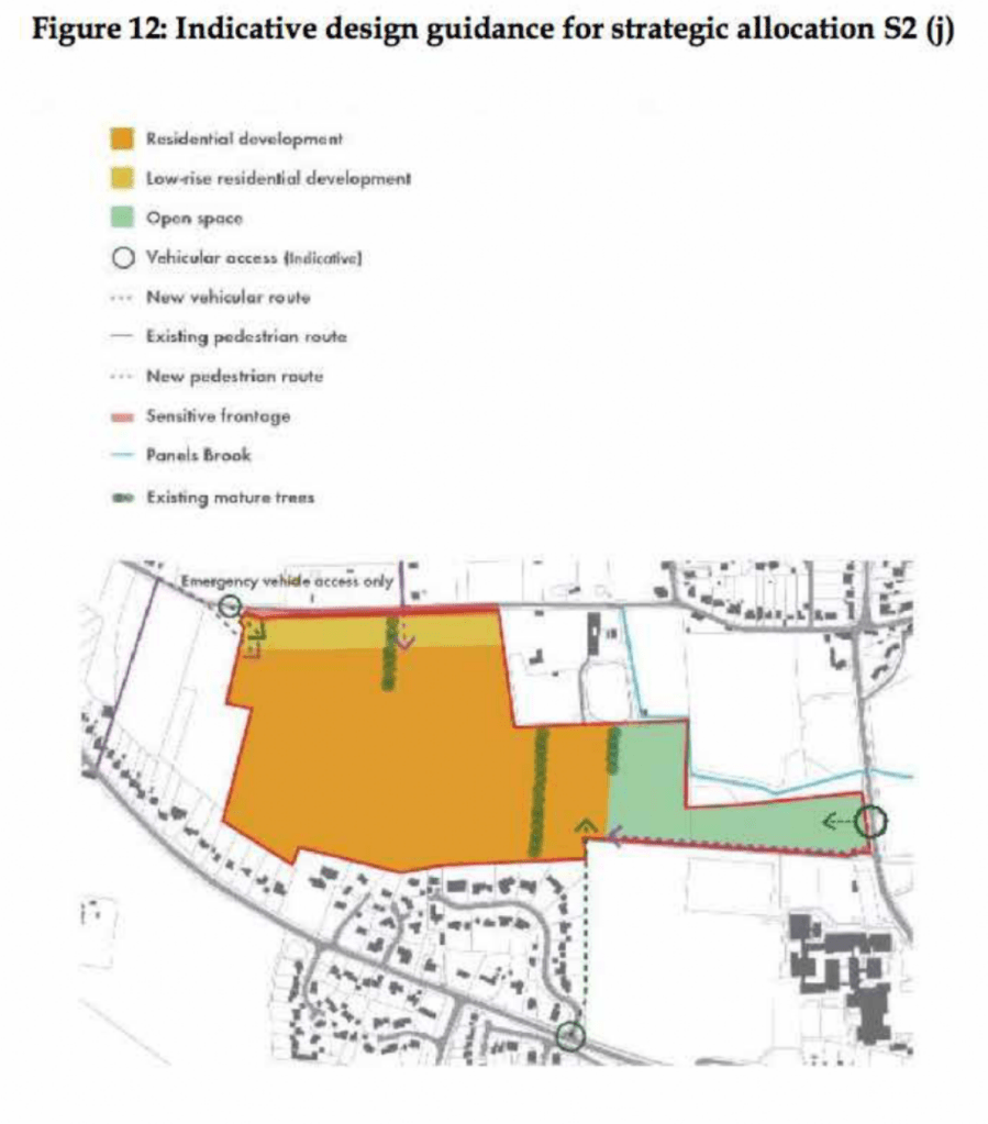
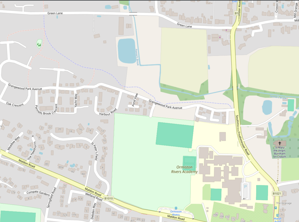
One of the first new neighbourhoods created after the NDP is the Grangewood Park estate which was built on agricultural land allocated for new housing as Site S2 (j) in the Maldon District Local Development Plan [pdf]. A site with a long southern boundary to the town’s Secondary School, the Ormiston Rivers Academy.
Figure 12 in the Burnham NDP (Apologies for poor image quality, this is as it appears online)
The masterplan [pdf] presented by developers Charles Church in their planning application included a new off-road foot/cycle path running through the green space on the estate and providing a connection from Southminster Road in the east to Green Lane in the north.
Their document notes that the Maldon LDP includes:
‘T2 Transport Infrastructure in New Developments The layout of new developments should provide for safe access to and from the highway including… links to adjacent or nearby foot/cycle path network’
and that it states that amongst the criteria any proposed development must satisfy is:
‘Safe pedestrian and cycle linkages are provided from the development to the town centre, other public service facilities and the existing urban area’.
(The Residential Travel Plan [pdf] supplied in the developer’s application noted that ‘[t]here are no dedicated cycle facilities in the vicinity of the development site’)
Later the planning application notes that ‘[t]he Burnham Neighbourhood Plan shows proposed cycle links that the Town would like to see progressed; within this diagram a possible link is shown into the site subject to this application. The provision of this link would rely on third party land and therefore cannot be provided by Charles Church, however the scheme has been developed to facilitate future connectivity.’
It’s unclear exactly what this is referring to, as the Burnham NDP includes text references to possible cycle routes but no maps showing these. The diagram with ‘a possible link’ is perhaps the green dotted line ‘new pedestrian route’ shown in the NDP’s ‘Figure 12’ (copied above) connecting the site to Maldon Road in the south, and running along the western boundary of Ormiston Rivers’s playing fields. This would have been a convenient addition to Burnham’s walk/wheel/cycle routes but it never materialised and it illustrates succinctly a key unaddressed problem in getting better active travel infrastructure.
i.e A government strategy proposes active travel infrastructure as an essential part of new developments, a developer provides infrastructure within the development – but the value of such infrastructure is largely produced by a larger connectivity that neither government nor developer is providing.
The National Planning Policy Framework (NPPF) make enough noises about pedestrian and cycle routes that applications for new housing tend to include vague promises about including them. On the ground this tends to result in intra-estate pathways that have genuine utility but terminate at the estates’ boundaries with no clear sense of how onward travel on foot, mobility device or bicycle might proceed.
Foot/cycle paths shown in grey to the north of the housingon Grangewood Park estate
True to their promise, the developers of Grangewood Park delivered the walk/cycle path on their masterplan and the estate includes what is, currently, the best example of active travel infrastructure in the town with an off-road path that connects Southminster Road with Green Lane – but what happens when you get to Southminster Road or Green Lane? What contribution does it make to a safe, active travel network?
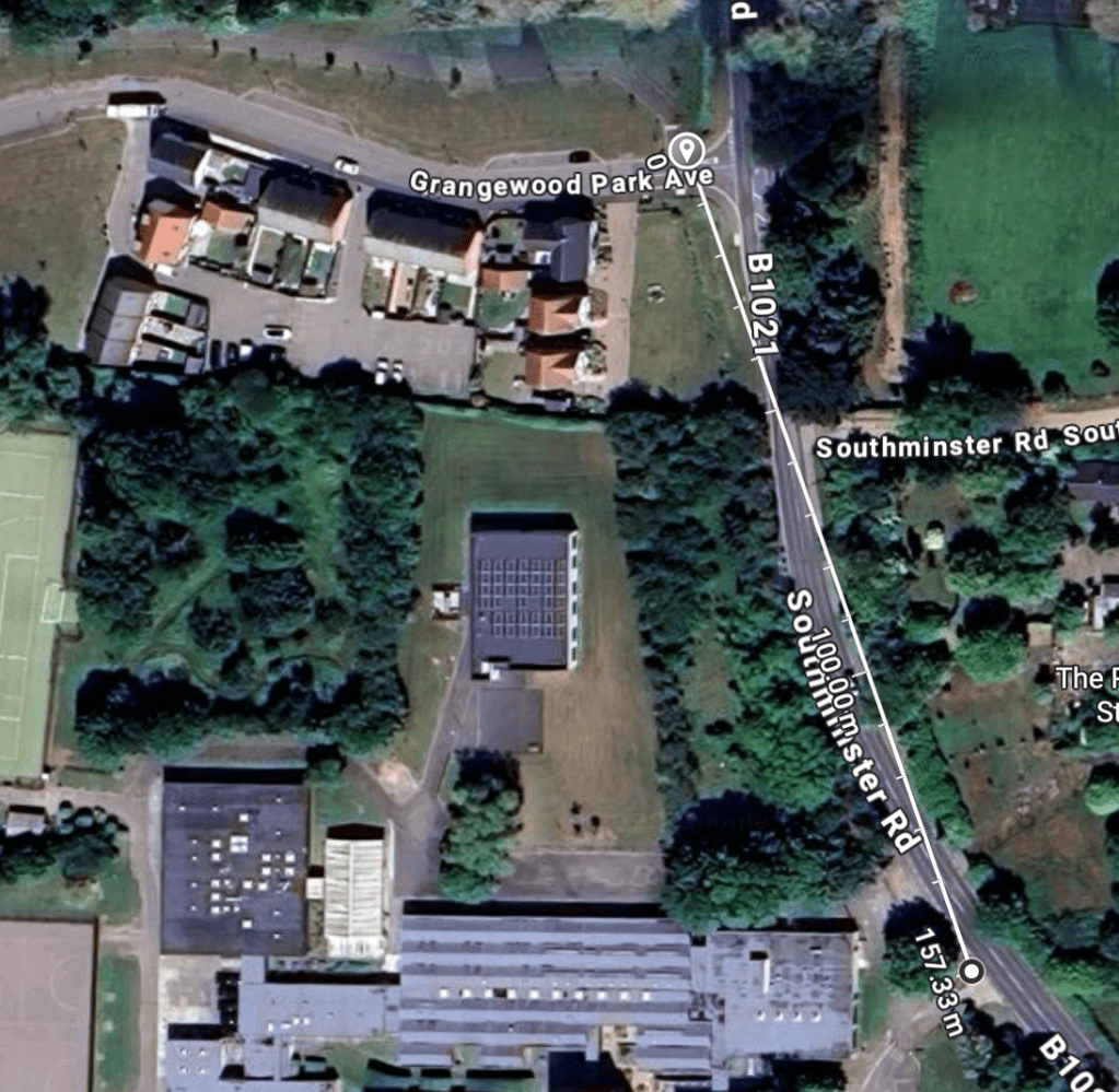
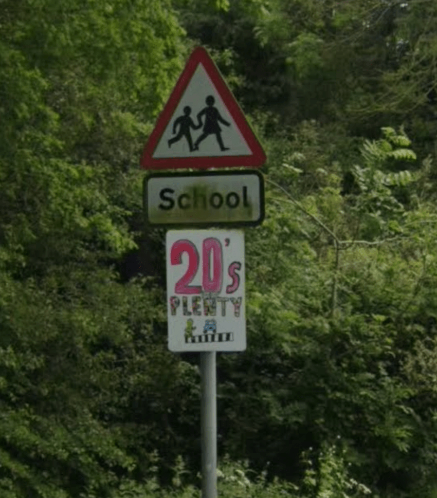
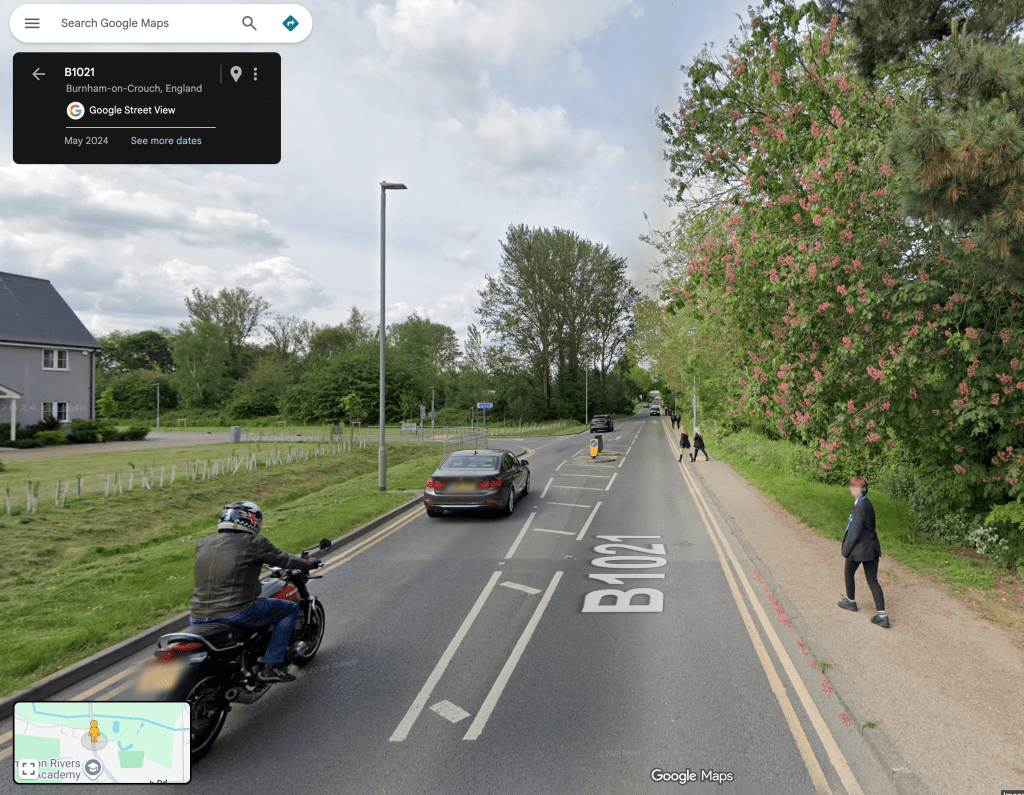
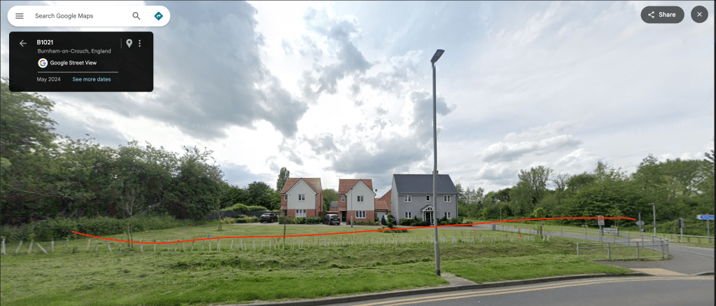
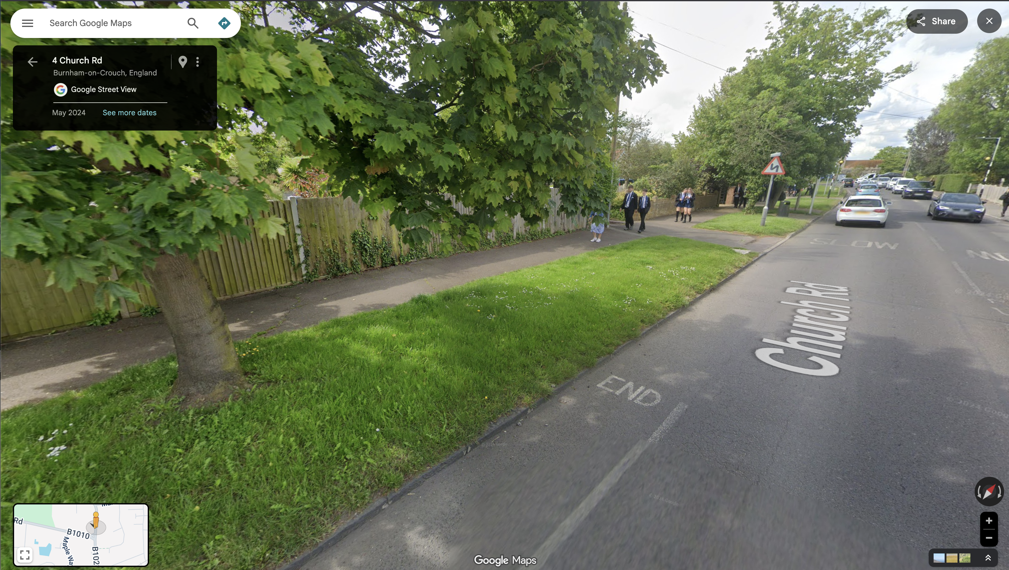
At Southminster Road (B1021) the pathway ends 160 metres north of the entrance to Ormiston Rivers school. A child on a bicycle coming through Grangewood Park must now leave the off-road cycle path, cross a lane of northbound traffic leaving town on the B1021, and join the southbound lane – before turning across the path of northbound traffic again to complete their journey to school. Opposite the Grangewood junction there’s a road sign with the red triangle warning of a school ahead and, beneath it, one of those advisory-only ’20’s Plenty’ signs – but the B1021 has a 30mph speed limit at this point and has limited direct access along this section, a form that tends to encourage vehicle speeds in excess of the legal limit. The common experience of cyclists, of all ages, using this road is driver impatience and an aggressive eagerness to pass.
Meanwhile, pedestrians leaving the off-road path at Southminster Road find there is no footway providing an onward walking route north or south. There is a narrow pavement on the east side of Southminster Road but there is no controlled crossing to reach it (a small traffic island provides some pedestrian refuge).
School children cross the B1021 to reach the Grangewood Park Estate.The junction of Grangewood Park Avenue and Southminster Road, where the foot/cycle path ends
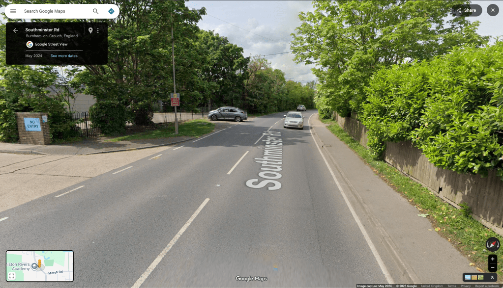
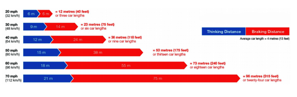
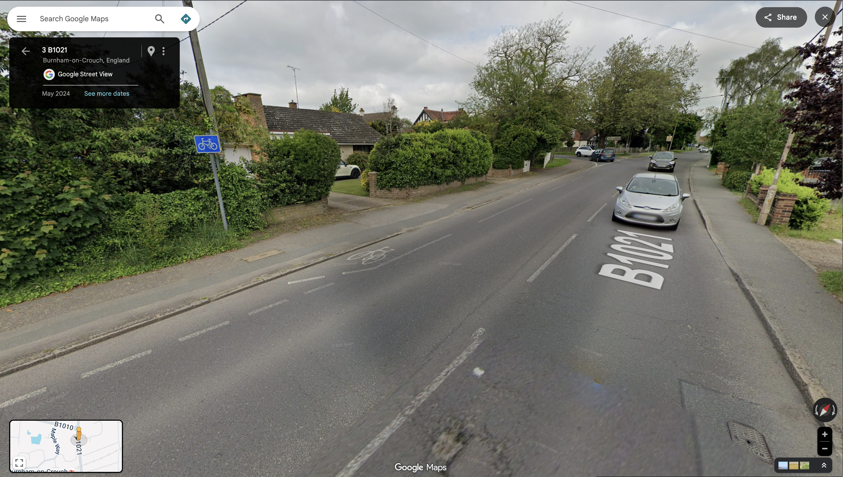
Once the road is crossed, a pedestrian can proceed south on pavement into Burnham. If it’s a child walking to the school they can pass the school entrance on the other side of the road and carry on further south around a bend to cross the road at a zebra crossing, then walk north again up the opposite pavement to reach the school entrance – a distance of 450m. Will they do that though? Of course not!, once they are opposite the school entrance our cyclist used – 160m down, they’ll do what she did and cross the road there. The curve of the road means that drivers travelling south will be blind to a child crossing the road there until they are quite close. The Highway Code calculates the stopping distance of an average car at 30mph in dry conditions to be 23 metres.
Looking north up Southminster Road where a child is liable to crossto reach the schoolCar stopping distances in the Highway Code
‘But there’s no alternative!’ I hear you cry, ‘you just have to make do with what you’ve got’.
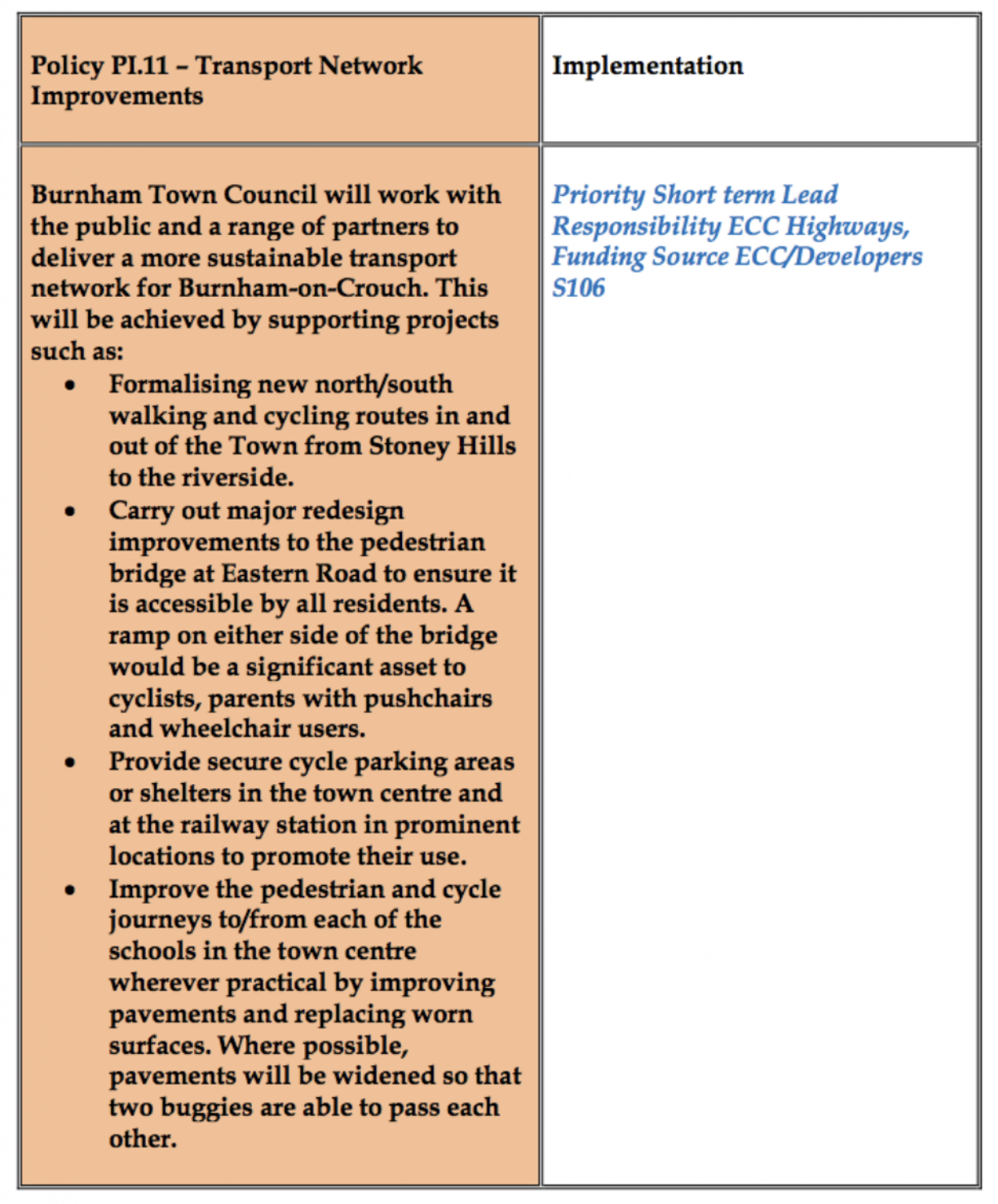
‘I know this estate is right next to the secondary school and we agreed in the neighbourhood plan to “plan, build and highlight clearly signposted, direct and safe cycle and pedestrian routes into the Town from new and existing neighbourhoods, between all schools and the town centre” and we agreed that we would “improve the pedestrian and cycle journeys to/from each of the schools” – but really what else could we have done?
Let me tell you!
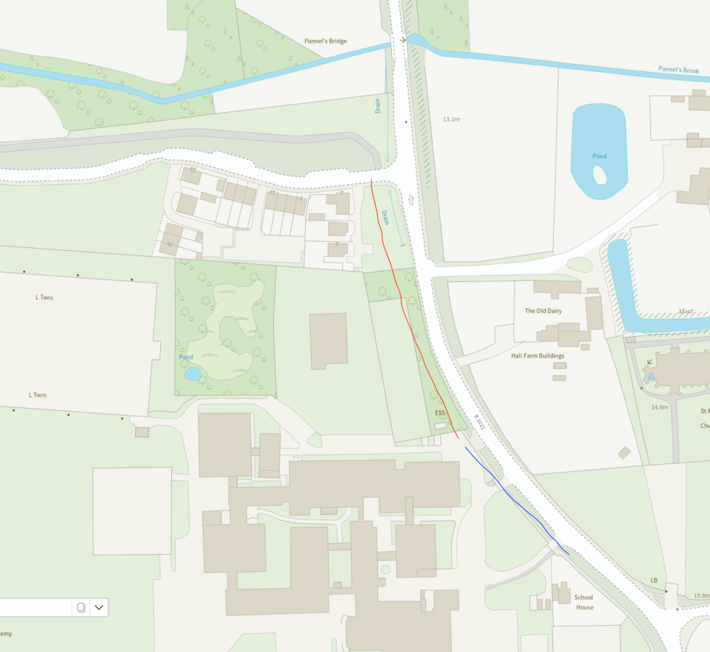
Grangewood Park shares a border with Ormiston Rivers school, their frontage to Southminster Road is contiguous. The foot/cycle path could have gone over Grangewood Park Avenue and continued south over amenity land to the boundary of the school and through the small woodland which separates it from the paved area of the school grounds.
The red line indicates where the Grangewood path could be connected to Ormiston school, the blue line how that could continue to the existing footway
All the land involved either belongs to the developer or to Essex County Council. The developer was on-board with facilitating connectivity, the Town and District Councils wanted connectivity, Essex County Council/Essex Highways wants kids to cycle to school. It should have happened… and it still can!
The current residents of the three houses on Grangewood Park estate facing Southminster Road might prefer the current area of mown grass and small flower bed, but they’d benefit from a walk/cycle/wheel route through it. Improving active travel routes is beneficial for everyone, not just children.
This missing link would facilitate footway access from Burnham’s riverside, urban centre and railway station through to Green Lane by reducing the number of necessary road crossings. It would complete a safe cycle route from the Grangewood Park estate to Ormiston school.
EXTRA CREDIT: The pavement going south from Ormiston School has an area of verge and is wide enough to allow a shared foot/cycle way to the junction with Maldon Road (B1010). Across the B1010 junction, in the northbound lane, there is also Burnham’s oldest piece of cycling infrastructure – a painted cycle lane that begins just south of it and finishes quickly north of it – it’s of spurious utility but nevertheless could easily merge into a cycleway on the west of Southminster Road and gain a connectivity it has never had before!
What happens at the other end of the Grangewood Park estate foot/cycle path though? Can we get anywhere from there? Look out for Stitching the Path: Connecting Disjointed Walk & Cycle Routes 2 – where I will address these very questions!