The latest newsletter from the Colchester Cycling Campaign includes Mike Polom‘s proposal for a cycle touring lap of Essex which includes a section through the Dengie. While this is primarily a leisure route, I think it makes a useful contribution to thinking about cycle routes on the Dengie, whether for utility, leisure, health or otherwise. Below, I take a closer look.
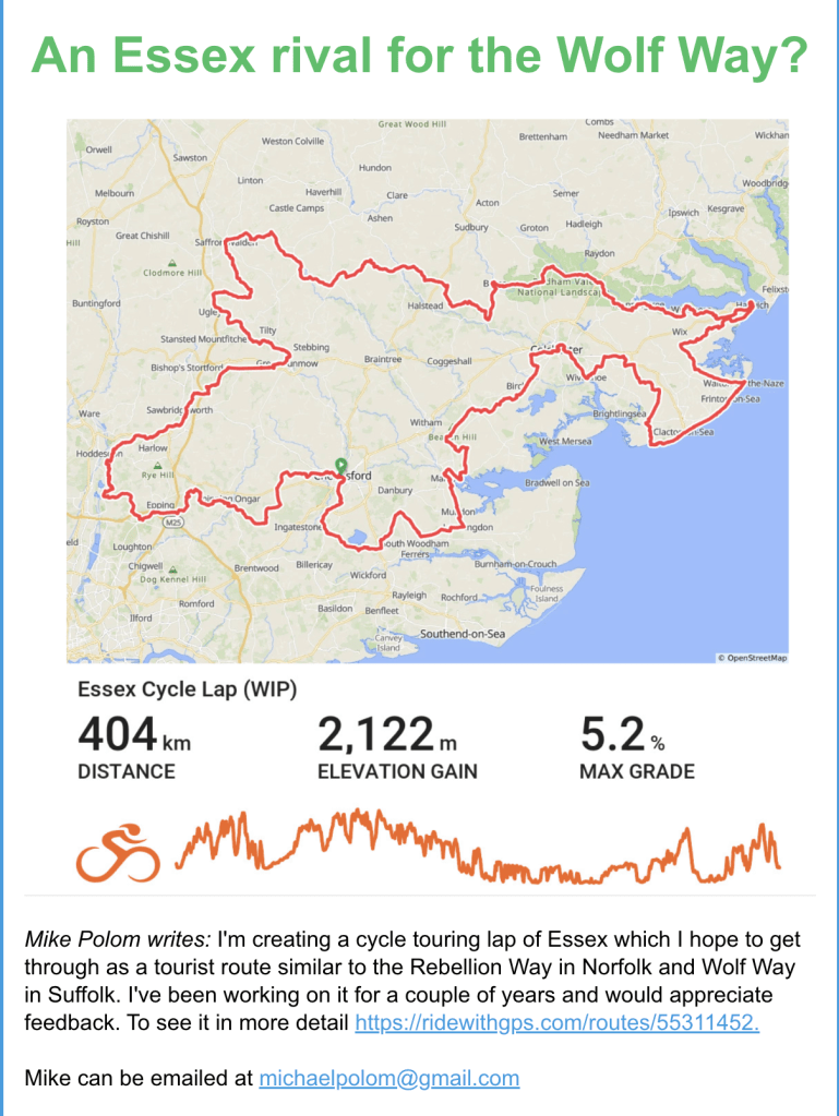
Polom has usefully created a map of the full lap on RideWithGPS allowing us to zoom in on the Dengie section of the route.
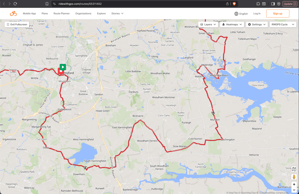
Polom’s intention is clearly to describe an already existing route that might be cycled now rather than to make proposals for new cycling infrastructure. It therefore follows roads and bridleways. We can see some crossover with the Mid Essex LCWIP proposals however, and there are elements of the Essex Cycle Lap that are useful provocations for how the Essex wide cycle network might be improved.
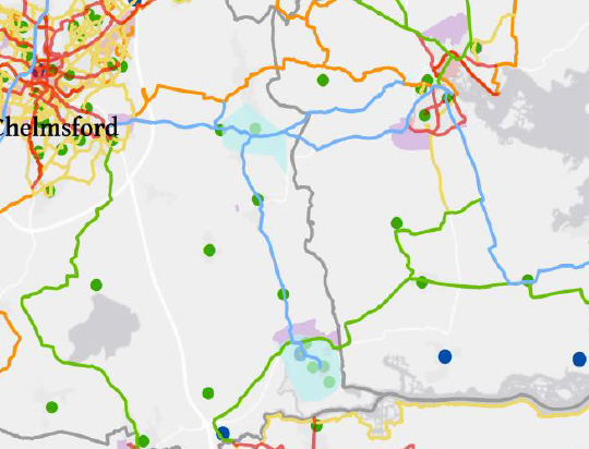
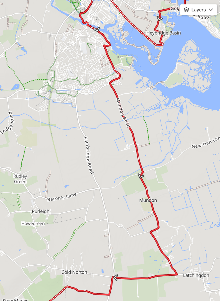
Going clockwise on the route into the Dengie, it leaves Maldon town via its ‘primary cycle route 5’ [pdf] on to the Mundon Road, goes through Mundon village and joins Burnham Road/Maldon Road south to Latchingdon at the Cold Norton Road/The Street junction. There can be a lot of motorised traffic on this section, but it’s one fo the ‘Countywide Routes’ mapped in Essex LCWIP proposals and I presume they have plans for improving the cyclist experience here. At the Cold Norton Road/The Street junction, it turns west along Cold Norton Road until it meets Fambridge Road (B1010). It goes south on Fambridge Road for about 500m before turning west on St Stephen’s Road.
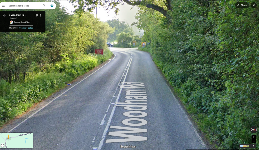
It leaves St Stephen’s Road where it interests with the old railway line and takes the bridleways south-west along the old track alignment (BR 29 243, BR 24 261) and exiting onto Woodham Road opposite Martin’s Lane Vinyard. It goes west on Woodham Road for about 400m before taking the climb north up Crow’s Lane. I consider this area a perilous one for walkers and cyclists, there’s poor visibility at the junction, little to no verge, and drivers use the road at speed. The Essex LCWIP proposals have a Green Link Route mapped here, so hopefully there are also plans to improve safety. (Their Green Link Route proceeds south on Woodham Road to South Woodham Ferrers – but a better route would be offered by the bridleways commencing at this junction (BR 17 261 leading on to BR 25 298)).
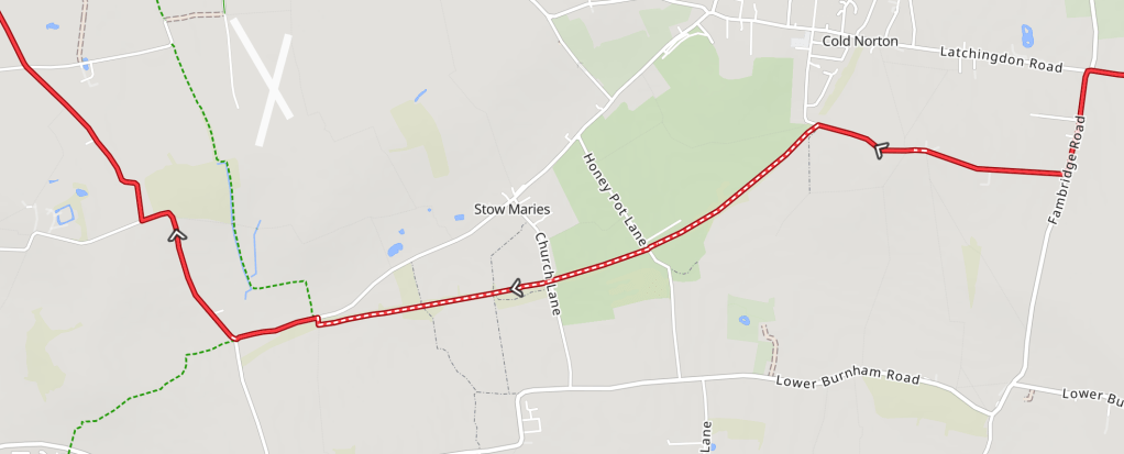
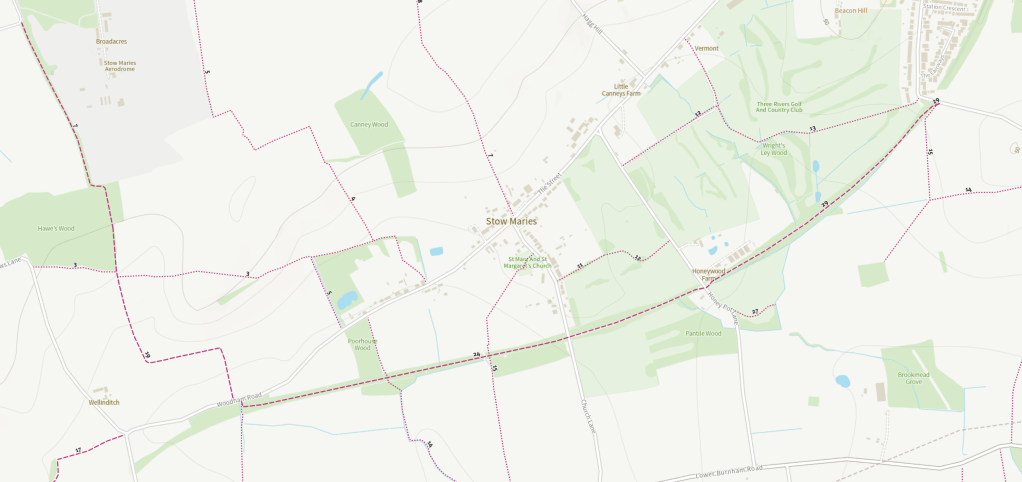
When Crow’s lane makes a definitive turn west by Emberson’s Wood, the route instead proceeds north-westerly up the bridleway (BR 7 237) past Thrift Wood until it intersects with another bridleway (BR 4 237). It’s important to note that the Essex Cycle Lap is listed as a ‘gravel cycling’ route. All the bridleways along it in the Dengie section are unsurfaced and recent weather conditions have a large impact on their accessibility to road-bike users.
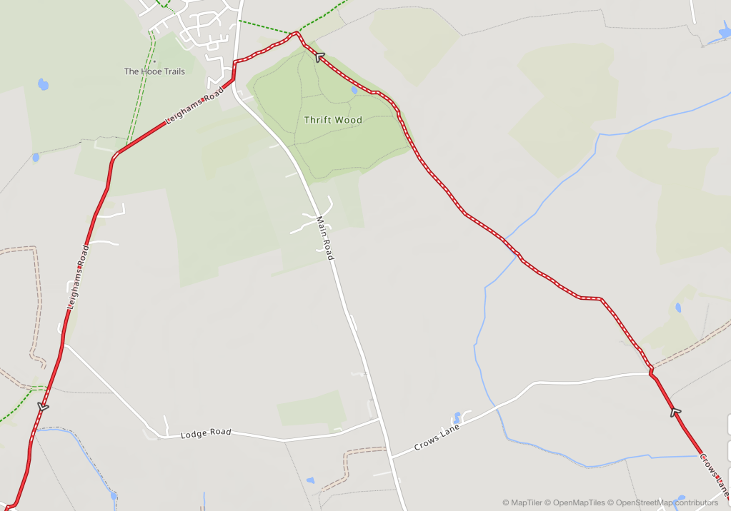
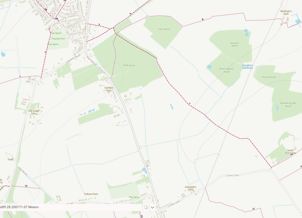
It takes takes this bridleway south-westerly for about 250m before joining Maldon Road in Bicknacre and going south on that for 70m and joing Leigham Road going broadly south-westerly to Creephedge Lane. Proceeding directly over Creephedge Lane it carries on to Buckhatch Lane past RHS Hyde Hall to where it meets East Hanningfield Road. South-westerly on East Hanningfield Road into Rettendon.
Here, Pollom’s route seems to do a wrong-un, mapping around Pound Farm on farm tracks and drives that aren’t a right of way (and possibly don’t even connect) to join a mixed-use path running south parallel with ‘Main Road’. I think Google Maps is ultimately to blame here as it plots in roads, which the Essex PROW map reveals don’t exist. Luckily, proceeding a bit further west on East Hanningfield Road there’s an intersection with the mixed-use path there which provides an alternative.
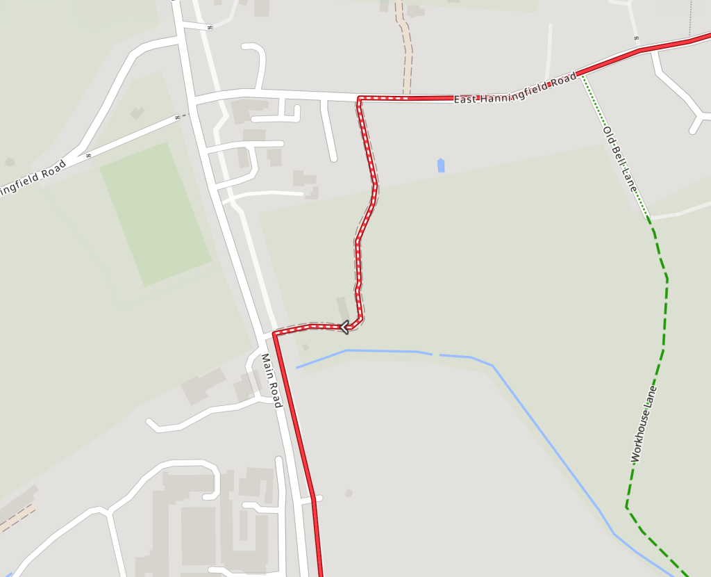
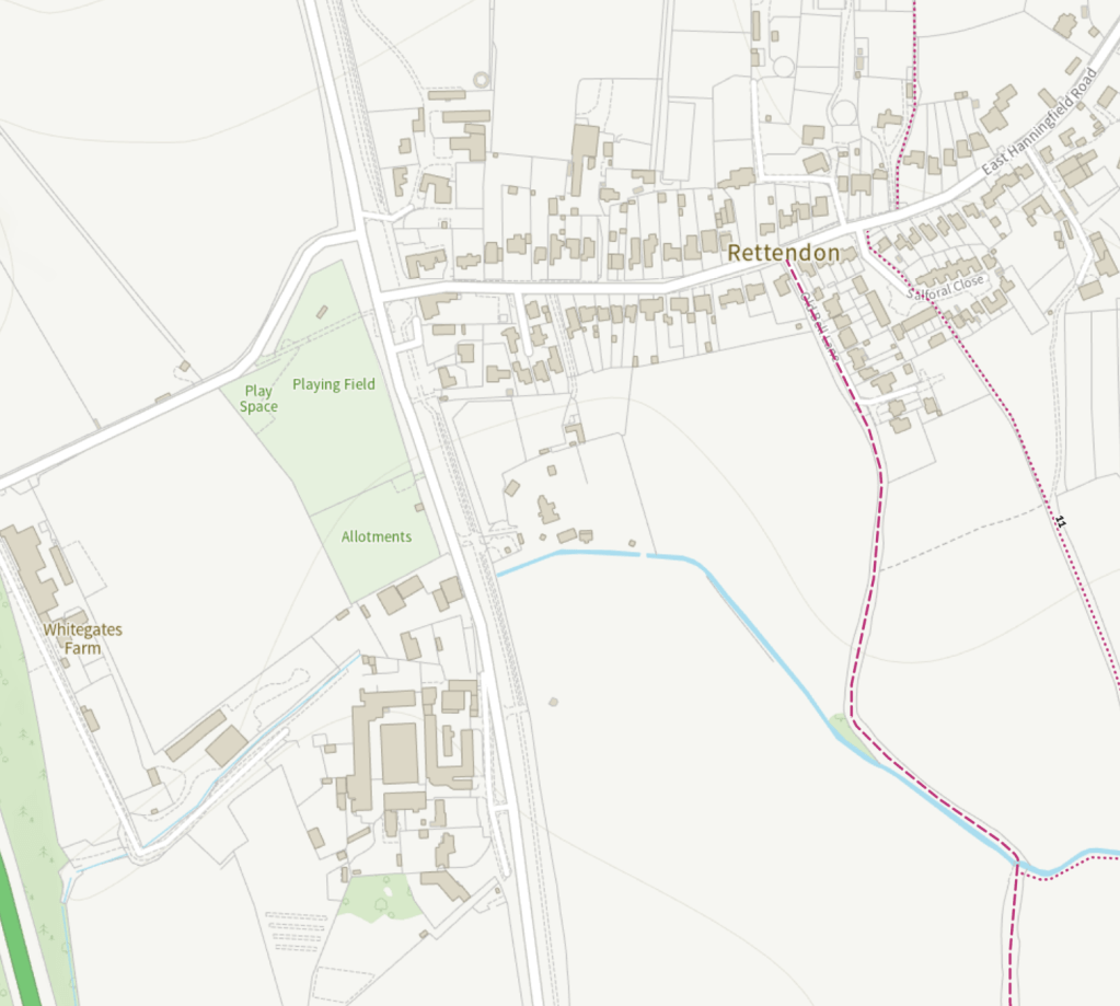
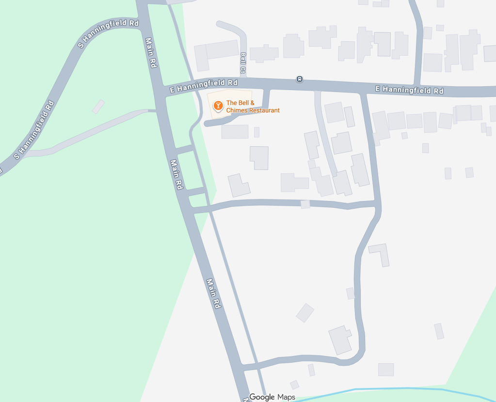
I don’t know this bit personally though, so I’m depending on google maps/streetview and the Essex PROW map to interpret. Signs for the mixed-use path are visible on Street View, but it’s not marked on the Google Maps cycling layer nor on the PROW map.
In any case, the mixed-use path takes the route most of the way south to the Hoe Lane junction (there’s a stretch of about 270m on Main Road itself). Hoe Lane goes west under the A130 and the route proceeds on towards Hanningfield Reservoir. One of the significant absences in the Essex Countywide LCWIP proposals is any cycle-friendly route crossing the A130 and this provides a good candidate for where to do so.
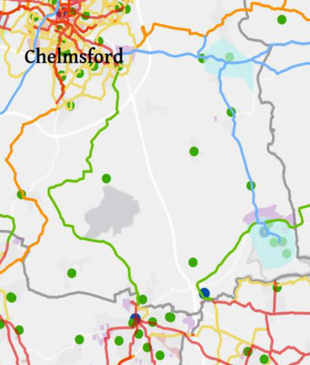
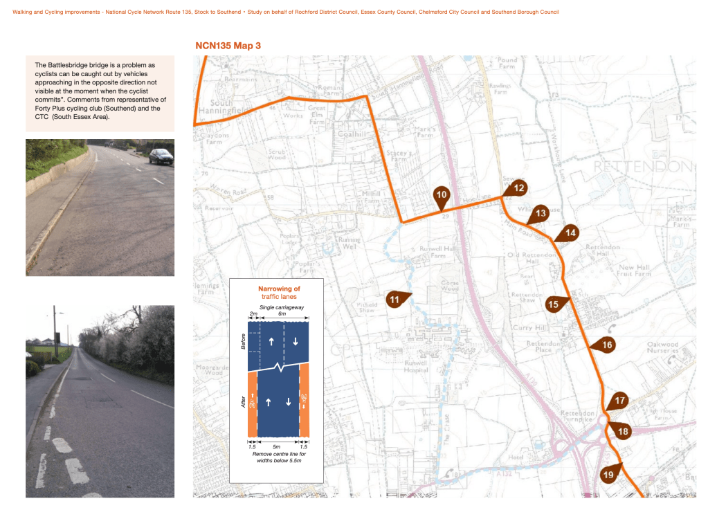
Even by my extended understanding of what the Dengie is we’ve left it now, so I won’t carry on analysing the route past here. It is worth noting however, that 1) after Hanningfield Reservoir the route reaches Stock – a place I consider an important nexus of active travel routes In Essex, not least because National Cycle Route 13 passes through here; and 2) at the Main Road/Howe Lane junction the Essex Cycle Lap intersects with the route of the proposed NCN 135 route [pdf] from Stock to Southend.
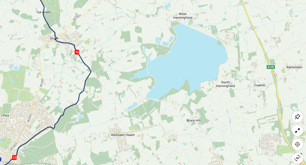
It’s worth comparing the Dengie section of the Essex Cycle Lap with Day Ride 5: Chelmsford and Maldon’ in the Essex & the Thames Estuary Cycle Map (Sustrans, 2021).
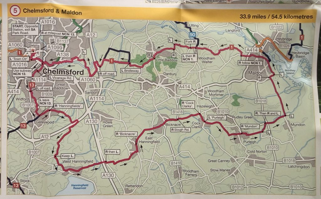
Day Ride 5 takes the same route out of Maldon town on the Mundon Road, but before reaching Mundon village it goes west on Blind Lane. At Fambridge Road (B1010) it proceeds east over to Barons Lane before taking Simmonds Lane southwards, then The Street (Purleigh) west into Purleigh village. From Purleigh it continues on to Cock Clarks via The Glebe, Mill Hill, Walton Hall Lane, and Birchwood Road. From Cock Clarks it proceeds to Bicknacre via Hackmans Lane and Slough Road, coming close again to the Essex Cycle Lap but not touching it. From Bicknacre it proceeds to East Hanningfield, seemingly via Priory Road and Bicknacre Road. It leaves East Hanningfield on Old Church Road, proceeding via Pan Lane and a short section of Southend Road to take Church Road west over the A130 – another useful option for crossing this ‘secret motorway’.
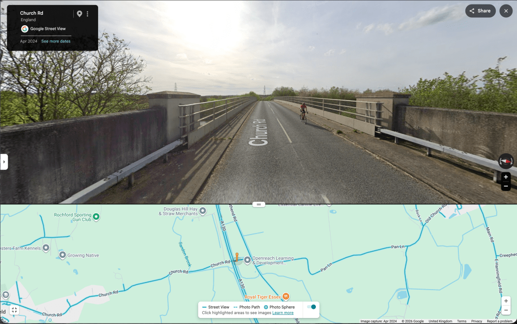
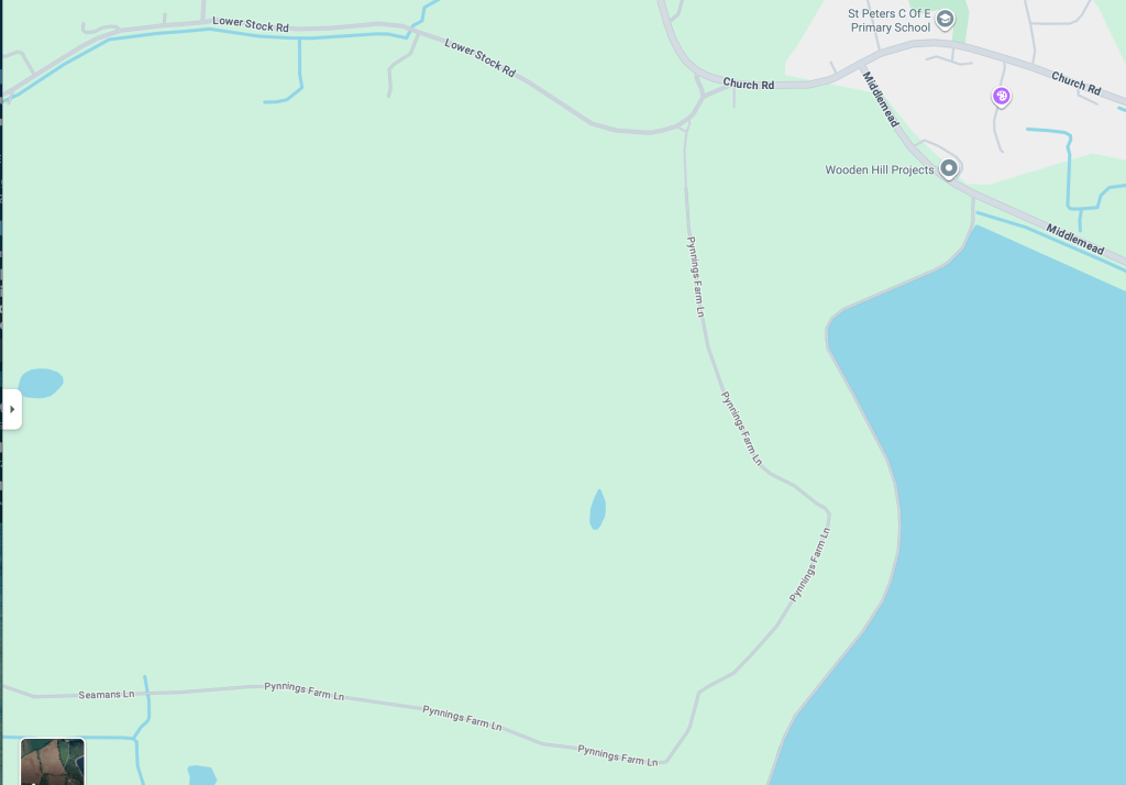
Once again, we’ve definitely left the greater Dengie by this point. Day Ride 5 continues west on to West Hanningfield and the north side of Hanningfield reservoir. It’s tantalising close to the National Cycle Network at Stock, with an appealing country lane route by Lower Stock Road. Connecting the Dengie to the NCN offers a clear benefit to the peninsula.
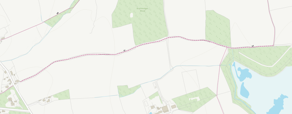
In April, I walked the Catholic St Peter’s Way route from Brentwood Cathedral to Stock, then along the main St Peter’s Way to East Hanningfield (still to write up!). This suggested an attractive alternativee cycle route from Stock to West Hanningfield, utilising the Seamans Lane bridleway (BR 57 235 & BR 46 236) and continuing on Pynnings Farm Lane to Church Road (West Hanningfield).
I have noted before that the Essex-wide cycling and walking network plans
(August 2025) [pdf] state that
‘Given the mainly rural nature of Essex, the Essex-wide plan prioritises links between villages, towns and cities. The proposals aim to make use of off-road routes such as byways and bridleways, alongside innovative on-road cycling solutions on space-limited networks such as quiet lanes to deliver the LCWIPs.‘
The key next task therefore seem to be the identification of those routes and their implementation. I began the identification task in previous post Push Biking .Both the Essex Cycle Lap proposal and ‘Day Ride 5’ offer further suggestions of local roads that would be good candidates for quiet lane status (Maldon district currently has no designated quiet lanes).
I’ve created a map combining my back-of-a-beer-mat proposed Dengie routes with these:
- NCN1 route
- NCN13 route
- NCN135 route (proposed)
- Essex Cycle Lap (WIP)
- Day Ride 5 Chelmsford-Maldon
To produce another hint at what a local cycling network might look like. This doesn’t include the Burnham-on-Crouch, Maldon and South Woodham Ferrers intra-settlement routes (or Chelmsford’s), nor does it include some of the other possibly relevant proposals (like the ‘Proposed Danbury and A414 Cycle Routes’ in the Chelmsford Cycling Action Plan (March 2017) [pdf]). I think it starts to look meaningful though.

The Local Transport Plan for Essex is now in the hands of the County Council’s new administration. It remains unclear at this point what the fate of active travel will be. The new administration has declared a pot-hole emergency, its Reforming Essex 100 Day Plan: first steps in reforming our county [pdf] mentions walking and cycling once (in reference to safer routes to school), the word transport appears once. I hope that initiatives like the Essex Cycle Lap or St Peters WayS might remain appealing to all those who express a love of place – we shall see!
 Dengie Bioregion
Leave a comment