Let a Thousand Knepps Bloom

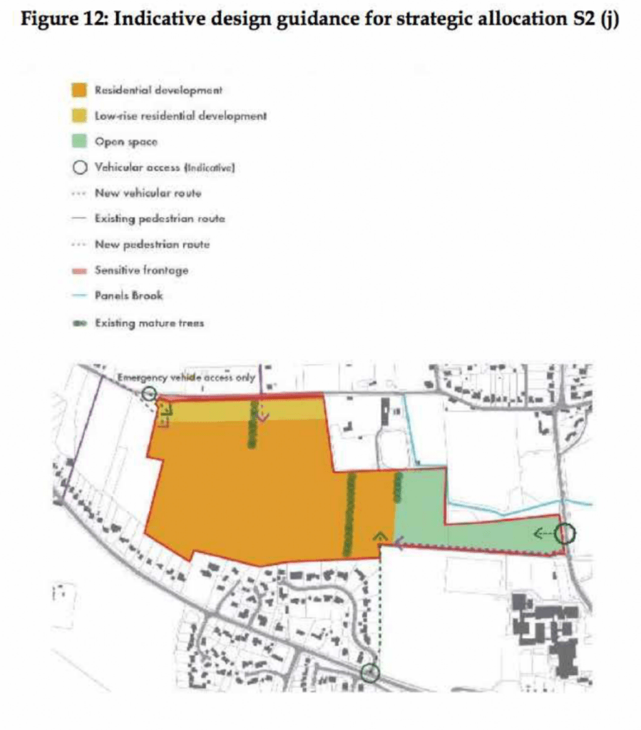
Yesterday, Maldon District Council (MDC) shared on social media that they would be working in partnership with a property consultancy company that has launched a Biodiversity Net Gain (BNG) scheme with the Braxted Park estate.


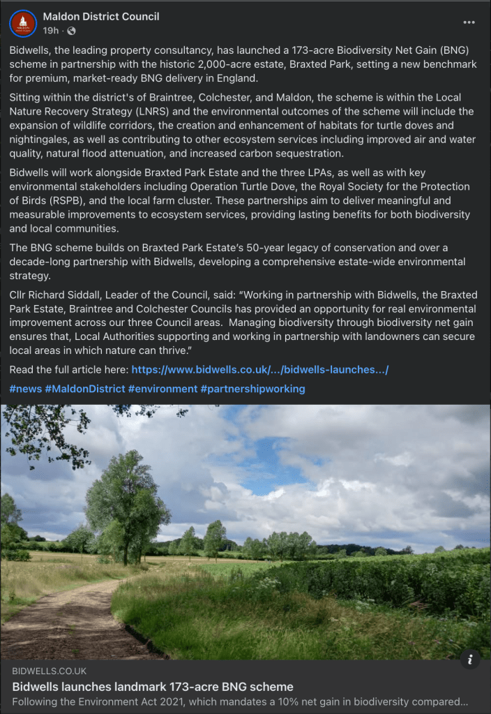
The post and linked article are light on detail, and there’s nothing about it on the MDC website, but this looks like MDC shaping up to allow developers to meet their ‘increase biodiversity’ requirements by paying someone else to do the nature recovery off-site.

Read more: Let a Thousand Knepps Bloom

Local District Councillor Wendy Stamp informs me that this scheme has not been discussed by Councillors and is seeking further detail.

Map on the Braxted Park website illustrating that it is ‘well connected’ shows no connection to locations in Maldon District


I can see some advantages in consolidating nature recovery activities in the best sited locations and that working at a landscape scale can have environmental outcomes not available to smaller sites

but…


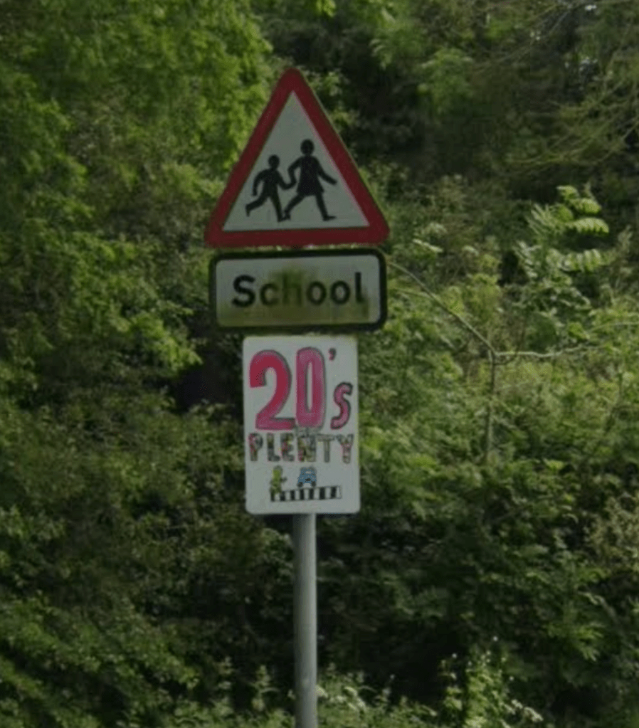
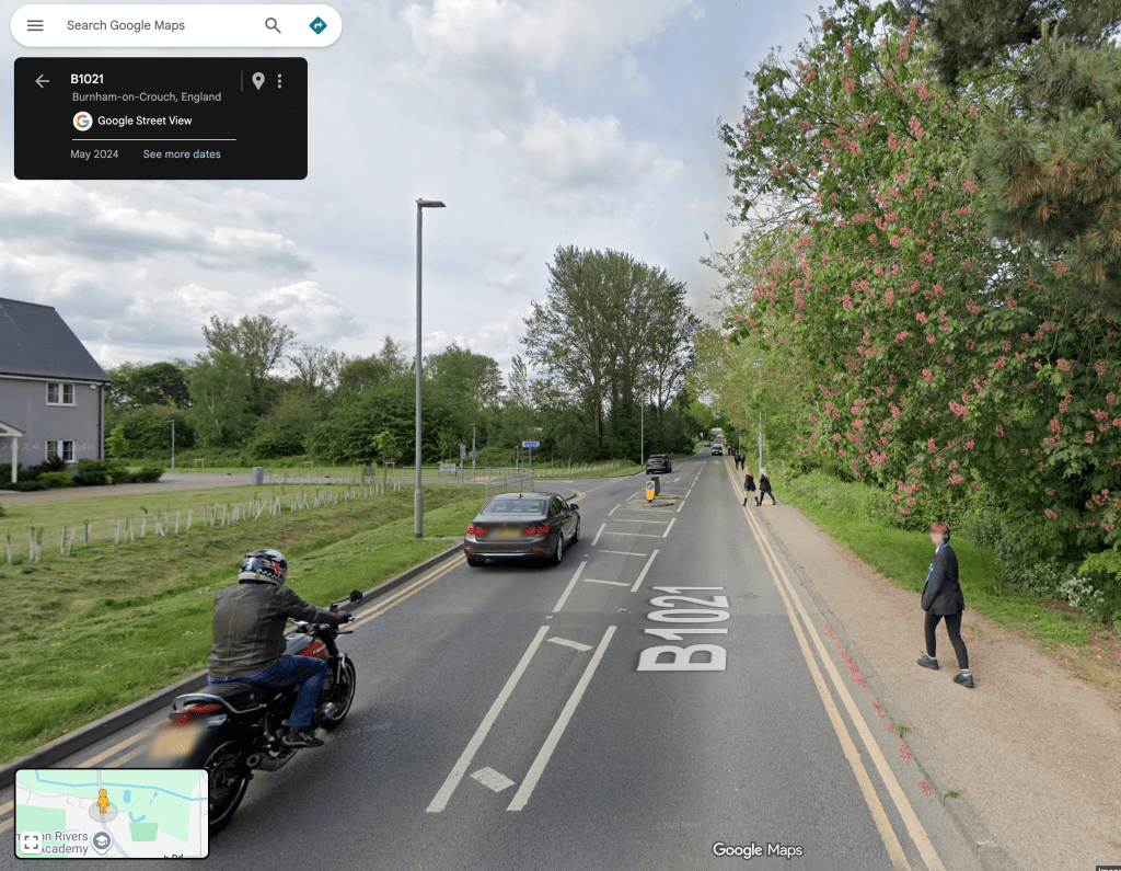
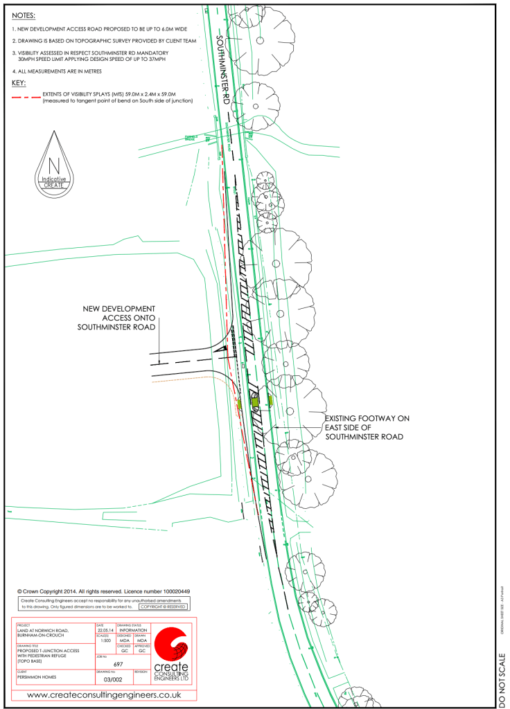
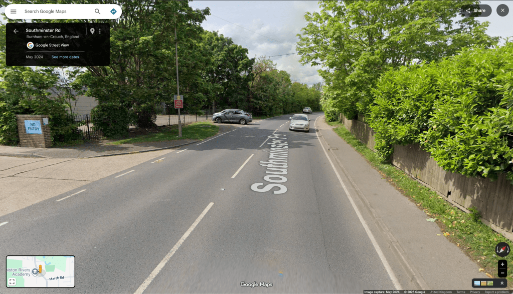
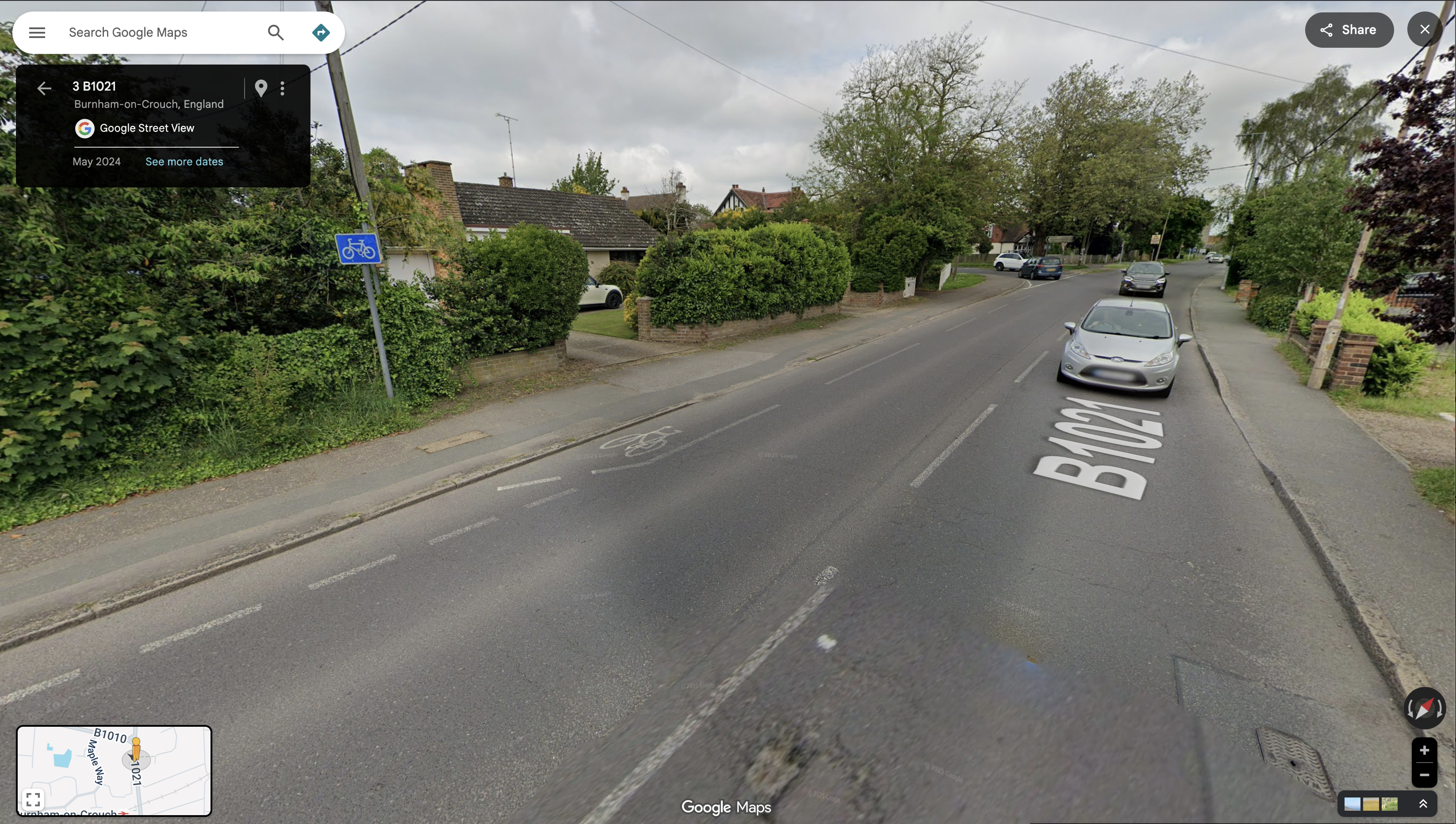
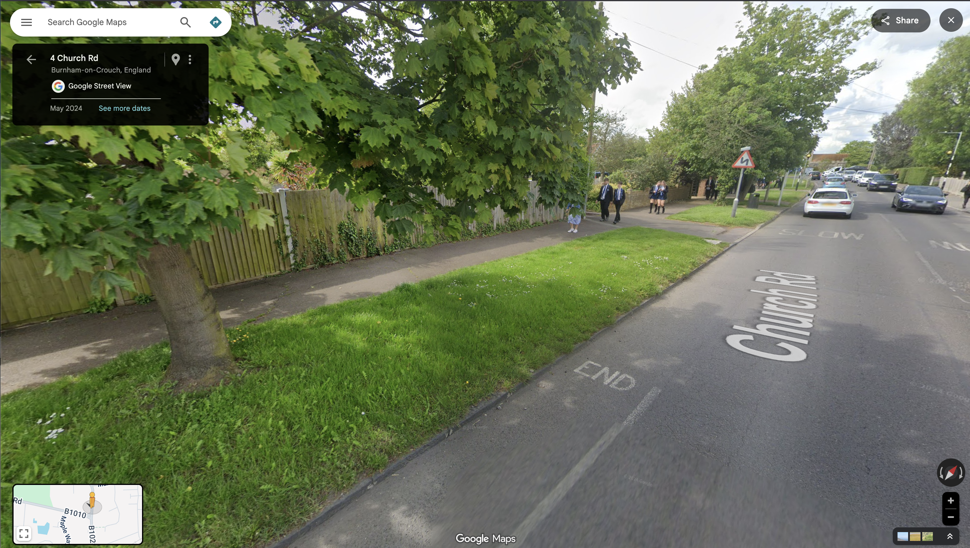
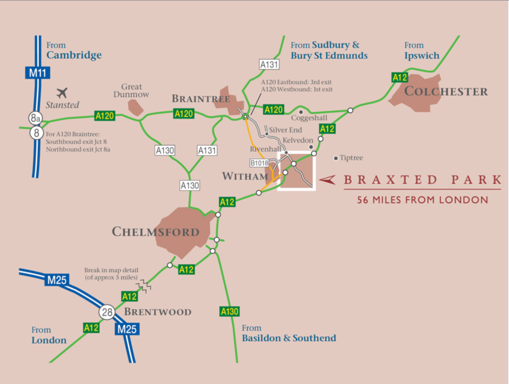
Braxted Park is barely in Maldon district (it’s on the North-west border with Braintree District, near to Witham) and it’s a long way from the Dengie peninsula. (It’s over 20km as the turtle dove flies from Braxted Park to the proposed Romans Farm development in Burnham on Crouch for example)
It’s hard to see how the environmental outcomes of the scheme will improve nature recovery out here.

Location map in the Bidwells document Biodiversity Net Gain Scheme Braxted Park Estate [pdf]

We must demand that nature recovery schemes happen locally to us, no biodiversity offsetting in distant locations!


The Maldon Nature Conservation Study (February 2023) produced by Essex Ecology Services (EECOS) for MDC spoke of the importance of wildlife corridors in the district and stated that ‘[t]he taking of measures to enhance connectivity would be worthwhile anywhere in the district… Certain areas suggest themselves as potential priority targets… Any part of the Dengie peninsula

Map from the ‘Maldon Nature Conservation Study 2022′ (February 2023) [pdf]


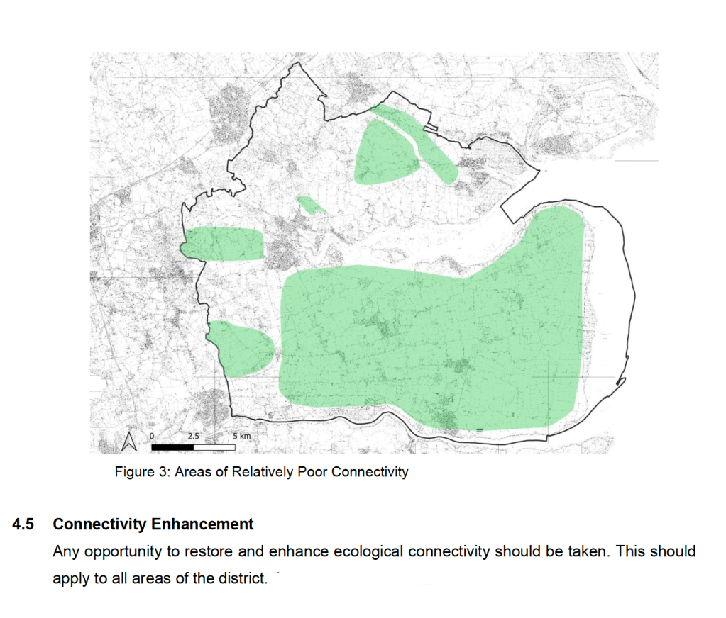
The whole peninsula was mentioned because the Study notes that ‘[t]he Dengie peninsula has few [local wildlife] sites and many of these are isolated in a landscape dominated by intensively managed farmland, with few areas of natural or semi-natural habitats aside from the coast’


It notes that ‘[t]he woodlands of Maldon are heavily concentrated in the north west of the district [where Braxted Park is located] and are virtually absent to the east of Northey Island, both north and south of the Blackwater estuary. The Dengie peninsula, in particular, is virtually devoid of woodland.’


Elsewhere in the document the Dengie is described as an ‘impoverished landscape dominated by large arable fields with few hedgerows’ and that ‘[t]he planting of new hedges and appropriate management of these features would be of great benefit to wildlife, including breeding birds, and any measures that can be taken to encourage this should be considered. The establishment of a well-connected network of hedgerows would represent a major landscape-scale enhancement.’


MDC knows where, and what, nature recovery interventions on the Dengie would be effective because the Study they commissioned informs them.

The pitch to developers in the Bidwells document Biodiversity Net Gain Scheme Braxted Park Estate [pdf]


This new scheme looks like a way for developers to avoid caring for and improving the natural world where they build by just paying a fee for someone else, to do something, somewhere else.

It should not be ignored that replacing an intensively managed, chemically dosed, arable monoculture field in our ‘impoverished landscape’ with houses and gardens will in itself create new niches for wildlife. Housing developments don’t in themselves, however, create a well-connected network of hedgerows, they don’t establish new woodlands, areas of natural or semi-natural habitats, or wildlife corridors between existing sites of biodiversity. Construction of these developments too often begins with violently making their site a tabula rasa, removing mature trees, bushes and hedgerows, blocking access to fauna, filling in scrapes, stripping topsoil, compressing the earth. It concludes with establishing neat show homes, where the ‘messiness’ of the wild is manicured away – no care to share the territory with what came before – no hedgehog holes or bee bricks, no bird and bat boxes, no quarter given to burrowing badgers and foxes, insects starved of fodder. In the amenity spaces, sapling trees are planted and then neglected to dry out and die. A councillor once told me that developers are generally contracted to support these trees for 5 years, but that it’s cheaper for them to replace those that die at the end of their period of responsibility than to maintain them for the intervening period. Any survey of the new estates in Burnham swiftly finds the desiccated evidence

BNG seemed to me from the get-go to be ‘biodiversity off-setting’ in the disgraced mode of carbon off-setting before it. So, it comes as no surprise that we are immediately seeing nature commodified and traded by third-party intermediaries.

When a developer grubs out a 300 year old oak tree near me, and the squirrels who ate the flowers disappear, the moths that relied on it don’t return, the oak-mining bee loses its pollen, the badger and wood mouse find no acorns, the jay has nothing to bury, and the caterpillar doesn’t come that the blue tit might consume, when the bat doesn’t roost, the fungus doesn’t feed, the lichen don’t spot the bark, the mushroom doesn’t fruit from its subterranean romance with roots – then I guess I can take solace in the knowledge that a seven hour walk from where I live, on the country estate of a retired banker, that an ‘off-the-shelf’ purchase by the developer will have financially contributed to the ‘creation of high-quality biodiverse habitats targeting ‘good’ condition as defined by the DEFRA Statutory Metric’. Call me a romantic if you will, but I prefer stewardship to the spreadsheet.

Chancellor vows to go further and faster to kickstart economic growth’ Rachel Reeves at Siemens Healthineers in Oxfordshire on 29 January 2025.

An ‘abundance’ YIMBYism is on the rise, an attitude on both the left and right of politics, and on both side of the Atlantic, that the future has been cancelled out of a gratuitous consideration for ‘bats and newts’, that we must just BUILD. Increasingly often this comes with a sanctimonious sneer that pits mitigating climate change against nature conservation “we could accelerate the construction of renewable energy infrastructure and energy efficient homes if you would just leave it out with bat tunnels and newt-counting delays”.

But why can’t we have both things? Because there’s a missing third part of this iron triangle

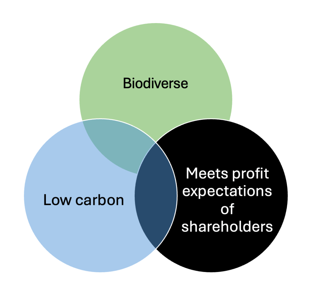
The great shapers of places in the UK, of our land and homes, are six volume housebuilders (Barratt/Redrow, Vistry, Taylor Wimpey, Bellway, Berkeley Group, Persimmon) and they are driven by profit, excessive profit. A 2023 report from the UK Collaborative Centre for Housing Evidence, Why have the volume housebuilders’ been so profitable? notes that

‘Since 2014, the largest housebuilders, and in particular the three largest housebuilders by
volume (Taylor Wimpey, Barratt and Persimmon – herein, the ‘big three’) have consistently reported supernormal levels of profitability, with gross profit margins reaching 32% and never falling below 17%’

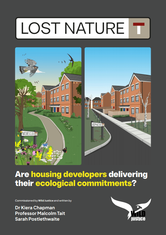
So, obviously, these companies are not interested in the business of stewardship, of long-term commitments to places, or indeed any commitments past the point when contracts are exchanged. A survey by University of Sheffield academics for the wildlife campaigning group Wild Justice discovered that nearly half of the nature-friendly enhancements promised by developers building new homes have failed to materialise.

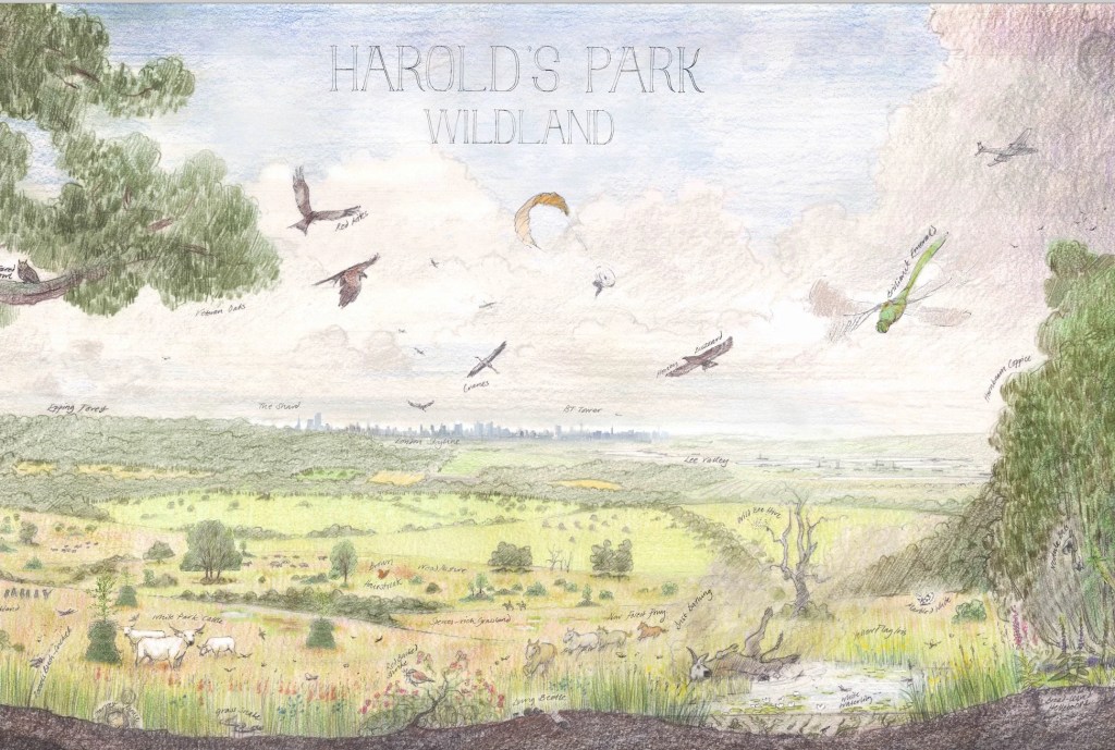
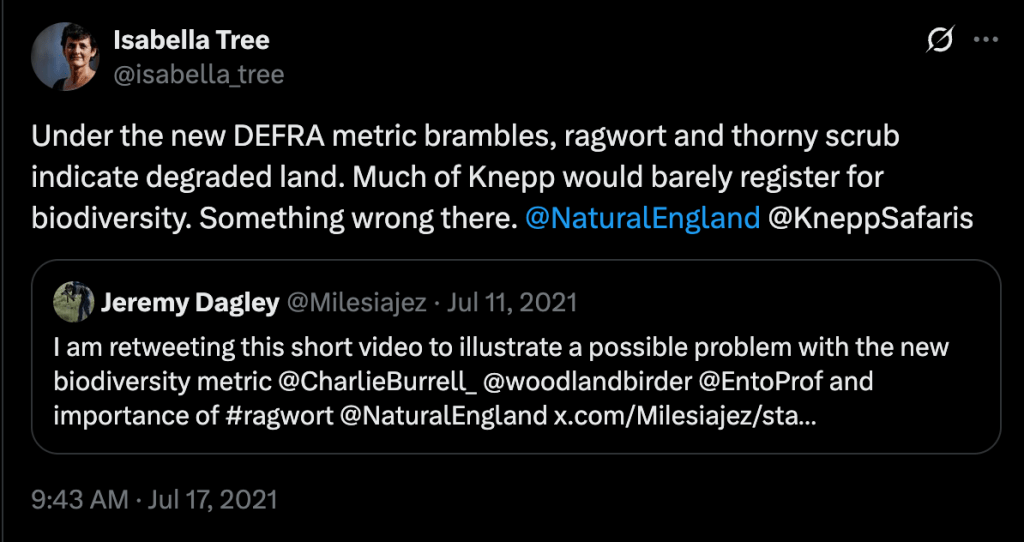
Instead of enforcing these commitments and penalising developers who fail to adhere, the BNG system surrenders and turns this all into a one-off transaction. Developers pay some ecologists to do a baseline survey before development, a wonk does some sums to account for 10% BNG, they pay a one-off fee to a mediator like Bidway and they’re done – on to the next one. The mediator creams some agency fees and passes on the remainder to a land owner adding BNG to their diversifed income streams. It could be a conference and wedding venue like Braxted Park, it could be elsewhere in Essex like the farm turned rewilderness Harold’s Park – 45km as the turtle dove flies from Braxted Park. (Recently purchased by ‘natural capital and rewilding company’ Nattergal.) These Essex projects stand in the shadow of the Knepp estate in Sussex -the poster child for UK rewilding – although Knepp’s owner Isabella Tree says it wouldn’t meet the DEFRA metrics.

All this is an approach to nature recovery that seems to depend on special places that are protected, another form of nature reserve, rather than forging a new symbiosis with nature and accepting that humans are completely embedded within a more-than-human world. Essex county council has a target of transforming 30% of Essex into wild and nature areas. Every place should be special, distinct among others of a kind. Nature recovery here, and there, and everywhere. Let a Thousand Knepps Bloom.

Stitching the Path: Connecting Disjointed Walk & Cycle Routes 1

A mission objective of the rECOnnect Dengie project is to improve the active travel infrastructure on the Dengie and get a safe network of routes connecting all the settlements. As I’ve noted previously, there are lots of good words about achieving this sort of thing in the strategy documents produced from the national level down to the parish – but what happens next? How does it happen?

This in the first in a series of posts where I’ll look at where there are opportunities on the Dengie to connect up existing routes and how we might turn document objectives into objective fact. I’m starting close to home in Burnham-on-Crouch.

The Burnham-on-Crouch Neighbourhood Development Plan [pdf](2017) expressed a clear desire for better active travel infrastructure:

5.3 Make Burnham-on-Crouch a More Pedestrian and Cycle Friendly Place to Live

The Town should have a friendlier environment for cycling and walking. Its main and secondary roads are dominated by vehicles. New pedestrian and cycle routes should be provided that link the town centre with existing and new neighbourhoods, schools and recreation areas via quieter roads.’

It substantiates this objective with policies including:

One of the first new neighbourhoods created after the NDP is the Grangewood Park estate which was built on agricultural land allocated for new housing as Site S2 (j) in the Maldon District Local Development Plan [pdf]. A site with a long southern boundary to the town’s Secondary School, the Ormiston Rivers Academy.

Figure 12 in the Burnham NDP (Apologies for poor image quality, this is as it appears online)

The masterplan [pdf] presented by developers Charles Church in their planning application included a new off-road foot/cycle path running through the green space on the estate and providing a connection from Southminster Road in the east to Green Lane in the north.

Their document notes that the Maldon LDP includes:

T2 Transport Infrastructure in New Developments The layout of new developments should provide for safe access to and from the highway including… links to adjacent or nearby foot/cycle path network’

and that it states that amongst the criteria any proposed development must satisfy is:

‘Safe pedestrian and cycle linkages are provided from the development to the town centre, other public service facilities and the existing urban area’.

(The Residential Travel Plan [pdf] supplied in the developer’s application noted that ‘[t]here are no dedicated cycle facilities in the vicinity of the development site’)

Later the planning application notes that ‘[t]he Burnham Neighbourhood Plan shows proposed cycle links that the Town would like to see progressed; within this diagram a possible link is shown into the site subject to this application. The provision of this link would rely on third party land and therefore cannot be provided by Charles Church, however the scheme has been developed to facilitate future connectivity.’

It’s unclear exactly what this is referring to, as the Burnham NDP includes text references to possible cycle routes but no maps showing these. The diagram with ‘a possible link’ is perhaps the green dotted line ‘new pedestrian route’ shown in the NDP’s ‘Figure 12’ (copied above) connecting the site to Maldon Road in the south, and running along the western boundary of Ormiston Rivers’s playing fields. This would have been a convenient addition to Burnham’s walk/wheel/cycle routes but it never materialised and it illustrates succinctly a key unaddressed problem in getting better active travel infrastructure.

i.e A government strategy proposes active travel infrastructure as an essential part of new developments, a developer provides infrastructure within the development – but the value of such infrastructure is largely produced by a larger connectivity that neither government nor developer is providing.

The National Planning Policy Framework (NPPF) make enough noises about pedestrian and cycle routes that applications for new housing tend to include vague promises about including them. On the ground this tends to result in intra-estate pathways that have genuine utility but terminate at the estates’ boundaries with no clear sense of how onward travel on foot, mobility device or bicycle might proceed.

Foot/cycle paths shown in grey to the north of the housing on Grangewood Park estate

True to their promise, the developers of Grangewood Park delivered the walk/cycle path on their masterplan and the estate includes what is, currently, the best example of active travel infrastructure in the town with an off-road path that connects Southminster Road with Green Lane – but what happens when you get to Southminster Road or Green Lane? What contribution does it make to a safe, active travel network?

At Southminster Road (B1021) the pathway ends 160 metres north of the entrance to Ormiston Rivers school. A child on a bicycle coming through Grangewood Park must now leave the off-road cycle path, cross a lane of northbound traffic leaving town on the B1021, and join the southbound lane – before turning across the path of northbound traffic again to complete their journey to school. Opposite the Grangewood junction there’s a road sign with the red triangle warning of a school ahead and, beneath it, one of those advisory-only ’20’s Plenty’ signs – but the B1021 has a 30mph speed limit at this point and has limited direct access along this section, a form that tends to encourage vehicle speeds in excess of the legal limit. The common experience of cyclists, of all ages, using this road is driver impatience and an aggressive eagerness to pass.

Meanwhile, pedestrians leaving the off-road path at Southminster Road find there is no footway providing an onward walking route north or south. There is a narrow pavement on the east side of Southminster Road but there is no controlled crossing to reach it (a small traffic island provides some pedestrian refuge).

School children cross the B1021 to reach the Grangewood Park Estate.
The junction of Grangewood Park Avenue and Southminster Road, where the foot/cycle path ends

Once the road is crossed, a pedestrian can proceed south on pavement into Burnham. If it’s a child walking to the school they can pass the school entrance on the other side of the road and carry on further south around a bend to cross the road at a zebra crossing, then walk north again up the opposite pavement to reach the school entrance – a distance of 450m. Will they do that though? Of course not!, once they are opposite the school entrance our cyclist used – 160m down, they’ll do what she did and cross the road there. The curve of the road means that drivers travelling south will be blind to a child crossing the road there until they are quite close. The Highway Code calculates the stopping distance of an average car at 30mph in dry conditions to be 23 metres.

Looking north up Southminster Road where a child is liable to cross to reach the school
Car stopping distances in the Highway Code

‘But there’s no alternative!’ I hear you cry, ‘you just have to make do with what you’ve got’.

‘I know this estate is right next to the secondary school and we agreed in the neighbourhood plan to “plan, build and highlight clearly signposted, direct and safe cycle and pedestrian routes into the Town from new and existing neighbourhoods, between all schools and the town centre” and we agreed that we would “improve the pedestrian and cycle journeys to/from each of the schools” – but really what else could we have done?

Let me tell you!

Grangewood Park shares a border with Ormiston Rivers school, their frontage to Southminster Road is contiguous. The foot/cycle path could have gone over Grangewood Park Avenue and continued south over amenity land to the boundary of the school and through the small woodland which separates it from the paved area of the school grounds.

The red line indicates where the Grangewood path could be connected to Ormiston school, the blue line how that could continue to the existing footway

All the land involved either belongs to the developer or to Essex County Council. The developer was on-board with facilitating connectivity, the Town and District Councils wanted connectivity, Essex County Council/Essex Highways wants kids to cycle to school. It should have happened… and it still can!

The current residents of the three houses on Grangewood Park estate facing Southminster Road might prefer the current area of mown grass and small flower bed, but they’d benefit from a walk/cycle/wheel route through it. Improving active travel routes is beneficial for everyone, not just children.

This missing link would facilitate footway access from Burnham’s riverside, urban centre and railway station through to Green Lane by reducing the number of necessary road crossings. It would complete a safe cycle route from the Grangewood Park estate to Ormiston school.

EXTRA CREDIT: The pavement going south from Ormiston School has an area of verge and is wide enough to allow a shared foot/cycle way to the junction with Maldon Road (B1010). Across the B1010 junction, in the northbound lane, there is also Burnham’s oldest piece of cycling infrastructure – a painted cycle lane that begins just south of it and finishes quickly north of it – it’s of spurious utility but nevertheless could easily merge into a cycleway on the west of Southminster Road and gain a connectivity it has never had before!

What happens at the other end of the Grangewood Park estate foot/cycle path though? Can we get anywhere from there? Look out for Stitching the Path: Connecting Disjointed Walk & Cycle Routes 2 – where I will address these very questions!